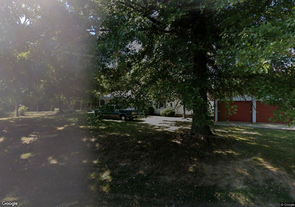
1757 N Shawtown Rd Hornbeak, TN 38232
Estimated Value: $183,922 - $247,000
3
Beds
2
Baths
2,248
Sq Ft
$97/Sq Ft
Est. Value
About This Home
This home is located at 1757 N Shawtown Rd, Hornbeak, TN 38232 and is currently estimated at $218,231, approximately $97 per square foot. 1757 N Shawtown Rd is a home located in Obion County.
Ownership History
Date
Name
Owned For
Owner Type
Purchase Details
Closed on
Sep 10, 2015
Sold by
Batchelor Leon Dale
Bought by
Higgins David and Higgins Angela
Current Estimated Value
Home Financials for this Owner
Home Financials are based on the most recent Mortgage that was taken out on this home.
Original Mortgage
$95,000
Outstanding Balance
$74,769
Interest Rate
3.97%
Mortgage Type
VA
Estimated Equity
$143,462
Purchase Details
Closed on
Jul 7, 2003
Bought by
Dale Batchelor Leon
Purchase Details
Closed on
Nov 13, 1991
Bought by
Stone Richard D and Stone Sheila M
Create a Home Valuation Report for This Property
The Home Valuation Report is an in-depth analysis detailing your home's value as well as a comparison with similar homes in the area
Home Values in the Area
Average Home Value in this Area
Purchase History
| Date | Buyer | Sale Price | Title Company |
|---|---|---|---|
| Higgins David | $95,000 | -- | |
| Dale Batchelor Leon | $80,000 | -- | |
| Stone Richard D | $31,500 | -- |
Source: Public Records
Mortgage History
| Date | Status | Borrower | Loan Amount |
|---|---|---|---|
| Open | Higgins David | $95,000 |
Source: Public Records
Tax History Compared to Growth
Tax History
| Year | Tax Paid | Tax Assessment Tax Assessment Total Assessment is a certain percentage of the fair market value that is determined by local assessors to be the total taxable value of land and additions on the property. | Land | Improvement |
|---|---|---|---|---|
| 2024 | $490 | $35,475 | $3,250 | $32,225 |
| 2023 | $490 | $35,475 | $3,250 | $32,225 |
| 2022 | $341 | $17,925 | $2,925 | $15,000 |
| 2021 | $341 | $17,925 | $2,925 | $15,000 |
| 2020 | $293 | $15,400 | $2,925 | $12,475 |
| 2019 | $293 | $15,400 | $2,925 | $12,475 |
| 2018 | $293 | $15,400 | $2,925 | $12,475 |
| 2017 | $296 | $14,750 | $2,925 | $11,825 |
| 2016 | $296 | $14,750 | $2,925 | $11,825 |
| 2015 | $296 | $14,750 | $2,925 | $11,825 |
| 2014 | $296 | $14,750 | $2,925 | $11,825 |
Source: Public Records
Map
Nearby Homes
- 4310 Old Samburg Rd
- 3232 W Shawtown Rd
- 3216 W Shawtown Rd
- 4211 Old Samburg Rd
- 000 Old Samburg Rd
- 4830 Kendall Rd
- 2845 Possum Trot Rd
- 0 Bogus Hollow Rd
- 280 N Main St
- 3454 Treece Rd
- 257 2nd Ave
- 354 E Lakeview Dr
- 0 Lakeview Dr Unit RRA45037
- 891 Dean Hill Rd
- 0 Dean Hill Rd Unit 2504755
- 5079 Tennessee 21
- 0 Tennessee 21
- 1645 Lake Dr
- 430 Jb Stricklin Rd
- 4815 Webb Store Rd
- 1835 N Shawtown Rd
- 1776 N Shawtown Rd
- 1938 N Shawtown Rd
- 1950 N Shawtown Rd
- 1913 N Shawtown Rd
- 3782 W Shawtown Rd
- 1533 N Shawtown Rd
- 3805 Old Samburg Rd
- 1818 N Shawtown Rd
- 3766 W Shawtown Rd
- 3771 W Shawtown Rd
- 3899 Old Samburg Rd
- 3834 Old Samburg Rd
- 3734 W Shawtown Rd
- 3734 W Shawtown Rd
- 3786 Old Samburg Rd
- 1491 N Shawtown Rd
- 3666 W Shawtown Rd
- 3713 W Shawtown Rd
- 1451 N Shawtown Rd