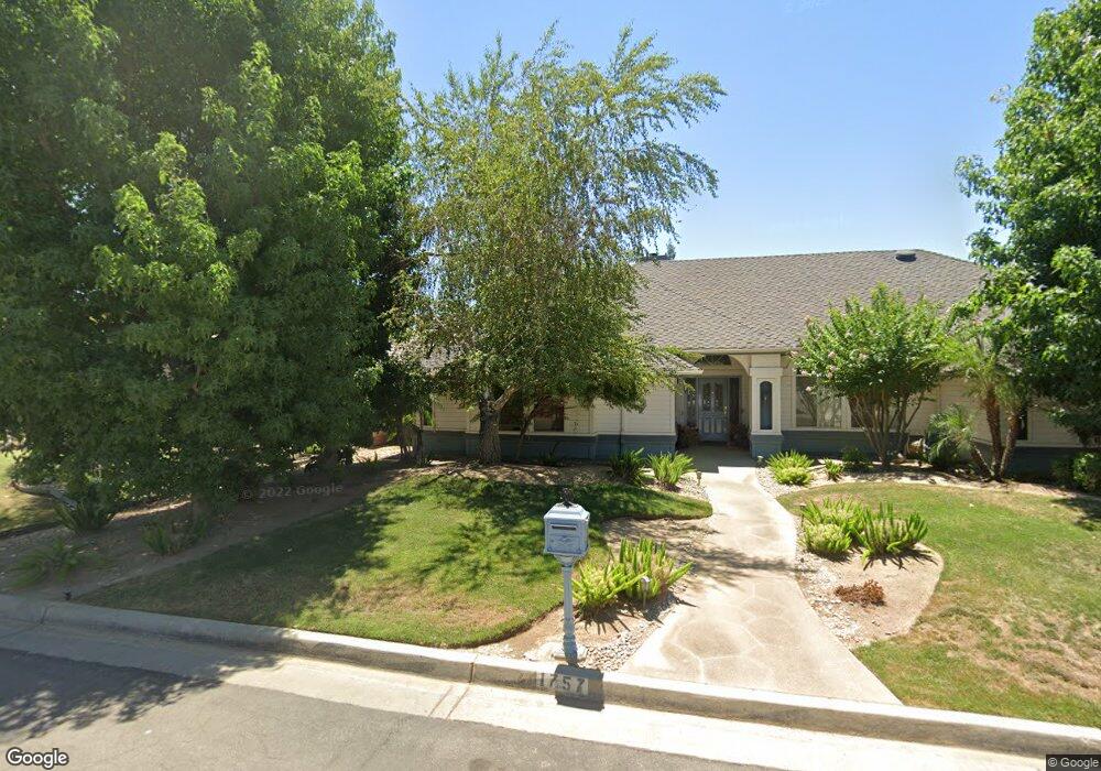
1757 W Spruce Ave Fresno, CA 93711
Bullard NeighborhoodEstimated Value: $622,284 - $763,000
3
Beds
3
Baths
2,258
Sq Ft
$312/Sq Ft
Est. Value
About This Home
This home is located at 1757 W Spruce Ave, Fresno, CA 93711 and is currently estimated at $704,821, approximately $312 per square foot. 1757 W Spruce Ave is a home located in Fresno County with nearby schools including Nelson Elementary School, Kastner Intermediate School, and Clovis West High School.
Ownership History
Date
Name
Owned For
Owner Type
Purchase Details
Closed on
Jun 1, 2015
Sold by
Howell Craig T and Bachman Terrie Kay
Bought by
Stevenson Robert A
Current Estimated Value
Home Financials for this Owner
Home Financials are based on the most recent Mortgage that was taken out on this home.
Original Mortgage
$361,000
Outstanding Balance
$280,202
Interest Rate
3.81%
Mortgage Type
New Conventional
Estimated Equity
$424,619
Purchase Details
Closed on
Dec 23, 2003
Sold by
Howell Craig T
Bought by
Howell Craig T and Bachman Terrie
Create a Home Valuation Report for This Property
The Home Valuation Report is an in-depth analysis detailing your home's value as well as a comparison with similar homes in the area
Home Values in the Area
Average Home Value in this Area
Purchase History
| Date | Buyer | Sale Price | Title Company |
|---|---|---|---|
| Stevenson Robert A | $380,000 | Fidelity National Title Co | |
| Howell Craig T | -- | Financial Title Company |
Source: Public Records
Mortgage History
| Date | Status | Borrower | Loan Amount |
|---|---|---|---|
| Open | Stevenson Robert A | $361,000 |
Source: Public Records
Tax History Compared to Growth
Tax History
| Year | Tax Paid | Tax Assessment Tax Assessment Total Assessment is a certain percentage of the fair market value that is determined by local assessors to be the total taxable value of land and additions on the property. | Land | Improvement |
|---|---|---|---|---|
| 2025 | $5,467 | $456,694 | $137,006 | $319,688 |
| 2023 | $5,359 | $438,962 | $131,687 | $307,275 |
| 2022 | $5,281 | $430,355 | $129,105 | $301,250 |
| 2021 | $5,127 | $421,918 | $126,574 | $295,344 |
| 2020 | $5,219 | $417,593 | $125,277 | $292,316 |
| 2019 | $5,120 | $409,406 | $122,821 | $286,585 |
| 2018 | $5,012 | $401,379 | $120,413 | $280,966 |
| 2017 | $4,773 | $393,509 | $118,052 | $275,457 |
| 2016 | $4,613 | $385,794 | $115,738 | $270,056 |
| 2015 | $3,879 | $324,553 | $108,182 | $216,371 |
| 2014 | $3,804 | $318,196 | $106,063 | $212,133 |
Source: Public Records
Map
Nearby Homes
- 7258 N Channing Way
- 7047 N Teilman Ave Unit 101
- 7047 N Teilman Ave Unit 102
- 7334 N Teilman Ave
- 7355 N Pacific Ave
- 6753 N Durant Ave
- 6743 N Dolores Ave
- 6671 N Channing Way
- 7166 N Fruit Ave Unit 160
- 7166 N Fruit Ave Unit 132
- 7166 N Fruit Ave Unit 133
- 7178 N Fruit Ave Unit 108
- 7166 N Fruit Ave Unit 127
- 2290 W Atlanta Ave
- 6670 N Sequoia Ave
- 6569 N Teilman Ave
- 2246 W Palo Alto Ave
- 6660 N St Catherine Ct
- 2284 W Palo Alto Ave
- 6518 N Dolores Ave
- 7190 N Brooks Ave
- 1743 W Spruce Ave
- 1758 W Locust Ave
- 1758 W Spruce Ave
- 1746 W Locust Ave
- 1772 W Spruce Ave
- 1744 W Spruce Ave
- 7173 N Brooks Ave
- 1729 W Spruce Ave
- 1734 W Locust Ave
- 1765 W Birch Ave
- 7161 N Brooks Ave
- 1730 W Spruce Ave
- 1749 W Birch Ave
- 7150 N Brooks Ave
- 1722 W Locust Ave
- 1745 W Locust Ave
- 7237 N Brooks Ave
- 1735 W Birch Ave
- 7149 N Brooks Ave