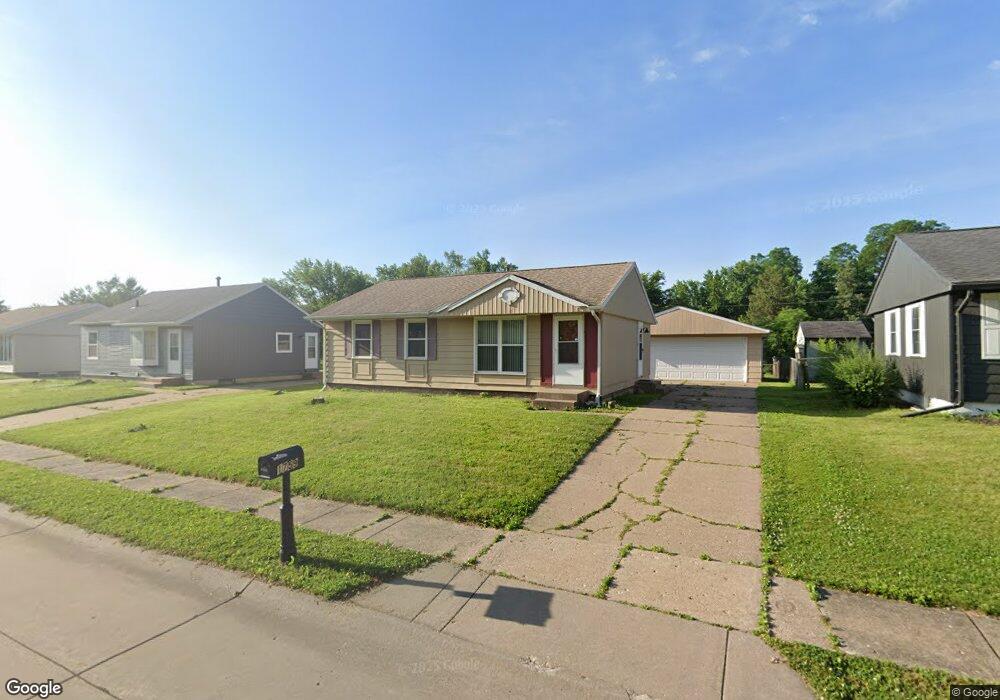
1759 Welshire Dr Davenport, IA 52806
North Side NeighborhoodEstimated Value: $157,092 - $178,000
3
Beds
2
Baths
850
Sq Ft
$196/Sq Ft
Est. Value
About This Home
This home is located at 1759 Welshire Dr, Davenport, IA 52806 and is currently estimated at $166,773, approximately $196 per square foot. 1759 Welshire Dr is a home located in Scott County with nearby schools including Truman Elementary School, Cumberland Hall School, and Academy Of Continuing Education.
Ownership History
Date
Name
Owned For
Owner Type
Purchase Details
Closed on
Oct 12, 2011
Sold by
Cramblett Michael A
Bought by
Cramblett Michelle Y
Current Estimated Value
Purchase Details
Closed on
Jan 2, 2009
Sold by
Cramblett Alva D and Cramblett Natalia N
Bought by
Cramblett Michelle Y and Cramblett Michael A
Purchase Details
Closed on
Dec 29, 2008
Sold by
Cramblett Alva D and Cramblett Natalia N
Bought by
Cramblett Michelle Y and Cramblett Michael A
Purchase Details
Closed on
Nov 13, 2008
Sold by
Cramblett Alva D
Bought by
Cramblett Alva D and Cramblett Natalia N
Create a Home Valuation Report for This Property
The Home Valuation Report is an in-depth analysis detailing your home's value as well as a comparison with similar homes in the area
Home Values in the Area
Average Home Value in this Area
Purchase History
| Date | Buyer | Sale Price | Title Company |
|---|---|---|---|
| Cramblett Michelle Y | -- | None Available | |
| Cramblett Michelle Y | -- | None Available | |
| Cramblett Michelle Y | -- | None Available | |
| Cramblett Alva D | -- | None Available |
Source: Public Records
Tax History Compared to Growth
Tax History
| Year | Tax Paid | Tax Assessment Tax Assessment Total Assessment is a certain percentage of the fair market value that is determined by local assessors to be the total taxable value of land and additions on the property. | Land | Improvement |
|---|---|---|---|---|
| 2025 | $2,508 | $152,010 | $30,360 | $121,650 |
| 2024 | $2,446 | $140,290 | $30,360 | $109,930 |
| 2023 | $2,662 | $140,290 | $30,360 | $109,930 |
| 2022 | $2,512 | $124,600 | $23,460 | $101,140 |
| 2021 | $2,512 | $117,020 | $23,460 | $93,560 |
| 2020 | $2,450 | $112,800 | $23,460 | $89,340 |
| 2019 | $2,690 | $107,750 | $23,460 | $84,290 |
| 2018 | $981 | $107,750 | $23,460 | $84,290 |
| 2017 | $599 | $107,750 | $23,460 | $84,290 |
| 2016 | $2,717 | $107,750 | $0 | $0 |
| 2015 | $2,360 | $99,090 | $0 | $0 |
| 2014 | $2,200 | $99,090 | $0 | $0 |
| 2013 | $2,162 | $0 | $0 | $0 |
| 2012 | -- | $98,740 | $23,760 | $74,980 |
Source: Public Records
Map
Nearby Homes
- 1729 Welshire Dr
- 5210 N Division St
- 5436 N Division St
- 1927 W 55th St
- 5510 N Division St
- 2127 W 51st St
- 5109 N Pine St
- 28 W Village Cir
- 4705 N Sturdevant St
- 4618 Fillmore Ln
- 1415 W 59th St
- 2620 W 54th St
- 5721 Taylor St
- 2434 W 59th St
- 5735 Taylor St
- 5556 N Thornwood Ave
- 4406 Regency Place
- 5312 Hillandale Rd
- 4757 Willow Cir
- 4743 Willow Cir
- 1753 Welshire Dr
- 1803 Welshire Dr
- 1809 Welshire Dr
- 1749 Welshire Dr
- 1762 Welshire Dr
- 1804 Welshire Dr
- 1756 Welshire Dr
- 1815 Welshire Dr
- 1741 Welshire Dr
- 1810 Welshire Dr
- 1750 Welshire Dr
- 1750 W 53rd St
- 1811 W 53rd St
- 1821 Welshire Dr
- 1744 Welshire Dr
- 1816 Welshire Dr
- 1735 Welshire Dr
- 1761 W 54th St
- 1755 W 54th St
- 1803 W 54th St