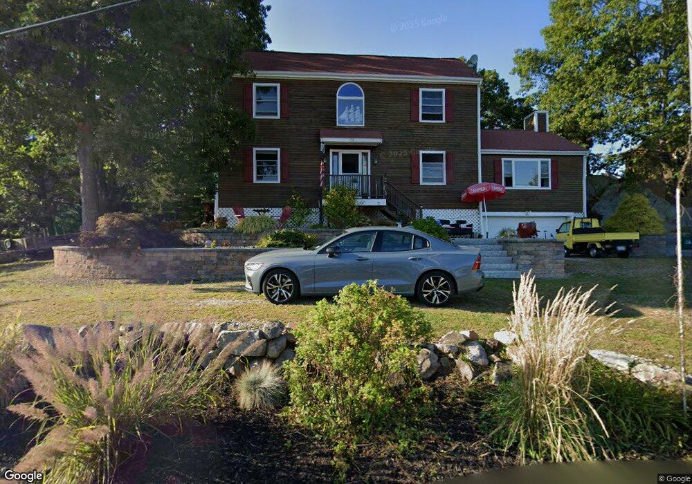
176 Atlantic St Gloucester, MA 01930
West Gloucester NeighborhoodEstimated Value: $974,793 - $1,345,000
3
Beds
3
Baths
2,680
Sq Ft
$436/Sq Ft
Est. Value
About This Home
This home is located at 176 Atlantic St, Gloucester, MA 01930 and is currently estimated at $1,169,448, approximately $436 per square foot. 176 Atlantic St is a home located in Essex County with nearby schools including West Parish, Ralph B O'maley Middle School, and Gloucester High School.
Ownership History
Date
Name
Owned For
Owner Type
Purchase Details
Closed on
Apr 2, 2019
Sold by
Bishop Carmela E and Bicknell Robert A
Bought by
Robert J & C E Bishop Lt
Current Estimated Value
Purchase Details
Closed on
Dec 5, 2005
Sold by
Stanton Patricia M and Stanton Patrick J
Bought by
Bishop Robert J and Bishop Carmela E
Home Financials for this Owner
Home Financials are based on the most recent Mortgage that was taken out on this home.
Original Mortgage
$359,000
Interest Rate
6.14%
Mortgage Type
Purchase Money Mortgage
Purchase Details
Closed on
Oct 29, 1998
Sold by
Eagan Jeffrey H and Eagan Cynthia C
Bought by
Stanton Patrick J and Stanton Patricia
Purchase Details
Closed on
Jun 10, 1988
Sold by
Atlantic Rlty Tr
Bought by
Stanton Patrick J
Home Financials for this Owner
Home Financials are based on the most recent Mortgage that was taken out on this home.
Original Mortgage
$250,000
Interest Rate
10.21%
Mortgage Type
Purchase Money Mortgage
Create a Home Valuation Report for This Property
The Home Valuation Report is an in-depth analysis detailing your home's value as well as a comparison with similar homes in the area
Home Values in the Area
Average Home Value in this Area
Purchase History
| Date | Buyer | Sale Price | Title Company |
|---|---|---|---|
| Robert J & C E Bishop Lt | -- | -- | |
| Bishop Robert J | $510,000 | -- | |
| Stanton Patrick J | $7,000 | -- | |
| Stanton Patrick J | $293,000 | -- |
Source: Public Records
Mortgage History
| Date | Status | Borrower | Loan Amount |
|---|---|---|---|
| Previous Owner | Stanton Patrick J | $336,000 | |
| Previous Owner | Stanton Patrick J | $359,000 | |
| Previous Owner | Stanton Patrick J | $20,000 | |
| Previous Owner | Stanton Patrick J | $250,000 |
Source: Public Records
Tax History Compared to Growth
Tax History
| Year | Tax Paid | Tax Assessment Tax Assessment Total Assessment is a certain percentage of the fair market value that is determined by local assessors to be the total taxable value of land and additions on the property. | Land | Improvement |
|---|---|---|---|---|
| 2025 | $8,480 | $872,400 | $277,100 | $595,300 |
| 2024 | $8,360 | $859,200 | $263,900 | $595,300 |
| 2023 | $8,008 | $756,200 | $235,700 | $520,500 |
| 2022 | $7,702 | $656,600 | $200,300 | $456,300 |
| 2021 | $7,435 | $597,700 | $182,100 | $415,600 |
| 2020 | $7,484 | $607,000 | $182,100 | $424,900 |
| 2019 | $7,228 | $569,600 | $182,100 | $387,500 |
| 2018 | $6,918 | $535,000 | $182,100 | $352,900 |
| 2017 | $6,703 | $508,200 | $173,400 | $334,800 |
| 2016 | $6,515 | $478,700 | $173,900 | $304,800 |
| 2015 | $6,263 | $458,800 | $173,900 | $284,900 |
Source: Public Records
Map
Nearby Homes
- 226 Atlantic St
- 672 Washington St
- 2 Finch Ln
- 5 Samoset Rd Unit B
- 7 Leaman Dr
- 6 Monroe Ct
- 196 Washington St
- 78 Grove St
- 98 Maplewood Ave
- 368 Essex Ave
- 16 Cleveland Place Unit 11
- 15 Harvard St
- 40 Sargent St
- 84 Centennial Ave
- 145 Essex St Unit 622
- 357 Concord St
- 33 Maplewood Ave Unit 16
- 20 Beacon St Unit 2
- 20 Beacon St Unit 1
- 587 Essex Ave
- 178 Atlantic St
- 180 Atlantic St
- 172 Atlantic St
- 172R Atlantic St
- 182 Atlantic St
- 170 Atlantic St
- 170 Atlantic St Unit R
- 170R Atlantic St
- 184 Atlantic St
- 168 Atlantic St
- 186 Atlantic St
- 13 Atlantic Ave
- 9 Atlantic Ave
- 9 Atlantic Ave Unit 2
- 7 Atlantic Ave
- 166 Atlantic St
- 11 Atlantic Ave
- 1 Brookfield Dr
- 190 Atlantic St
- 3 Brookfield Dr