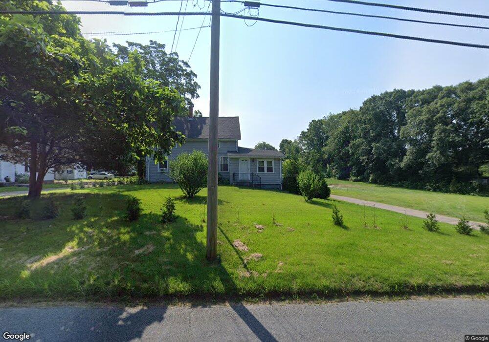
176 Bushee Rd Swansea, MA 02777
Luther Corner NeighborhoodEstimated Value: $477,000 - $602,000
3
Beds
2
Baths
1,517
Sq Ft
$338/Sq Ft
Est. Value
About This Home
This home is located at 176 Bushee Rd, Swansea, MA 02777 and is currently estimated at $513,279, approximately $338 per square foot. 176 Bushee Rd is a home located in Bristol County with nearby schools including Joseph Case High School, Highlander Charter Middle and High School, and East Bay Career Academy.
Ownership History
Date
Name
Owned For
Owner Type
Purchase Details
Closed on
Nov 17, 2008
Sold by
Tyrrell Melanie E
Bought by
Vieira Frank A and Vieira Sandra L
Current Estimated Value
Home Financials for this Owner
Home Financials are based on the most recent Mortgage that was taken out on this home.
Original Mortgage
$197,500
Outstanding Balance
$129,964
Interest Rate
6.13%
Mortgage Type
Purchase Money Mortgage
Estimated Equity
$383,315
Purchase Details
Closed on
Feb 27, 2007
Sold by
Marum Dennis J
Bought by
Tyrrell Melanie E
Purchase Details
Closed on
Feb 24, 2006
Sold by
Berard Jean M
Bought by
Marum Dennis J and Tyrrell Melanie E
Home Financials for this Owner
Home Financials are based on the most recent Mortgage that was taken out on this home.
Original Mortgage
$125,000
Interest Rate
6.17%
Mortgage Type
Purchase Money Mortgage
Create a Home Valuation Report for This Property
The Home Valuation Report is an in-depth analysis detailing your home's value as well as a comparison with similar homes in the area
Home Values in the Area
Average Home Value in this Area
Purchase History
| Date | Buyer | Sale Price | Title Company |
|---|---|---|---|
| Vieira Frank A | $227,500 | -- | |
| Tyrrell Melanie E | -- | -- | |
| Marum Dennis J | $125,000 | -- |
Source: Public Records
Mortgage History
| Date | Status | Borrower | Loan Amount |
|---|---|---|---|
| Open | Vieira Frank A | $197,500 | |
| Previous Owner | Marum Dennis J | $125,000 |
Source: Public Records
Tax History Compared to Growth
Tax History
| Year | Tax Paid | Tax Assessment Tax Assessment Total Assessment is a certain percentage of the fair market value that is determined by local assessors to be the total taxable value of land and additions on the property. | Land | Improvement |
|---|---|---|---|---|
| 2025 | $4,553 | $382,000 | $188,000 | $194,000 |
| 2024 | $4,556 | $380,000 | $188,000 | $192,000 |
| 2023 | $4,351 | $331,400 | $140,400 | $191,000 |
| 2022 | $3,970 | $275,900 | $128,700 | $147,200 |
| 2021 | $4,036 | $258,200 | $128,700 | $129,500 |
| 2020 | $3,999 | $256,700 | $128,700 | $128,000 |
| 2019 | $3,850 | $248,200 | $116,100 | $132,100 |
| 2018 | $3,663 | $239,700 | $114,400 | $125,300 |
| 2017 | $3,219 | $242,400 | $114,400 | $128,000 |
| 2016 | $2,770 | $204,900 | $100,100 | $104,800 |
| 2015 | $2,672 | $203,500 | $100,100 | $103,400 |
| 2014 | $2,613 | $203,500 | $100,100 | $103,400 |
Source: Public Records
Map
Nearby Homes
- 147 Bushee Rd
- 1405 Gar Hwy Unit A
- 46 Magnolia Dr
- 447 Old Warren Rd
- 0 Old Fall River Rd Unit 73399047
- 192 Schoolhouse Rd
- 107 & 107R Walker
- 24 Nod Rd
- 383 Vinnicum Rd
- 9 Kenny Dr
- 79 Cedar Ave
- 17 Colonial Dr
- 34 Columbia Rd
- 510 Child St Unit 303A
- 510 Child St Unit 105B
- 510 Child St Unit 201C
- 510 Child St Unit 402B
- 510 Child St Unit 305B
- 10 Quaker Ln
- 1 Cedarbrook Unit A