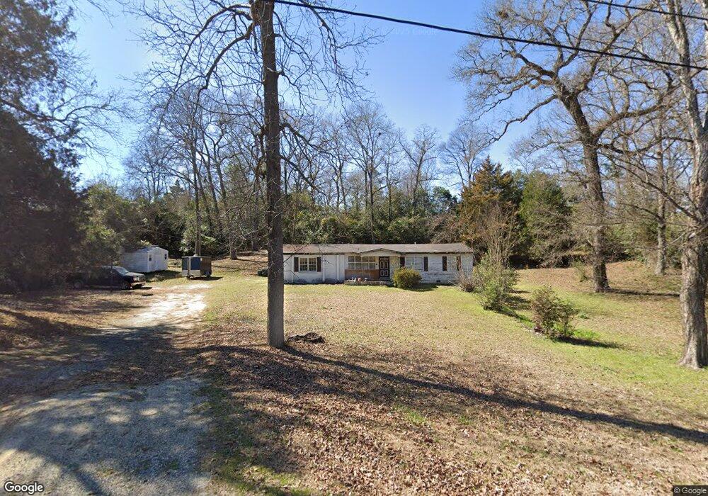
176 Carter Cir Warner Robins, GA 31093
Estimated Value: $136,000 - $172,000
3
Beds
2
Baths
1,299
Sq Ft
$119/Sq Ft
Est. Value
About This Home
This home is located at 176 Carter Cir, Warner Robins, GA 31093 and is currently estimated at $154,084, approximately $118 per square foot. 176 Carter Cir is a home located in Houston County with nearby schools including Westside Elementary School, Northside Middle School, and Northside High School.
Ownership History
Date
Name
Owned For
Owner Type
Purchase Details
Closed on
Aug 10, 1992
Sold by
Brady George
Bought by
Lawhorn Stephen M
Current Estimated Value
Purchase Details
Closed on
Jul 30, 1992
Sold by
Brady George
Bought by
Brady George
Purchase Details
Closed on
Feb 19, 1991
Sold by
Secretary Of Veterans Affairs
Bought by
Brady George
Purchase Details
Closed on
Oct 2, 1990
Sold by
Fleet Real Estate Funding Corp
Bought by
Secretary Of Veterans Affairs
Purchase Details
Closed on
Sep 24, 1976
Sold by
Humphries James F and Humphries Claudia B
Bought by
Cleary Peter R and Cleary Patricia A
Purchase Details
Closed on
Apr 7, 1971
Sold by
Champion James H and Champion Ada S
Bought by
Humphries James F and Humphries Claudia B
Purchase Details
Closed on
Feb 10, 1970
Sold by
Wortham William S and H M
Bought by
Champion James H and Champion Ada S
Create a Home Valuation Report for This Property
The Home Valuation Report is an in-depth analysis detailing your home's value as well as a comparison with similar homes in the area
Home Values in the Area
Average Home Value in this Area
Purchase History
| Date | Buyer | Sale Price | Title Company |
|---|---|---|---|
| Lawhorn Stephen M | $42,000 | -- | |
| Brady George | -- | -- | |
| Brady George | -- | -- | |
| Secretary Of Veterans Affairs | -- | -- | |
| Fleet Real Estate Funding Corp | -- | -- | |
| Cleary Peter R | -- | -- | |
| Humphries James F | -- | -- | |
| Champion James H | -- | -- |
Source: Public Records
Tax History Compared to Growth
Tax History
| Year | Tax Paid | Tax Assessment Tax Assessment Total Assessment is a certain percentage of the fair market value that is determined by local assessors to be the total taxable value of land and additions on the property. | Land | Improvement |
|---|---|---|---|---|
| 2024 | $754 | $33,520 | $5,560 | $27,960 |
| 2023 | $680 | $30,120 | $7,360 | $22,760 |
| 2022 | $615 | $27,440 | $7,360 | $20,080 |
| 2021 | $570 | $25,480 | $7,360 | $18,120 |
| 2020 | $597 | $26,440 | $7,360 | $19,080 |
| 2019 | $597 | $26,440 | $7,360 | $19,080 |
| 2018 | $597 | $26,440 | $7,360 | $19,080 |
| 2017 | $597 | $26,440 | $7,360 | $19,080 |
| 2016 | $598 | $26,440 | $7,360 | $19,080 |
| 2015 | $599 | $26,440 | $7,360 | $19,080 |
| 2014 | -- | $26,440 | $7,360 | $19,080 |
| 2013 | -- | $26,560 | $7,360 | $19,200 |
Source: Public Records
Map
Nearby Homes
- 209 Knodishall Dr
- 129 Maryjay Dr
- 111 Hawthorne Rd
- 501 Pinecrest Dr
- 301 Millside Dr
- 112 Peacock Dr
- 318 Somerset Dr
- 106 Westcliff Cir
- 110 Westcliff Cir Unit C
- 321 Somerset Dr
- 103 Westcliff Cir Unit A
- 103 Westcliff Cir Unit A
- 127 N Amanda Place
- 141 Peacock Dr
- 221 Gilchrist Dr
- 725 B East Side Dr
- 707 Wilmington Dr
- 303 Pinecrest Dr
- 86 Westcliff Cir
- 102 Westcliff Center St Unit D
- 174 Carter Cir
- 106 Fisher St
- 2400 Watson Blvd
- 108 Fisher St
- 2410 Watson Blvd
- 181 Carter Cir
- 110 Fisher St
- 170 Carter Cir
- 173 Carter Cir
- 2328 Watson Blvd
- 171 Carter Cir
- 107 Fisher St
- 2320 Watson Blvd
- 168 Carter Cir
- 169 Carter Cir
- 105 Fisher St
- 109 Fisher St
- 2502 Watson Blvd
- 111 Fisher St
- 167 Carter Cir