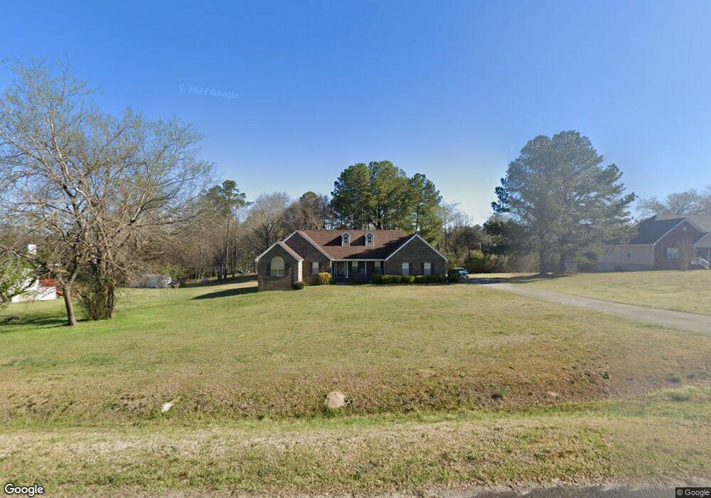
176 John Michael Dr Macon, GA 31211
Estimated Value: $224,000 - $277,000
Studio
2
Baths
2,423
Sq Ft
$106/Sq Ft
Est. Value
About This Home
This home is located at 176 John Michael Dr, Macon, GA 31211 and is currently estimated at $255,896, approximately $105 per square foot. 176 John Michael Dr is a home located in Jones County with nearby schools including Mattie Wells Elementary School, Clifton Ridge Middle School, and Jones County High School.
Ownership History
Date
Name
Owned For
Owner Type
Purchase Details
Closed on
Jan 30, 2015
Sold by
Riggins Brenda C
Bought by
Riggins Brenda C and Riggins Allen
Current Estimated Value
Purchase Details
Closed on
Jul 31, 2014
Sold by
Wright Christopher
Bought by
Riggins Brenda C
Home Financials for this Owner
Home Financials are based on the most recent Mortgage that was taken out on this home.
Original Mortgage
$112,000
Interest Rate
4.16%
Mortgage Type
New Conventional
Purchase Details
Closed on
May 6, 2014
Sold by
Knight Hetty L
Bought by
Wright Christopher
Purchase Details
Closed on
May 15, 2000
Sold by
Dublin Investments Llc
Bought by
Knight Hetty L
Create a Home Valuation Report for This Property
The Home Valuation Report is an in-depth analysis detailing your home's value as well as a comparison with similar homes in the area
Purchase History
| Date | Buyer | Sale Price | Title Company |
|---|---|---|---|
| Riggins Brenda C | -- | -- | |
| Riggins Brenda C | $140,000 | -- | |
| Wright Christopher | -- | -- | |
| Knight Hetty L | -- | -- | |
| Knight Hetty L | $117,000 | -- |
Source: Public Records
Mortgage History
| Date | Status | Borrower | Loan Amount |
|---|---|---|---|
| Previous Owner | Riggins Brenda C | $112,000 |
Source: Public Records
Tax History
| Year | Tax Paid | Tax Assessment Tax Assessment Total Assessment is a certain percentage of the fair market value that is determined by local assessors to be the total taxable value of land and additions on the property. | Land | Improvement |
|---|---|---|---|---|
| 2025 | $3,330 | $118,897 | $12,480 | $106,417 |
| 2023 | $1,479 | $76,090 | $9,600 | $66,490 |
| 2022 | $1,959 | $71,891 | $9,600 | $62,291 |
| 2021 | $1,961 | $71,891 | $9,600 | $62,291 |
| 2020 | $1,963 | $71,891 | $9,600 | $62,291 |
| 2019 | $1,963 | $71,891 | $9,600 | $62,291 |
| 2018 | $1,963 | $71,891 | $9,600 | $62,291 |
| 2017 | $1,963 | $71,891 | $9,600 | $62,291 |
| 2016 | $1,963 | $71,891 | $9,600 | $62,291 |
| 2015 | $1,777 | $71,891 | $9,600 | $62,291 |
| 2014 | $1,873 | $71,891 | $9,600 | $62,291 |
Source: Public Records
Map
Nearby Homes
- 225 Olivia Cir
- 3608 Joycliff Rd
- 227 Dusty Ln
- 118 Oakwood Dr
- 687 Jasmine Dr
- 3462 Joycliff Rd
- 1030 Sun Valley Ct Unit C55
- 1030 Sun Valley Ct
- 1034 Sun Valley Ct Unit C56
- 1034 Sun Valley Ct
- 1038 Sun Valley Ct Unit C57
- 1038 Sun Valley Ct
- 131 Sun Valley Dr
- 240 Neptune Ct
- 3614 Kingsview Dr
- 132 Spradley Dr
- 0 Kings Ct N Unit 10666708
- 201 Joycliff Cir
- 168 Ruby Dr
- 2815 New Clinton Rd
- 170 John Michael Dr
- 182 John Michael Dr
- 188 John Michael Dr
- 198 Olivia Cir
- 173 John Michael Dr
- 177 John Michael Dr
- 190 Olivia Cir
- 182 Olivia Cir
- 183 John Michael Dr
- 192 John Michael Dr
- 148 John Michael Dr
- 0 Olivia Cir Unit Par A 117429
- 0 Olivia Cir Unit Par A M117429
- 172 Olivia Cir
- 189 John Michael Dr
- 163 John Michael Dr
- 528 Dusty Ln
- 524 Dusty Ln
- 181 Olivia Cir
- 157 John Michael Dr
Your Personal Tour Guide
Ask me questions while you tour the home.