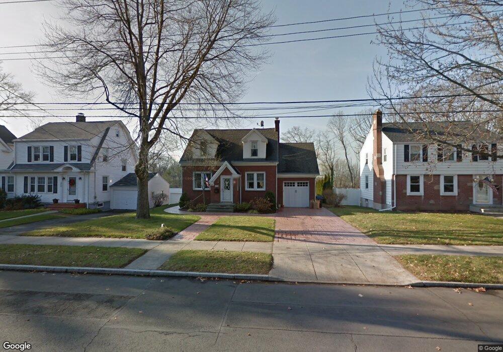
176 Kneeland Rd New Haven, CT 06512
East Shore NeighborhoodEstimated Value: $378,147 - $499,000
2
Beds
2
Baths
1,608
Sq Ft
$276/Sq Ft
Est. Value
About This Home
This home is located at 176 Kneeland Rd, New Haven, CT 06512 and is currently estimated at $443,037, approximately $275 per square foot. 176 Kneeland Rd is a home located in New Haven County with nearby schools including Cold Spring School, St Francis & St Rose Of Lima School, and Pathway School.
Ownership History
Date
Name
Owned For
Owner Type
Purchase Details
Closed on
Mar 12, 2010
Sold by
Sanseverino Joyce
Bought by
Candelora Andrew
Current Estimated Value
Purchase Details
Closed on
Oct 1, 1979
Bought by
Sanseverino Emilio M and Joyce Sanseverino J
Create a Home Valuation Report for This Property
The Home Valuation Report is an in-depth analysis detailing your home's value as well as a comparison with similar homes in the area
Home Values in the Area
Average Home Value in this Area
Purchase History
| Date | Buyer | Sale Price | Title Company |
|---|---|---|---|
| Candelora Andrew | -- | -- | |
| Sanseverino Emilio M | $40,900 | -- |
Source: Public Records
Mortgage History
| Date | Status | Borrower | Loan Amount |
|---|---|---|---|
| Open | Sanseverino Emilio M | $168,000 | |
| Previous Owner | Sanseverino Emilio M | $40,000 |
Source: Public Records
Tax History Compared to Growth
Tax History
| Year | Tax Paid | Tax Assessment Tax Assessment Total Assessment is a certain percentage of the fair market value that is determined by local assessors to be the total taxable value of land and additions on the property. | Land | Improvement |
|---|---|---|---|---|
| 2025 | $7,427 | $188,510 | $63,210 | $125,300 |
| 2024 | $7,258 | $188,510 | $63,210 | $125,300 |
| 2023 | $7,013 | $188,510 | $63,210 | $125,300 |
| 2022 | $7,493 | $188,510 | $63,210 | $125,300 |
| 2021 | $6,063 | $138,180 | $39,480 | $98,700 |
| 2020 | $6,063 | $138,180 | $39,480 | $98,700 |
| 2019 | $5,939 | $138,180 | $39,480 | $98,700 |
| 2018 | $5,939 | $138,180 | $39,480 | $98,700 |
| 2017 | $5,345 | $138,180 | $39,480 | $98,700 |
| 2016 | $5,672 | $136,500 | $41,020 | $95,480 |
| 2015 | $5,672 | $136,500 | $41,020 | $95,480 |
| 2014 | $5,672 | $136,500 | $41,020 | $95,480 |
Source: Public Records
Map
Nearby Homes
- 745 Townsend Ave Unit Lot 1
- 745 Townsend Ave Unit Lot 2
- 745 Townsend Ave Unit Lot 4
- 745 Townsend Ave Unit Lot 6
- 745 Townsend Ave Unit Lot 3
- 745 Townsend Ave Unit Lot 5
- 30 Upson Terrace
- 444 Woodward Ave
- 516 Woodward Ave
- 140 Townsend Terrace
- 62 Huntington Rd Unit 7
- 66 Elizabeth Ann Dr
- 52 Stuyvesant Ave
- 366 Burr St
- 4 Laura Ln
- 32 Huntington Ave
- 44 Huntington Ave
- 45 Huntington Ave
- 18 Lenox St
- 34 Hughes St
- 184 Kneeland Rd
- 164 Kneeland Rd
- 190 Kneeland Rd
- 315 Woodward Ave
- 321 Woodward Ave
- 327 Woodward Ave
- 307 Woodward Ave
- 34 Raynham Rd
- 333 Woodward Ave
- 26 Raynham Rd
- 179 Kneeland Rd
- 173 Kneeland Rd
- 19 Tuttle St
- 185 Kneeland Rd
- 196 Kneeland Rd
- 20 Raynham Rd
- 165 Kneeland Rd
- 191 Kneeland Rd
- 337 Woodward Ave
- 50 Raynham Rd