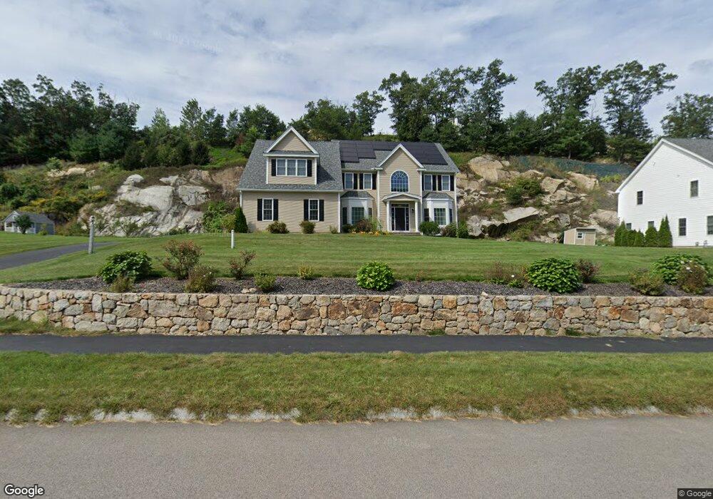
176 Mohawk Path Holliston, MA 01746
Estimated Value: $1,225,331 - $1,452,000
4
Beds
4
Baths
3,704
Sq Ft
$365/Sq Ft
Est. Value
About This Home
This home is located at 176 Mohawk Path, Holliston, MA 01746 and is currently estimated at $1,353,583, approximately $365 per square foot. 176 Mohawk Path is a home with nearby schools including Placentino Elementary School, Miller Elementary School, and Robert H. Adams Middle School.
Ownership History
Date
Name
Owned For
Owner Type
Purchase Details
Closed on
Jun 11, 2015
Sold by
Kandru Srinivasa
Bought by
Pavuluri Gayathri and Kandru Srinivasa
Current Estimated Value
Home Financials for this Owner
Home Financials are based on the most recent Mortgage that was taken out on this home.
Original Mortgage
$561,330
Outstanding Balance
$433,208
Interest Rate
3.65%
Mortgage Type
Purchase Money Mortgage
Estimated Equity
$920,375
Create a Home Valuation Report for This Property
The Home Valuation Report is an in-depth analysis detailing your home's value as well as a comparison with similar homes in the area
Home Values in the Area
Average Home Value in this Area
Purchase History
| Date | Buyer | Sale Price | Title Company |
|---|---|---|---|
| Pavuluri Gayathri | -- | -- | |
| Kandru Srinivasa | $729,000 | -- |
Source: Public Records
Mortgage History
| Date | Status | Borrower | Loan Amount |
|---|---|---|---|
| Open | Kandru Srinivasa | $561,330 |
Source: Public Records
Tax History
| Year | Tax Paid | Tax Assessment Tax Assessment Total Assessment is a certain percentage of the fair market value that is determined by local assessors to be the total taxable value of land and additions on the property. | Land | Improvement |
|---|---|---|---|---|
| 2025 | $15,935 | $1,087,700 | $274,900 | $812,800 |
| 2024 | $15,837 | $1,051,600 | $274,900 | $776,700 |
| 2023 | $15,144 | $983,400 | $274,900 | $708,500 |
| 2022 | $14,180 | $815,900 | $274,900 | $541,000 |
| 2021 | $14,296 | $800,900 | $259,900 | $541,000 |
| 2020 | $14,901 | $790,500 | $255,200 | $535,300 |
| 2019 | $14,744 | $783,000 | $247,700 | $535,300 |
| 2018 | $14,126 | $756,600 | $247,700 | $508,900 |
| 2017 | $13,744 | $742,100 | $260,300 | $481,800 |
| 2016 | $13,625 | $725,100 | $243,300 | $481,800 |
| 2015 | $3,802 | $196,200 | $196,200 | $0 |
Source: Public Records
Map
Nearby Homes
- 9 Adams Ln Unit 9
- 1 Adams Ln Unit 1
- 306 Trailside Way
- 241 Trailside Way
- 3 Danforth Dr
- 1 Danforth Dr
- 59 Brooksmont Dr Unit 59
- 363 Eliot St
- 2 Adams Rd Unit 2
- 147 Turner Rd Unit 80
- 26 Meeting House Path Unit 26
- 62 Ashland St
- 269 Concord St
- 74 Meeting House Path
- 9 Mountain Gate Rd
- 207 Eliot St
- 2 Arrowhead Cir Unit 2
- 45 Half Crown Cir
- 102 Captain Eames Cir
- 37 James Rd
- 180 Mohawk Path
- 179 Mohawk Path
- 175 Mohawk Path
- 172 Mohawk Path
- 172 Mohawk Path Unit 74
- 32 Hiawatha Trail
- 187 Mohawk Path
- Lot 56 Hiawatha Trail
- 88 Mohawk Path Unit 88
- 183 Mohawk Path Unit lot 87
- 183 Mohawk Path
- 89 Mohawk Path Unit 89
- 169 Mohawk Path
- 29 Hiawatha Trail
- 168 Mohawk Path
- 111 Hiawatha Trail Unit lot 111
- 113 Hiawatha Trail Unit lot 113
- 108 Hiawatha Trail Unit lot 108
- 110 Hiawatha Trail Unit lot 110
- 28 Hiawatha Trail
Your Personal Tour Guide
Ask me questions while you tour the home.