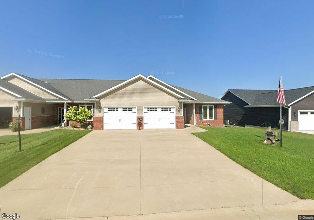
176 Mulberry Dr Cascade, IA 52033
Estimated Value: $346,661 - $406,000
3
Beds
3
Baths
2,603
Sq Ft
$144/Sq Ft
Est. Value
About This Home
This home is located at 176 Mulberry Dr, Cascade, IA 52033 and is currently estimated at $374,915, approximately $144 per square foot. 176 Mulberry Dr is a home located in Dubuque County with nearby schools including Cascade Elementary School, Cascade Junior/Senior High School, and Aquin Catholic Elementary School.
Ownership History
Date
Name
Owned For
Owner Type
Purchase Details
Closed on
Oct 9, 2012
Sold by
Tauke Wayne and Tauke Patricia
Bought by
Tauke Wayne and Tauke Patricia
Current Estimated Value
Home Financials for this Owner
Home Financials are based on the most recent Mortgage that was taken out on this home.
Original Mortgage
$250,000
Outstanding Balance
$173,722
Interest Rate
3.66%
Mortgage Type
Purchase Money Mortgage
Estimated Equity
$201,193
Purchase Details
Closed on
Sep 18, 2012
Sold by
Mulberry Estates Llc
Bought by
Tauke Wayne and Tauke Patricia
Home Financials for this Owner
Home Financials are based on the most recent Mortgage that was taken out on this home.
Original Mortgage
$250,000
Outstanding Balance
$173,722
Interest Rate
3.66%
Mortgage Type
Purchase Money Mortgage
Estimated Equity
$201,193
Create a Home Valuation Report for This Property
The Home Valuation Report is an in-depth analysis detailing your home's value as well as a comparison with similar homes in the area
Home Values in the Area
Average Home Value in this Area
Purchase History
| Date | Buyer | Sale Price | Title Company |
|---|---|---|---|
| Tauke Wayne | -- | None Available | |
| Tauke Wayne | $244,500 | None Available |
Source: Public Records
Mortgage History
| Date | Status | Borrower | Loan Amount |
|---|---|---|---|
| Open | Tauke Wayne | $250,000 |
Source: Public Records
Tax History
| Year | Tax Paid | Tax Assessment Tax Assessment Total Assessment is a certain percentage of the fair market value that is determined by local assessors to be the total taxable value of land and additions on the property. | Land | Improvement |
|---|---|---|---|---|
| 2025 | $3,946 | $338,600 | $21,100 | $317,500 |
| 2024 | $3,946 | $302,300 | $21,100 | $281,200 |
| 2023 | $4,018 | $302,300 | $21,100 | $281,200 |
| 2022 | $3,654 | $258,370 | $21,140 | $237,230 |
| 2021 | $3,654 | $258,370 | $21,140 | $237,230 |
| 2020 | $3,460 | $235,370 | $19,730 | $215,640 |
| 2019 | $3,712 | $235,370 | $19,730 | $215,640 |
| 2018 | $3,616 | $240,100 | $14,340 | $225,760 |
| 2017 | $3,358 | $240,100 | $14,340 | $225,760 |
| 2016 | $3,358 | $215,260 | $13,530 | $201,730 |
| 2015 | $3,280 | $215,260 | $13,530 | $201,730 |
| 2014 | $3,202 | $204,360 | $13,530 | $190,830 |
Source: Public Records
Map
Nearby Homes
- 145 Mulberry Dr
- 141 Mulberry Dr
- 131 Jack Oak Dr
- 105 Harrison St SE
- 207 Arthur St SW
- 607 5th Ave SW
- 816 6th Ave NW
- 805 4th Ave SW
- 1115 NW Clare Ct
- 1016 Clare Ct NW
- 23419 Gehl Ln
- XXX Larkin Ln
- 0 Larkin Ln
- Mcdevitt Ln
- 212 Park Dr
- Lot 7 4th St SW
- 0 W 1st Ave
- Lot 2 NW 4th Ave
- Lot 3 NW 4th Ave
- Lot 17 NW 4th Ave
- 178 Mulberry Dr
- 180 Mulberry Dr
- 182 Mulberry Dr
- 177 Mulberry Dr
- 173 Mulberry Dr
- 184 Mulberry Dr
- 158 Mulberry Dr
- 181 Mulberry Dr
- 169 Mulberry Dr
- 186 Mulberry Dr
- 170 Mulberry Dr
- 164 Mulberry Dr
- 168 Mulberry Dr
- 166 Mulberry Dr
- 162 Mulberry Dr
- 172 Mulberry Dr
- 185 Mulberry Dr
- 176 Jack Oak Dr
- 165 Mulberry Dr
- 180 Jack Oak Dr
Your Personal Tour Guide
Ask me questions while you tour the home.