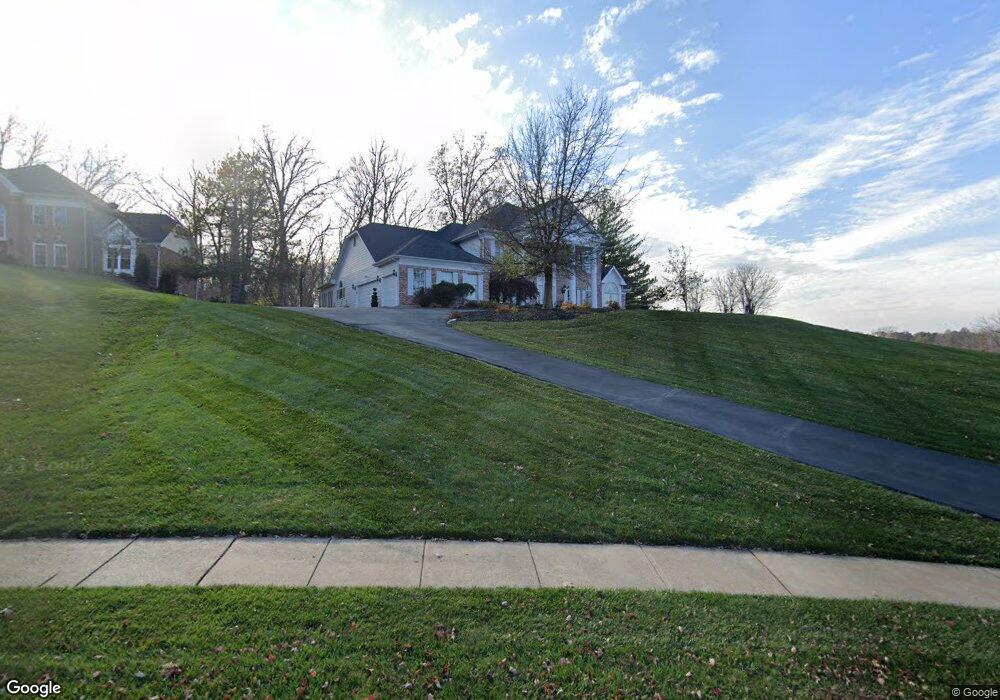
17608 Burnham Ct Chesterfield, MO 63005
Estimated Value: $995,585 - $1,179,000
4
Beds
4
Baths
5,227
Sq Ft
$201/Sq Ft
Est. Value
About This Home
This home is located at 17608 Burnham Ct, Chesterfield, MO 63005 and is currently estimated at $1,050,146, approximately $200 per square foot. 17608 Burnham Ct is a home located in St. Louis County with nearby schools including Chesterfield Elementary School, Rockwood Valley Middle School, and Lafayette High School.
Ownership History
Date
Name
Owned For
Owner Type
Purchase Details
Closed on
Sep 10, 2001
Sold by
Ratteree Steven M and Ratteree Karen J
Bought by
Riddick Thomas Franklin and Riddick Shelia Anne
Current Estimated Value
Purchase Details
Closed on
Aug 31, 2001
Sold by
Rattree Steven M and Ratteree Karen J
Bought by
Ratteree Steven M and Ratteree Karen J
Purchase Details
Closed on
Aug 17, 1998
Sold by
Boedeker Paul J and Boedeker Barbara A
Bought by
Ratteree Steven M and Ratterre Karen J
Home Financials for this Owner
Home Financials are based on the most recent Mortgage that was taken out on this home.
Original Mortgage
$516,800
Interest Rate
8.5%
Create a Home Valuation Report for This Property
The Home Valuation Report is an in-depth analysis detailing your home's value as well as a comparison with similar homes in the area
Home Values in the Area
Average Home Value in this Area
Purchase History
| Date | Buyer | Sale Price | Title Company |
|---|---|---|---|
| Riddick Thomas Franklin | $610,000 | -- | |
| Ratteree Steven M | $610,000 | -- | |
| Ratteree Steven M | -- | First American Title |
Source: Public Records
Mortgage History
| Date | Status | Borrower | Loan Amount |
|---|---|---|---|
| Previous Owner | Ratteree Steven M | $516,800 | |
| Closed | Riddick Thomas Franklin | -- |
Source: Public Records
Tax History Compared to Growth
Tax History
| Year | Tax Paid | Tax Assessment Tax Assessment Total Assessment is a certain percentage of the fair market value that is determined by local assessors to be the total taxable value of land and additions on the property. | Land | Improvement |
|---|---|---|---|---|
| 2025 | $10,241 | $179,930 | $50,310 | $129,620 |
| 2024 | $10,241 | $143,910 | $25,160 | $118,750 |
| 2023 | $9,975 | $143,910 | $25,160 | $118,750 |
| 2022 | $9,499 | $127,420 | $27,950 | $99,470 |
| 2021 | $9,445 | $127,420 | $27,950 | $99,470 |
| 2020 | $8,375 | $109,060 | $24,170 | $84,890 |
| 2019 | $8,329 | $109,060 | $24,170 | $84,890 |
| 2018 | $9,158 | $113,120 | $21,790 | $91,330 |
| 2017 | $8,952 | $113,120 | $21,790 | $91,330 |
| 2016 | $9,592 | $116,490 | $24,170 | $92,320 |
| 2015 | $9,392 | $116,490 | $24,170 | $92,320 |
| 2014 | $8,793 | $106,160 | $24,170 | $81,990 |
Source: Public Records
Map
Nearby Homes
- 17609 Burnham Ct
- 17702 Horse Creek Ct
- 1482 Country Lake Estates Dr
- 1084 Greystone Manor Pkwy
- 17738 Drummer Ln
- 17421 Private Valley Ln
- 17707 Hornbean Dr
- 17707 Wild Horse Creek Rd
- 1577 Kehrs Mill Rd
- 782 Schaeffer's Grove Ct
- 724 Silver Buck Ln
- 783 Schaeffer's Grove Ct
- 776 Schaeffer's Grove Ct
- 744 Silver Buck Ln
- 753 Silver Buck Ln
- 805 Silver Buck Ln
- 962 Silver Buck Ln
- 1504 Kehrs Mill Rd
- 1556 Wildhorse Parkway Dr
- 16907 Lewis Spring Farms Rd
- 17605 Burnham Ct
- 17601 Burnham Ct
- 17600 Burnham Ct
- 17702 Chaistain Ct
- 17706 Chaistain Ct
- 1302 Wildhorse Parkway Dr
- 17712 Chaistain Ct
- 17601 Bridgeway Dr
- 1231 Wildhorse Parkway Dr
- 17703 Copper Trail Ct
- 17718 Chaistain Ct
- 1208 Turnberry Ridge Ct
- 17600 Bridgeway Dr
- 17717 Chaistain Ct
- 1204 Turnberry Ct
- 17607 Bridgeway Dr
- 17692 Bridgeway Dr
- 1320 Wildhorse Parkway Dr
- 17700 Copper Trail Ct
- 1200 Turnberry Ridge Ct