Estimated Value: $258,750 - $342,000
4
Beds
3
Baths
2,731
Sq Ft
$107/Sq Ft
Est. Value
About This Home
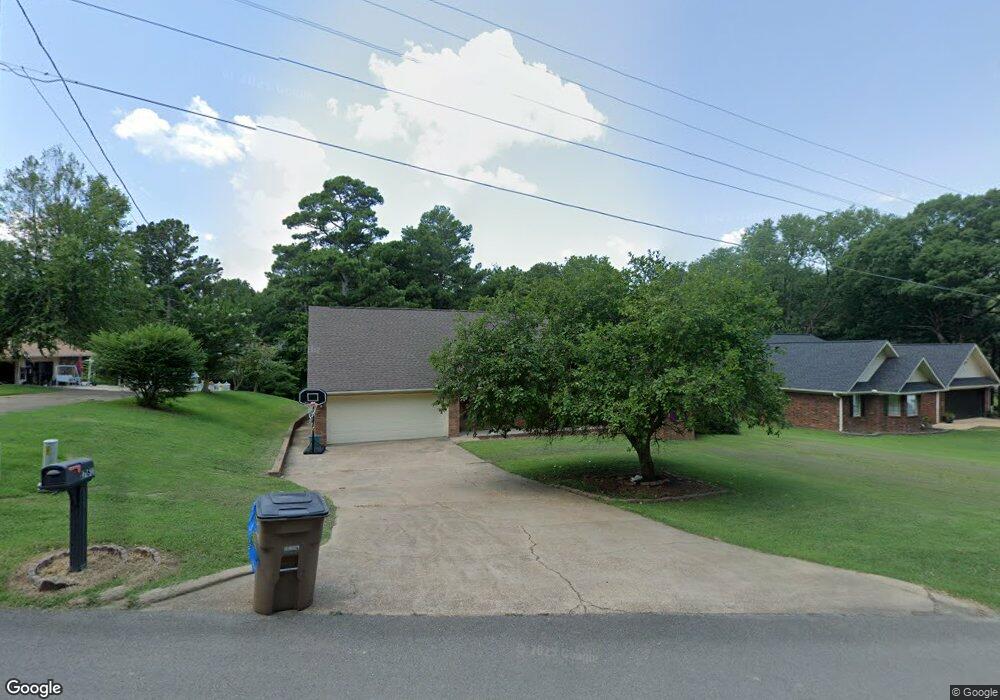
This home is located at 1761 Peterson Rd, Wynne, AR 72396 and is currently estimated at $291,938, approximately $106 per square foot. 1761 Peterson Rd is a home located in Cross County with nearby schools including Wynne Intermediate School, Wynne Primary School, and Wynne Junior High School.
Ownership History
Date
Name
Owned For
Owner Type
Purchase Details
Closed on
Dec 23, 2021
Sold by
Davis Zachary and Davis Karla
Bought by
Watson Randy and Watson Sharon
Current Estimated Value
Home Financials for this Owner
Home Financials are based on the most recent Mortgage that was taken out on this home.
Original Mortgage
$150,000
Outstanding Balance
$39,711
Interest Rate
3.11%
Mortgage Type
New Conventional
Estimated Equity
$252,227
Purchase Details
Closed on
Mar 29, 2019
Sold by
Perry Cleo C and Perry Janet D
Bought by
Davis Zachary D and Davis Karla
Home Financials for this Owner
Home Financials are based on the most recent Mortgage that was taken out on this home.
Original Mortgage
$195,886
Interest Rate
4.62%
Mortgage Type
FHA
Purchase Details
Closed on
Feb 2, 1999
Bought by
Perry Cleo C
Purchase Details
Closed on
Mar 26, 1998
Bought by
Estes Christopher Clyde
Purchase Details
Closed on
Mar 22, 1994
Bought by
Estes Chris and Estes Dianne
Purchase Details
Closed on
Feb 2, 1994
Bought by
Estes Chris and Estes Dianne
Create a Home Valuation Report for This Property
The Home Valuation Report is an in-depth analysis detailing your home's value as well as a comparison with similar homes in the area
Home Values in the Area
Average Home Value in this Area
Purchase History
| Date | Buyer | Sale Price | Title Company |
|---|---|---|---|
| Watson Randy | $187,600 | Janus Title | |
| Davis Zachary D | $200,000 | Cowling Title | |
| Perry Cleo C | $140,000 | -- | |
| Estes Christopher Clyde | -- | -- | |
| Estes Chris | -- | -- | |
| Estes Chris | -- | -- |
Source: Public Records
Mortgage History
| Date | Status | Borrower | Loan Amount |
|---|---|---|---|
| Open | Watson Randy | $150,000 | |
| Previous Owner | Davis Zachary D | $195,886 |
Source: Public Records
Tax History Compared to Growth
Tax History
| Year | Tax Paid | Tax Assessment Tax Assessment Total Assessment is a certain percentage of the fair market value that is determined by local assessors to be the total taxable value of land and additions on the property. | Land | Improvement |
|---|---|---|---|---|
| 2024 | $1,835 | $37,140 | $4,940 | $32,200 |
| 2023 | $1,838 | $37,140 | $4,940 | $32,200 |
| 2022 | $1,838 | $37,140 | $4,940 | $32,200 |
| 2021 | $1,463 | $37,140 | $4,940 | $32,200 |
| 2020 | $1,463 | $37,140 | $4,940 | $32,200 |
| 2019 | $1,236 | $32,550 | $4,080 | $28,470 |
| 2018 | $1,261 | $32,550 | $4,080 | $28,470 |
| 2017 | $1,261 | $32,550 | $4,080 | $28,470 |
| 2016 | $1,261 | $32,550 | $4,080 | $28,470 |
| 2015 | $1,261 | $32,550 | $4,080 | $28,470 |
| 2014 | $1,218 | $30,160 | $4,980 | $25,180 |
Source: Public Records
Map
Nearby Homes
- 1721 Peterson Dr
- 1805 Hf Henson Rd
- 1840 Cogbill Rd
- 1812 Eve St
- 1709 Quail Run Dr
- 1721 Quail Run Dr
- 1405 Peterson Rd
- 1737 Peterson Rd
- 1810 Killough Rd N
- 1916 Cogbill Rd
- 1308 Killough Rd N
- 1310 Bridges Ave E
- 1920 Airpark Rd
- 1003 Oakwood Dr
- 1404 Airpark Rd
- 1011 Hilltop Dr
- 345 Rhine Ave
- 4 Briarcliff Cir
- 29 Sunset Dr
- 1910 Hess Ln
- 1761 Peterson Dr
- 1763 Peterson Dr
- 1757 Peterson Dr
- 1756 Peterson Dr
- 1769 Peterson Dr
- 1760 Peterson Dr
- 1740 Peterson Rd
- 1730 Peterson Dr
- 1431 Eldridge Ave E
- 1740 Peterson Dr
- 1721 Peterson Rd
- 1720 Peterson Dr
- 1429 Eldridge Ave E
- 1797 H F Henson
- 0 H F Henson Dr Unit 24025972
- 1799 H F Henson Dr
- 1427 Eldridge Ave E
- 1490 Eldridge Ave E
- 1797 HF HENSON Henson Dr
- 1802 Cogbill Rd