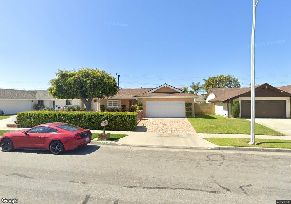
17611 Collie Ln Huntington Beach, CA 92647
Estimated Value: $1,283,083 - $1,418,000
3
Beds
2
Baths
1,724
Sq Ft
$788/Sq Ft
Est. Value
About This Home
This home is located at 17611 Collie Ln, Huntington Beach, CA 92647 and is currently estimated at $1,358,521, approximately $788 per square foot. 17611 Collie Ln is a home located in Orange County with nearby schools including Hope View Elementary School, Mesa View Middle School, and Ocean View High.
Ownership History
Date
Name
Owned For
Owner Type
Purchase Details
Closed on
Aug 7, 2009
Sold by
Lalonde John C and Lalonde Kathleen L
Bought by
Lalonde John C and Lalonde Kathleen L
Current Estimated Value
Purchase Details
Closed on
Feb 15, 2001
Sold by
Lalonde Kathleen L and Mcdonald Lalonde Kathleen L
Bought by
Lalonde John C and Lalonde Kathleen L
Home Financials for this Owner
Home Financials are based on the most recent Mortgage that was taken out on this home.
Original Mortgage
$172,300
Interest Rate
6.89%
Purchase Details
Closed on
Dec 22, 1993
Sold by
Macdonald Lalonde Kathleen L and Mclaughlin Edith
Bought by
Macdonald Lalonde Kathleen L
Home Financials for this Owner
Home Financials are based on the most recent Mortgage that was taken out on this home.
Original Mortgage
$179,500
Interest Rate
4.12%
Create a Home Valuation Report for This Property
The Home Valuation Report is an in-depth analysis detailing your home's value as well as a comparison with similar homes in the area
Home Values in the Area
Average Home Value in this Area
Purchase History
| Date | Buyer | Sale Price | Title Company |
|---|---|---|---|
| Lalonde John C | -- | None Available | |
| Lalonde John C | -- | Lawyers Title Company | |
| Macdonald Lalonde Kathleen L | -- | Orange Coast Title |
Source: Public Records
Mortgage History
| Date | Status | Borrower | Loan Amount |
|---|---|---|---|
| Closed | Lalonde John C | $172,300 | |
| Closed | Macdonald Lalonde Kathleen L | $179,500 |
Source: Public Records
Tax History Compared to Growth
Tax History
| Year | Tax Paid | Tax Assessment Tax Assessment Total Assessment is a certain percentage of the fair market value that is determined by local assessors to be the total taxable value of land and additions on the property. | Land | Improvement |
|---|---|---|---|---|
| 2025 | $4,204 | $362,175 | $243,410 | $118,765 |
| 2024 | $4,204 | $355,074 | $238,637 | $116,437 |
| 2023 | $4,105 | $348,112 | $233,958 | $114,154 |
| 2022 | $4,041 | $341,287 | $229,371 | $111,916 |
| 2021 | $3,967 | $334,596 | $224,874 | $109,722 |
| 2020 | $3,922 | $331,166 | $222,569 | $108,597 |
| 2019 | $3,856 | $324,673 | $218,205 | $106,468 |
| 2018 | $3,769 | $318,307 | $213,926 | $104,381 |
| 2017 | $3,709 | $312,066 | $209,731 | $102,335 |
| 2016 | $3,560 | $305,948 | $205,619 | $100,329 |
| 2015 | $3,504 | $301,353 | $202,531 | $98,822 |
| 2014 | $3,434 | $295,450 | $198,563 | $96,887 |
Source: Public Records
Map
Nearby Homes
- 5862 Raphael Dr
- 5812 Raphael Dr
- 17532 Montbury Cir
- 17372 Forbes Ln
- 5852 Bellfield Ln
- 17982 Whitford Ln
- 6051 Summerdale Dr
- 17071 Pinehurst Ln
- 18202 Foss Ln
- 6611 Crista Palma Dr
- 6161 Norbrook Dr
- 18321 Fieldbury Ln
- 6241 Warner Ave Unit 108
- 17042 Twain Ln
- 17352 Eucalyptus Ln
- 6301 Warner Ave Unit 40
- 6301 Warner Ave Unit 88
- 6600 Warner Ave Unit 119
- 6600 Warner Ave Unit 50
- 6600 Warner Ave
- 17601 Collie Ln
- 17621 Collie Ln
- 17612 Still Harbor Ln
- 17622 Still Harbor Ln
- 17602 Still Harbor Ln
- 17591 Collie Ln
- 17641 Collie Ln
- 17642 Still Harbor Ln
- 17592 Still Harbor Ln
- 17612 Collie Ln
- 17622 Collie Ln
- 17602 Collie Ln
- 17651 Collie Ln
- 17581 Collie Ln
- 17642 Collie Ln
- 17592 Collie Ln
- 17652 Still Harbor Ln
- 17582 Still Harbor Ln
- 17652 Collie Ln
- 17582 Collie Ln