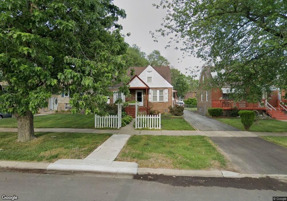
17611 Maple St Lansing, IL 60438
Estimated Value: $178,744 - $232,000
3
Beds
1
Bath
1,294
Sq Ft
$160/Sq Ft
Est. Value
About This Home
This home is located at 17611 Maple St, Lansing, IL 60438 and is currently estimated at $206,436, approximately $159 per square foot. 17611 Maple St is a home located in Cook County with nearby schools including Coolidge Elementary School, Memorial Jr High School, and Thornton Fractnl So High School.
Ownership History
Date
Name
Owned For
Owner Type
Purchase Details
Closed on
Apr 9, 2009
Sold by
Mesko Mark and Mesko Carole A
Bought by
Mesko Mark and Mesko Carole A
Current Estimated Value
Home Financials for this Owner
Home Financials are based on the most recent Mortgage that was taken out on this home.
Original Mortgage
$69,500
Outstanding Balance
$44,952
Interest Rate
5.62%
Mortgage Type
New Conventional
Estimated Equity
$161,484
Purchase Details
Closed on
Apr 26, 2002
Sold by
1740 North Maplewood Llc
Bought by
Engel Cammie K
Create a Home Valuation Report for This Property
The Home Valuation Report is an in-depth analysis detailing your home's value as well as a comparison with similar homes in the area
Home Values in the Area
Average Home Value in this Area
Purchase History
| Date | Buyer | Sale Price | Title Company |
|---|---|---|---|
| Mesko Mark | -- | Chicago Title | |
| Engel Cammie K | -- | -- |
Source: Public Records
Mortgage History
| Date | Status | Borrower | Loan Amount |
|---|---|---|---|
| Open | Mesko Mark | $69,500 |
Source: Public Records
Tax History
| Year | Tax Paid | Tax Assessment Tax Assessment Total Assessment is a certain percentage of the fair market value that is determined by local assessors to be the total taxable value of land and additions on the property. | Land | Improvement |
|---|---|---|---|---|
| 2025 | $4,637 | $12,900 | $2,391 | $10,509 |
| 2024 | $4,637 | $12,900 | $2,391 | $10,509 |
| 2023 | $3,938 | $12,900 | $2,391 | $10,509 |
| 2022 | $3,938 | $9,480 | $2,109 | $7,371 |
| 2021 | $3,887 | $9,479 | $2,109 | $7,370 |
| 2020 | $3,741 | $9,479 | $2,109 | $7,370 |
| 2019 | $3,452 | $9,493 | $1,968 | $7,525 |
| 2018 | $3,385 | $9,493 | $1,968 | $7,525 |
| 2017 | $3,452 | $9,493 | $1,968 | $7,525 |
| 2016 | $3,777 | $9,404 | $1,828 | $7,576 |
| 2015 | $3,445 | $9,404 | $1,828 | $7,576 |
| 2014 | $3,425 | $9,404 | $1,828 | $7,576 |
| 2013 | $3,619 | $10,668 | $1,828 | $8,840 |
Source: Public Records
Map
Nearby Homes
- 3645 177th Place
- 17702 Bernadine St
- 3520 Jackson St
- 108 Beverly Place
- 17945 Maple St
- 3617 Monroe St
- 7937 Forest Ave
- 17913 William St
- 222 Beacon Place
- 3659 Madison St
- 17519 Community St
- 17614 Community St
- 17244 Wentworth Ave
- 17831 Community St
- 8039 Forest Ave
- 3522 Washington St
- 17552 Roy St
- 17821 Roy St
- 17518 Roy St
- 17335 Community St
- 17615 Maple St
- 17607 Maple St
- 17621 Maple St
- 3714 176th Place
- 17601 Maple St
- 17610 State Line Ave
- 3674 176th Place
- 3718 176th Place
- 17545 Maple Ave
- 17600 State Line Ave
- 17631 Maple St
- 3670 176th Place
- 17600 Maple St
- 17635 Maple St
- 17544 Maple Ave
- 3711 176th Place
- 17634 Maple St
- 17548 State Line Ave
- 3662 176th Place
- 3717 176th Place
Your Personal Tour Guide
Ask me questions while you tour the home.