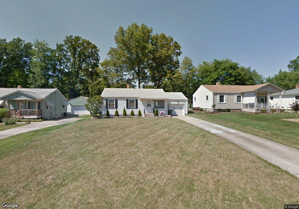
1762 Basil Ave Youngstown, OH 44514
Estimated Value: $136,000 - $152,000
2
Beds
2
Baths
1,008
Sq Ft
$141/Sq Ft
Est. Value
About This Home
This home is located at 1762 Basil Ave, Youngstown, OH 44514 and is currently estimated at $141,730, approximately $140 per square foot. 1762 Basil Ave is a home located in Mahoning County with nearby schools including Paul C. Bunn Elementary School, Chaney High School, and The Montessori School of the Mahoning Valley.
Ownership History
Date
Name
Owned For
Owner Type
Purchase Details
Closed on
May 23, 2011
Sold by
Walters Roger E and Walters Rosalee J
Bought by
Wardle Michael A and Wardle Pamela L
Current Estimated Value
Home Financials for this Owner
Home Financials are based on the most recent Mortgage that was taken out on this home.
Original Mortgage
$40,500
Outstanding Balance
$27,848
Interest Rate
4.96%
Mortgage Type
New Conventional
Estimated Equity
$113,882
Purchase Details
Closed on
Sep 28, 2004
Sold by
Kundus Mark E and Goubeaux Ginger L
Bought by
Walters Roger E and Walters Rosalee J
Home Financials for this Owner
Home Financials are based on the most recent Mortgage that was taken out on this home.
Original Mortgage
$62,000
Interest Rate
5.93%
Mortgage Type
Purchase Money Mortgage
Purchase Details
Closed on
Aug 26, 2002
Sold by
Kundus Ethel M
Bought by
Kundus Ethel M and Kundus Mark E
Purchase Details
Closed on
Aug 5, 1963
Bought by
Kundus Edw J and E M
Create a Home Valuation Report for This Property
The Home Valuation Report is an in-depth analysis detailing your home's value as well as a comparison with similar homes in the area
Home Values in the Area
Average Home Value in this Area
Purchase History
| Date | Buyer | Sale Price | Title Company |
|---|---|---|---|
| Wardle Michael A | $54,000 | Attorney | |
| Walters Roger E | $77,500 | -- | |
| Kundus Ethel M | -- | -- | |
| Kundus Edw J | -- | -- |
Source: Public Records
Mortgage History
| Date | Status | Borrower | Loan Amount |
|---|---|---|---|
| Open | Wardle Michael A | $40,500 | |
| Closed | Walters Roger E | $62,000 | |
| Closed | Walters Roger E | $15,500 |
Source: Public Records
Tax History
| Year | Tax Paid | Tax Assessment Tax Assessment Total Assessment is a certain percentage of the fair market value that is determined by local assessors to be the total taxable value of land and additions on the property. | Land | Improvement |
|---|---|---|---|---|
| 2025 | $1,763 | $34,400 | $5,670 | $28,730 |
| 2024 | $2,001 | $34,400 | $5,670 | $28,730 |
| 2023 | $1,989 | $34,400 | $5,670 | $28,730 |
| 2022 | $1,565 | $20,320 | $5,510 | $14,810 |
| 2021 | $1,565 | $20,320 | $5,510 | $14,810 |
| 2020 | $1,573 | $20,320 | $5,510 | $14,810 |
| 2019 | $1,575 | $17,510 | $4,750 | $12,760 |
| 2018 | $1,481 | $17,510 | $4,750 | $12,760 |
| 2017 | $1,383 | $17,510 | $4,750 | $12,760 |
| 2016 | $1,306 | $17,070 | $5,810 | $11,260 |
| 2015 | $1,283 | $17,070 | $5,810 | $11,260 |
| 2014 | $1,276 | $17,070 | $5,810 | $11,260 |
| 2013 | $1,260 | $17,070 | $5,810 | $11,260 |
Source: Public Records
Map
Nearby Homes
- 1750 Halbert Dr
- 1737 Halbert Dr
- 0 Lemoyne Ave
- 1870 Basil Ave
- 0 Woodlawn Ave
- 1514 Thalia Ave
- 0 Oles Ave
- 5425 Sheridan Rd
- 1926 Brandon Ave
- 1654 Thalia Ave
- 1933 Brandon Ave
- 5007 Sheridan Rd
- 0 Mathews Rd Unit 5149232
- 0 Mathews Rd Unit 5143059
- 1913 Country Club Ave
- 1928 Palo Verde Dr
- 850 Afton Ave
- 895 Cook Ave
- 1634 Meadowbrook Ave
- 1553 Bancroft Ave
- 1768 Basil Ave
- 1756 Basil Ave
- 1774 Basil Ave
- 1750 Basil Ave
- 1778 Basil Ave
- 1744 Basil Ave
- 1517 Brandon Ave
- 1525 Brandon Ave
- 1763 Basil Ave
- 1769 Basil Ave
- 1757 Basil Ave
- 1782 Basil Ave
- 1775 Basil Ave
- 1505 Brandon Ave
- 1738 Basil Ave
- 1751 Basil Ave
- 1533 Brandon Ave
- 1779 Basil Ave
- 1745 Basil Ave
- 1786 Basil Ave
Your Personal Tour Guide
Ask me questions while you tour the home.