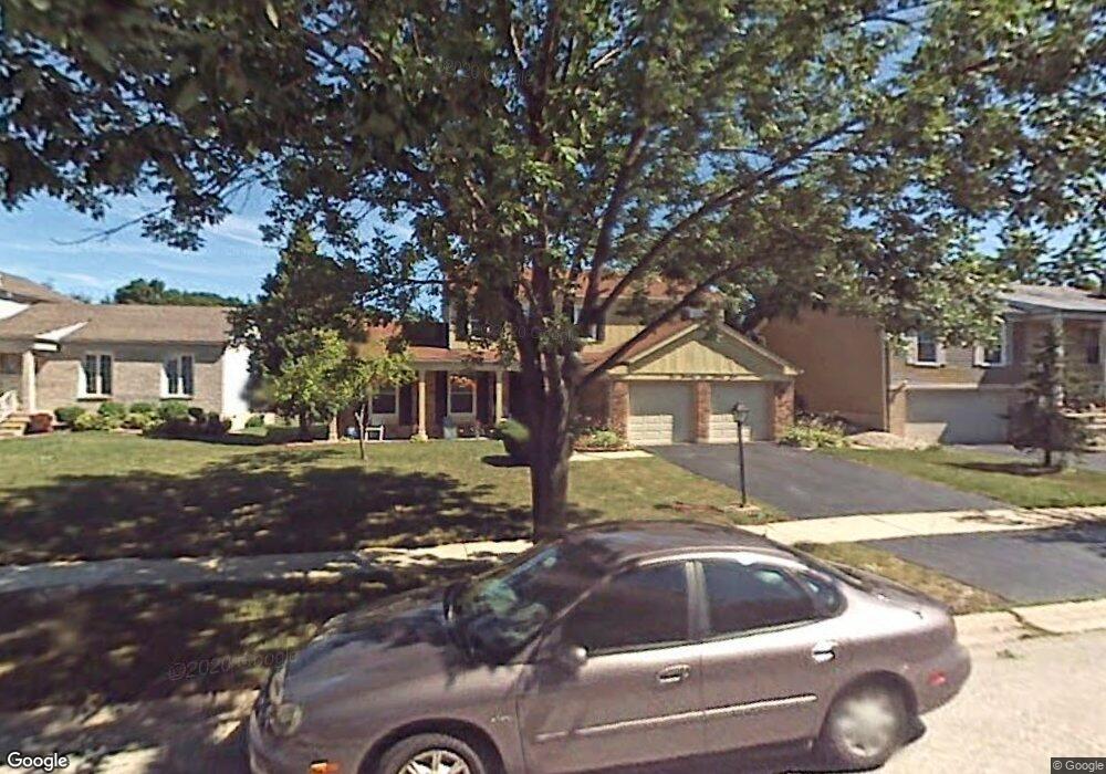
17629 Stonebridge Dr Hazel Crest, IL 60429
Stonebridge NeighborhoodEstimated Value: $252,000 - $356,000
4
Beds
3
Baths
2,024
Sq Ft
$153/Sq Ft
Est. Value
About This Home
This home is located at 17629 Stonebridge Dr, Hazel Crest, IL 60429 and is currently estimated at $309,410, approximately $152 per square foot. 17629 Stonebridge Dr is a home located in Cook County with nearby schools including Mae Jemison School, Prairie-Hills Junior High School, and Hillcrest High School.
Ownership History
Date
Name
Owned For
Owner Type
Purchase Details
Closed on
Jan 5, 2022
Sold by
Jones Linda L and Jones Willie A
Bought by
Jones Linda L and Jones Willie A
Current Estimated Value
Purchase Details
Closed on
Nov 29, 2011
Sold by
Jones Willie A and Jones Linda L
Bought by
Jones Willie A and Jones Linda L
Create a Home Valuation Report for This Property
The Home Valuation Report is an in-depth analysis detailing your home's value as well as a comparison with similar homes in the area
Home Values in the Area
Average Home Value in this Area
Purchase History
| Date | Buyer | Sale Price | Title Company |
|---|---|---|---|
| Jones Linda L | -- | -- | |
| Jones Willie A | -- | None Available |
Source: Public Records
Tax History Compared to Growth
Tax History
| Year | Tax Paid | Tax Assessment Tax Assessment Total Assessment is a certain percentage of the fair market value that is determined by local assessors to be the total taxable value of land and additions on the property. | Land | Improvement |
|---|---|---|---|---|
| 2024 | $10,262 | $21,131 | $3,177 | $17,954 |
| 2023 | $2,620 | $26,000 | $3,177 | $22,823 |
| 2022 | $2,620 | $9,725 | $2,803 | $6,922 |
| 2021 | $3,312 | $10,676 | $2,803 | $7,873 |
| 2020 | $4,388 | $12,116 | $2,803 | $9,313 |
| 2019 | $2,958 | $10,591 | $2,616 | $7,975 |
| 2018 | $4,667 | $13,377 | $2,616 | $10,761 |
| 2017 | $4,426 | $13,377 | $2,616 | $10,761 |
| 2016 | $5,433 | $11,789 | $2,242 | $9,547 |
| 2015 | $5,134 | $11,789 | $2,242 | $9,547 |
| 2014 | $5,037 | $11,789 | $2,242 | $9,547 |
| 2013 | $5,421 | $13,950 | $2,242 | $11,708 |
Source: Public Records
Map
Nearby Homes
- 17622 Oakwood Dr
- 5 E Carriageway Dr Unit 210
- 7 E Carriageway Dr Unit 101
- 7 E Carriageway Dr Unit 311
- 17613 Grandview Dr
- 17714 Dogwood Ln
- 2805 Knollwood Place
- 2908 Buttonwood Walk
- 17804 Pebblewood Ln
- 17803 Dogwood Ln
- 2912 175th St
- 2722 Cherrywood Ln
- 17805 Dogwood Ln
- 2900 175th St
- 2711 Larkspur Ln
- 17405 Longfellow Ave
- 17410 Emerson Ave
- 2814 Lexington Dr
- 2810 Lexington Dr
- 3107 Longfellow Ave
- 17627 Stonebridge Dr
- 17631 Stonebridge Dr
- 17633 Stonebridge Dr
- 17625 Stonebridge Dr
- 17624 Stonebridge Dr
- 17635 Stonebridge Dr
- 17622 Stonebridge Dr
- 17626 Stonebridge Dr
- 17623 Stonebridge Dr
- 17620 Stonebridge Dr
- 17628 Stonebridge Dr
- 17637 Stonebridge Dr
- 17621 Stonebridge Dr
- 17618 Stonebridge Dr
- 17630 Stonebridge Dr
- 17624 Oakwood Dr
- 17700 Oakwood Dr
- 17707 Stonebridge Dr
- 17616 Stonebridge Dr
- 17619 Stonebridge Dr