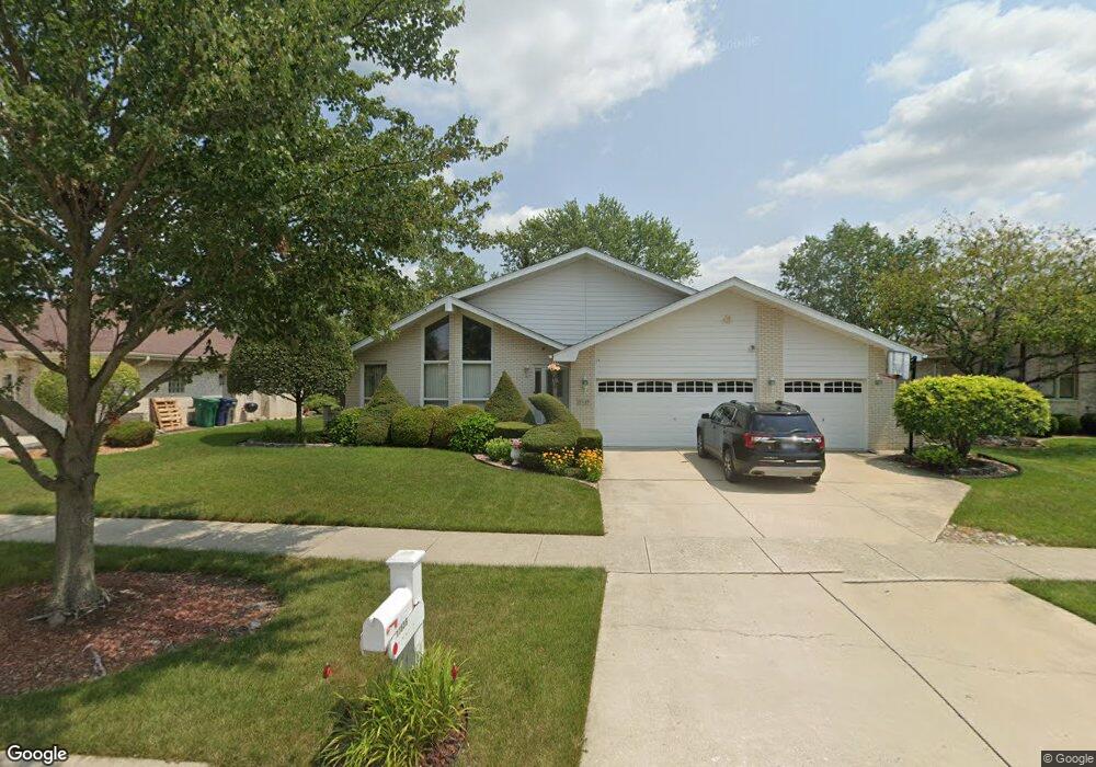
17639 Westbrook Dr Orland Park, IL 60467
Grasslands NeighborhoodEstimated Value: $505,647 - $612,000
3
Beds
3
Baths
2,516
Sq Ft
$218/Sq Ft
Est. Value
About This Home
This home is located at 17639 Westbrook Dr, Orland Park, IL 60467 and is currently estimated at $547,412, approximately $217 per square foot. 17639 Westbrook Dr is a home located in Cook County with nearby schools including Centennial School, Meadow Ridge School, and Century Junior High School.
Ownership History
Date
Name
Owned For
Owner Type
Purchase Details
Closed on
Oct 18, 1996
Sold by
Marquette National Bank
Bought by
Ulber Joseph and Ulber Cathy A
Current Estimated Value
Home Financials for this Owner
Home Financials are based on the most recent Mortgage that was taken out on this home.
Original Mortgage
$110,000
Interest Rate
7.85%
Create a Home Valuation Report for This Property
The Home Valuation Report is an in-depth analysis detailing your home's value as well as a comparison with similar homes in the area
Home Values in the Area
Average Home Value in this Area
Purchase History
| Date | Buyer | Sale Price | Title Company |
|---|---|---|---|
| Ulber Joseph | $247,000 | -- |
Source: Public Records
Mortgage History
| Date | Status | Borrower | Loan Amount |
|---|---|---|---|
| Previous Owner | Ulber Joseph | $110,000 |
Source: Public Records
Tax History Compared to Growth
Tax History
| Year | Tax Paid | Tax Assessment Tax Assessment Total Assessment is a certain percentage of the fair market value that is determined by local assessors to be the total taxable value of land and additions on the property. | Land | Improvement |
|---|---|---|---|---|
| 2024 | $8,697 | $40,718 | $7,280 | $33,438 |
| 2023 | $7,348 | $46,000 | $7,280 | $38,720 |
| 2022 | $7,348 | $30,688 | $5,980 | $24,708 |
| 2021 | $7,915 | $30,687 | $5,980 | $24,707 |
| 2020 | $7,681 | $30,687 | $5,980 | $24,707 |
| 2019 | $8,023 | $32,658 | $5,460 | $27,198 |
| 2018 | $7,801 | $32,658 | $5,460 | $27,198 |
| 2017 | $7,641 | $32,658 | $5,460 | $27,198 |
| 2016 | $8,634 | $33,440 | $4,940 | $28,500 |
| 2015 | $8,516 | $33,440 | $4,940 | $28,500 |
| 2014 | $8,405 | $33,440 | $4,940 | $28,500 |
| 2013 | $8,726 | $36,673 | $4,940 | $31,733 |
Source: Public Records
Map
Nearby Homes
- 17654 Greenfield Ct
- 11854 Swilly Ct
- 17813 Westbrook Dr
- 12130 179th St
- 11914 Dunree Ln
- 11760 Imperial Ln
- 18011 Breckenridge Blvd
- 11528 Brookwood Dr
- 12415 W Bruce Rd
- 17389 Highwood Dr
- 11573 Brook Hill Dr
- 12243 179th St
- 17950 Settlers Pond Way Unit 3B
- 18145 Breckenridge Blvd
- 11508 Lake Shore Dr
- 17396 Brook Crossing Ln
- 12057 Longmeadow Ln
- 11228 Cameron Pkwy
- 11424 Lakebrook Ct Unit 281
- 17292 Lakebrook Dr
- 17649 Westbrook Dr
- 17631 Westbrook Dr
- 17625 Westbrook Dr Unit 3
- 17657 Westbrook Dr
- 17642 Greenfield Ct
- 17701 Westbrook Dr
- 17615 Westbrook Dr
- 17640 Westbrook Dr
- 17634 Greenfield Ct
- 17650 Westbrook Dr
- 17630 Westbrook Dr
- 17620 Westbrook Dr Unit III
- 11915 Greenfield Dr
- 17660 Westbrook Dr
- 17707 Westbrook Dr
- 11905 Greenfield Dr
- 17607 Westbrook Dr
- 11901 Greenfield Dr
- 17610 Westbrook Dr