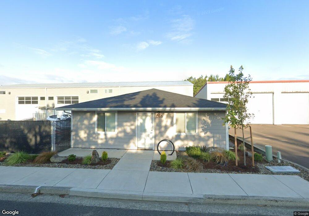
1765 Laurel Place Florence, OR 97439
Estimated Value: $464,512
Studio
--
Bath
1,260
Sq Ft
$369/Sq Ft
Est. Value
About This Home
This home is located at 1765 Laurel Place, Florence, OR 97439 and is currently estimated at $464,512, approximately $368 per square foot. 1765 Laurel Place is a home located in Lane County with nearby schools including Siuslaw Elementary School, Siuslaw Middle School, and Siuslaw High School.
Ownership History
Date
Name
Owned For
Owner Type
Purchase Details
Closed on
Dec 2, 2016
Sold by
Heceta Inc
Bought by
Goss David L
Current Estimated Value
Home Financials for this Owner
Home Financials are based on the most recent Mortgage that was taken out on this home.
Original Mortgage
$150,000
Outstanding Balance
$68,464
Interest Rate
2.79%
Mortgage Type
Seller Take Back
Estimated Equity
$396,048
Purchase Details
Closed on
Jul 15, 2008
Sold by
Sweet Creek Creations Llc
Bought by
Heceta Inc
Purchase Details
Closed on
Oct 30, 2002
Sold by
Wade Larry and Maria Dorothea
Bought by
Sweet Creek Creations Llc
Home Financials for this Owner
Home Financials are based on the most recent Mortgage that was taken out on this home.
Original Mortgage
$87,000
Interest Rate
5.99%
Mortgage Type
Seller Take Back
Purchase Details
Closed on
Nov 27, 2000
Sold by
Sanford Gene and Sanford Irene
Bought by
Wade Larry and Wade Maria Dorothea
Create a Home Valuation Report for This Property
The Home Valuation Report is an in-depth analysis detailing your home's value as well as a comparison with similar homes in the area
Home Values in the Area
Average Home Value in this Area
Purchase History
| Date | Buyer | Sale Price | Title Company |
|---|---|---|---|
| Goss David L | $200,000 | Cascade Title Co | |
| Heceta Inc | $165,000 | Western Title | |
| Sweet Creek Creations Llc | $97,000 | Western Title & Escrow Compa | |
| Wade Larry | -- | -- |
Source: Public Records
Mortgage History
| Date | Status | Borrower | Loan Amount |
|---|---|---|---|
| Open | Goss David L | $150,000 | |
| Previous Owner | Sweet Creek Creations Llc | $87,000 |
Source: Public Records
Tax History
| Year | Tax Paid | Tax Assessment Tax Assessment Total Assessment is a certain percentage of the fair market value that is determined by local assessors to be the total taxable value of land and additions on the property. | Land | Improvement |
|---|---|---|---|---|
| 2025 | $5,397 | $395,560 | -- | -- |
| 2024 | $5,241 | $384,039 | -- | -- |
| 2023 | $5,241 | $372,854 | $0 | $0 |
| 2022 | $4,890 | $361,995 | $0 | $0 |
| 2021 | $3,405 | $249,873 | $0 | $0 |
| 2020 | $1,745 | $127,663 | $0 | $0 |
| 2019 | $1,680 | $123,945 | $0 | $0 |
| 2018 | $1,683 | $116,830 | $0 | $0 |
| 2017 | $1,623 | $116,830 | $0 | $0 |
| 2016 | $1,546 | $113,427 | $0 | $0 |
| 2015 | $1,543 | $110,123 | $0 | $0 |
| 2014 | $1,527 | $106,916 | $0 | $0 |
Source: Public Records
Map
Nearby Homes
- 1640 17th St
- 1265 Laurel St
- 1150 Hemlock St Unit C11
- 1150 Hemlock St Unit E17
- 1150 Hemlock St Unit D14
- 1260 10th St Unit 11
- 1260 10th St Unit 5
- 1600 Rhododendron Dr Unit 285
- 1600 Rhododendron Dr Unit 415
- 1600 Rhododendron Dr Unit 218
- 1600 Rhododendron Dr Unit 200
- 1600 Rhododendron Dr Unit 279
- 1600 Rhododendron Dr Unit 155
- 1600 Rhododendron Dr Unit 278
- 1600 Rhododendron Dr Unit 76
- 1600 Rhododendron Dr Unit 261
- 1600 Rhododendron Dr
- 1600 Rhododendron Dr Unit 113
- 1600 Rhododendron Dr Unit 429
- 1600 Rhododendron Dr Unit 29
Your Personal Tour Guide
Ask me questions while you tour the home.