Estimated Value: $467,227 - $523,000
3
Beds
2
Baths
1,481
Sq Ft
$334/Sq Ft
Est. Value
About This Home
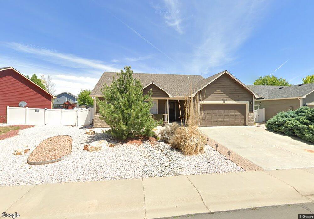
This home is located at 17650 Margil Rd, Mead, CO 80542 and is currently estimated at $494,557, approximately $333 per square foot. 17650 Margil Rd is a home located in Weld County with nearby schools including Mead Elementary School, Mead Middle School, and Mead High School.
Ownership History
Date
Name
Owned For
Owner Type
Purchase Details
Closed on
May 13, 2019
Sold by
Hindman Warren R
Bought by
Neiman Ronald L
Current Estimated Value
Home Financials for this Owner
Home Financials are based on the most recent Mortgage that was taken out on this home.
Original Mortgage
$235,000
Outstanding Balance
$205,769
Interest Rate
4%
Mortgage Type
New Conventional
Estimated Equity
$288,788
Purchase Details
Closed on
Jul 13, 2011
Sold by
Hindman Susan L and Breckenridge Susan L
Bought by
Hindman Warren R
Purchase Details
Closed on
Aug 21, 2009
Sold by
Hindman Warren R and Hindman Susan A
Bought by
Hindman Warren R and Hindman Susan L
Purchase Details
Closed on
Dec 22, 2004
Sold by
J & J Construction Northern Colorado Llc
Bought by
Hindman Warren R and Hindman Susan A
Home Financials for this Owner
Home Financials are based on the most recent Mortgage that was taken out on this home.
Original Mortgage
$226,855
Interest Rate
5.78%
Mortgage Type
VA
Create a Home Valuation Report for This Property
The Home Valuation Report is an in-depth analysis detailing your home's value as well as a comparison with similar homes in the area
Home Values in the Area
Average Home Value in this Area
Purchase History
| Date | Buyer | Sale Price | Title Company |
|---|---|---|---|
| Neiman Ronald L | $375,000 | First American Title | |
| Hindman Warren R | -- | None Available | |
| Hindman Warren R | -- | None Available | |
| Hindman Warren R | $226,855 | -- |
Source: Public Records
Mortgage History
| Date | Status | Borrower | Loan Amount |
|---|---|---|---|
| Open | Neiman Ronald L | $235,000 | |
| Previous Owner | Hindman Warren R | $226,855 |
Source: Public Records
Tax History Compared to Growth
Tax History
| Year | Tax Paid | Tax Assessment Tax Assessment Total Assessment is a certain percentage of the fair market value that is determined by local assessors to be the total taxable value of land and additions on the property. | Land | Improvement |
|---|---|---|---|---|
| 2025 | $2,437 | $28,490 | $8,630 | $19,860 |
| 2024 | $2,437 | $28,490 | $8,630 | $19,860 |
| 2023 | $2,349 | $26,840 | $4,940 | $21,900 |
| 2022 | $2,534 | $23,730 | $5,070 | $18,660 |
| 2021 | $2,582 | $24,410 | $5,220 | $19,190 |
| 2020 | $2,512 | $23,940 | $4,500 | $19,440 |
| 2019 | $1,760 | $23,940 | $4,500 | $19,440 |
| 2018 | $1,359 | $20,320 | $3,460 | $16,860 |
| 2017 | $1,309 | $20,320 | $3,460 | $16,860 |
| 2016 | $1,041 | $18,320 | $3,180 | $15,140 |
| 2015 | $1,785 | $18,320 | $3,180 | $15,140 |
| 2014 | $1,403 | $14,220 | $3,180 | $11,040 |
Source: Public Records
Map
Nearby Homes
- 17635 Silver Fox Ct
- 3757 Settler Ridge Dr
- 102 Cattail Ct
- 3796 Vale View Ln
- 215 Willow Dr
- 17790 County Road 7
- 4326 County Road 38
- 16835 Mckay Dr
- 16870 Mckay Dr
- Silverton Plan at Highlands Preserve
- Jefferson Plan at Highlands Preserve
- Keystone II Plan at Highlands Preserve
- Minturn Plan at Highlands Preserve
- Lakewood II Plan at Highlands Preserve
- Jansen Plan at Highlands Preserve
- Gunnison Plan at Highlands Preserve
- Jackson Plan at Highlands Preserve
- 3425 Ballinger Cir
- 16836 Roberts St
- 16873 Ballinger Cir
- 17598 Margil Rd
- 17672 Margil Rd
- 17584 Margil Rd
- 3613 Homestead Dr
- 3601 Homestead Dr
- 3625 Homestead Dr
- 17698 Margil Rd
- 3559 Homestead Dr
- 17651 Margil Rd
- 17673 Margil Rd
- 3647 Homestead Dr
- 17568 Margil Rd
- 17685 Margil Rd
- 17575 Margil Rd
- 3659 Homestead Dr
- 17697 Margil Rd
- 3535 Homestead Dr
- 17556 Margil Rd
- 17567 Margil Rd
- 3600 Homestead Dr