Estimated Value: $228,000 - $341,003
3
Beds
2
Baths
2,122
Sq Ft
$126/Sq Ft
Est. Value
About This Home
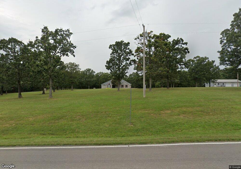
This home is located at 17655 Highway 133, Dixon, MO 65459 and is currently estimated at $267,334, approximately $125 per square foot. 17655 Highway 133 is a home located in Pulaski County with nearby schools including Dixon Elementary School, Dixon Middle School, and Dixon High School.
Ownership History
Date
Name
Owned For
Owner Type
Purchase Details
Closed on
Jul 13, 2011
Sold by
Stennett Joseph L
Bought by
Withers Angela Kay and Mayo Yuvonda Fay
Current Estimated Value
Purchase Details
Closed on
Mar 31, 2010
Sold by
Bowman Gary Lee and Bowman Patty
Bought by
Withers Angela Kay and Withers Randall Lynn
Home Financials for this Owner
Home Financials are based on the most recent Mortgage that was taken out on this home.
Original Mortgage
$60,841
Interest Rate
4.9%
Mortgage Type
New Conventional
Create a Home Valuation Report for This Property
The Home Valuation Report is an in-depth analysis detailing your home's value as well as a comparison with similar homes in the area
Home Values in the Area
Average Home Value in this Area
Purchase History
| Date | Buyer | Sale Price | Title Company |
|---|---|---|---|
| Withers Angela Kay | -- | None Available | |
| Withers Angela Kay | -- | None Available |
Source: Public Records
Mortgage History
| Date | Status | Borrower | Loan Amount |
|---|---|---|---|
| Previous Owner | Withers Angela Kay | $60,841 |
Source: Public Records
Tax History Compared to Growth
Tax History
| Year | Tax Paid | Tax Assessment Tax Assessment Total Assessment is a certain percentage of the fair market value that is determined by local assessors to be the total taxable value of land and additions on the property. | Land | Improvement |
|---|---|---|---|---|
| 2024 | $1,535 | $37,283 | $4,465 | $32,818 |
| 2023 | $1,528 | $37,283 | $4,465 | $32,818 |
| 2022 | $1,527 | $37,283 | $4,465 | $32,818 |
| 2021 | $1,527 | $37,283 | $4,465 | $32,818 |
| 2020 | $1,470 | $35,908 | $0 | $0 |
| 2019 | $1,470 | $35,720 | $0 | $0 |
| 2018 | $1,469 | $35,720 | $0 | $0 |
| 2017 | $1,467 | $35,467 | $0 | $0 |
| 2016 | $1,468 | $35,730 | $0 | $0 |
| 2015 | $1,469 | $35,730 | $0 | $0 |
| 2014 | $1,469 | $35,730 | $0 | $0 |
Source: Public Records
Map
Nearby Homes
- 10771 Crest Rd
- 11880 Cypress Rd
- 12810 State Route N
- 16560 Highway 133
- 0 Maries 638 Rd Unit MIS25067458
- 15005 Carthage Rd
- 15785 Commander Dr
- 615 W 4th St
- 602 W 6th St
- 105 S Oak St
- 10601 Barnard Rd
- 501 W 5th St
- 0 Copperstone Ln
- 0 Creek Rd Unit MAR24062770
- 204 W 4th St
- 104 W 3rd St
- 200 W 6th St
- 103 S Ellen St
- 100 E 6th St
- 10935 Barnard Rd
- 17670 Highway 133
- 17645 Highway 133
- 0 Hwy N Unit 902193
- 0 Hwy N Unit 23000033
- 0 Hwy N Unit 22009694
- 17639 Highway 133
- 17635 Highway 133
- 11550 Cherry Rd
- 11600 Cherry Rd
- 17595 Highway 133
- 17595 N Highway 133
- 11650 Cherry Rd
- 11549 Cherry Rd
- 11545 Cherry Rd
- 11862 Cherry Rd
- 11565 Cherry Rd
- 17525 Highway 133
- 1 Cherry Rd
- 18471 Missouri 133
- 12001 Highway N