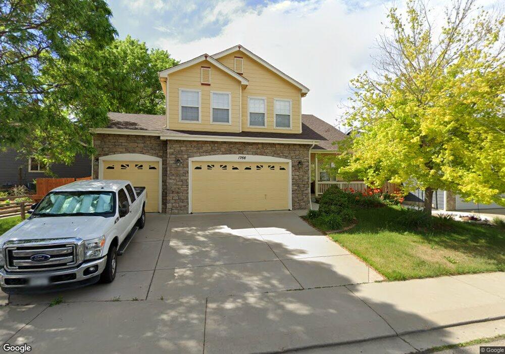
1766 Preston Dr Longmont, CO 80504
East Side NeighborhoodEstimated Value: $678,000 - $759,000
3
Beds
3
Baths
2,937
Sq Ft
$245/Sq Ft
Est. Value
About This Home
This home is located at 1766 Preston Dr, Longmont, CO 80504 and is currently estimated at $719,153, approximately $244 per square foot. 1766 Preston Dr is a home located in Boulder County with nearby schools including Alpine Elementary School, Skyline High School, and Longmont Christian School.
Ownership History
Date
Name
Owned For
Owner Type
Purchase Details
Closed on
Sep 12, 2025
Sold by
Mason Timothy R and Tan Joo Gaik
Bought by
Mason Revocable Trust and Mason
Current Estimated Value
Purchase Details
Closed on
Jun 30, 2000
Sold by
Centex Homes
Bought by
Mason Timothy R
Home Financials for this Owner
Home Financials are based on the most recent Mortgage that was taken out on this home.
Original Mortgage
$228,650
Interest Rate
8.66%
Purchase Details
Closed on
Jun 29, 2000
Sold by
Mason Timothy R
Bought by
Mason Timothy R and Tan Joo Gaik
Home Financials for this Owner
Home Financials are based on the most recent Mortgage that was taken out on this home.
Original Mortgage
$228,650
Interest Rate
8.66%
Create a Home Valuation Report for This Property
The Home Valuation Report is an in-depth analysis detailing your home's value as well as a comparison with similar homes in the area
Home Values in the Area
Average Home Value in this Area
Purchase History
| Date | Buyer | Sale Price | Title Company |
|---|---|---|---|
| Mason Revocable Trust | -- | None Listed On Document | |
| Mason Timothy R | $293,167 | First American Heritage Titl | |
| Mason Timothy R | -- | First American Heritage Titl |
Source: Public Records
Mortgage History
| Date | Status | Borrower | Loan Amount |
|---|---|---|---|
| Previous Owner | Mason Timothy R | $228,650 |
Source: Public Records
Tax History Compared to Growth
Tax History
| Year | Tax Paid | Tax Assessment Tax Assessment Total Assessment is a certain percentage of the fair market value that is determined by local assessors to be the total taxable value of land and additions on the property. | Land | Improvement |
|---|---|---|---|---|
| 2025 | $4,214 | $43,494 | $7,263 | $36,231 |
| 2024 | $4,214 | $43,494 | $7,263 | $36,231 |
| 2023 | $4,156 | $44,053 | $8,000 | $39,738 |
| 2022 | $3,597 | $36,349 | $6,047 | $30,302 |
| 2021 | $3,644 | $37,395 | $6,221 | $31,174 |
| 2020 | $3,376 | $34,756 | $5,720 | $29,036 |
| 2019 | $3,323 | $34,756 | $5,720 | $29,036 |
| 2018 | $2,937 | $30,924 | $5,760 | $25,164 |
| 2017 | $2,897 | $34,188 | $6,368 | $27,820 |
| 2016 | $2,714 | $28,393 | $7,164 | $21,229 |
| 2015 | $2,586 | $24,214 | $5,572 | $18,642 |
| 2014 | $2,262 | $24,214 | $5,572 | $18,642 |
Source: Public Records
Map
Nearby Homes
- 1750 Preston Dr
- 605 Saint Andrews Dr
- 1705 Preston Dr
- 508 Ashford Dr
- 653 Glenarbor Cir
- 1703 Whitehall Dr Unit G
- 1703 Whitehall Dr Unit 3C
- 1703 Whitehall Dr Unit 10B
- 665 Glenarbor Cir
- 1761 Sunlight Dr
- 1534 Mount Evans Dr
- 2010 Glenarbor Ct
- 1455 Hilltop Dr
- 1840 Red Cloud Rd
- 1830 Red Cloud Rd
- 1711 Antero Dr
- 1506 Crestwood Cir
- 2100 Boise Ct
- 50 Forsyth Dr
- 1504 Pinewood Ct
- 1770 Preston Dr
- 1762 Preston Dr
- 1774 Preston Dr
- 1758 Preston Dr
- 1773 Preston Dr
- 1775 Preston Dr
- 1769 Preston Dr
- 1778 Preston Dr
- 1765 Preston Dr
- 1779 Preston Dr
- 1754 Preston Dr
- 1761 Preston Dr
- 1783 Preston Dr
- 547 Abbey Dr
- 1759 Preston Dr
- 543 Abbey Dr
- 1787 Preston Dr
- 1757 Preston Dr
- 1746 Preston Dr
- 1722 Polo Way