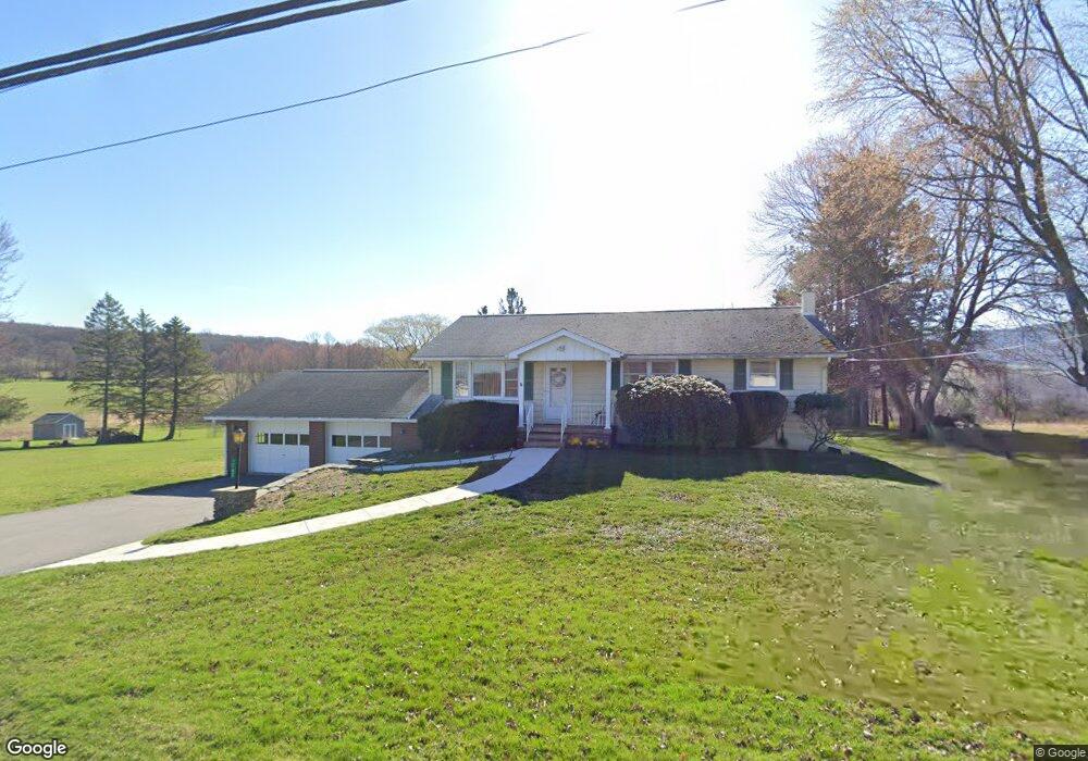
1767 Newton Ransom Blvd Unit Pcl B Clarks Summit, PA 18411
Estimated Value: $234,458 - $420,000
--
Bed
1
Bath
--
Sq Ft
1.13
Acres
About This Home
This home is located at 1767 Newton Ransom Blvd Unit Pcl B, Clarks Summit, PA 18411 and is currently estimated at $336,865. 1767 Newton Ransom Blvd Unit Pcl B is a home located in Lackawanna County with nearby schools including Abington Heights High School.
Ownership History
Date
Name
Owned For
Owner Type
Purchase Details
Closed on
Jul 18, 2024
Sold by
Lehnert Joseph and Lehnert Christina
Bought by
Vilogi Michael
Current Estimated Value
Home Financials for this Owner
Home Financials are based on the most recent Mortgage that was taken out on this home.
Original Mortgage
$300,000
Outstanding Balance
$296,389
Interest Rate
6.95%
Mortgage Type
New Conventional
Estimated Equity
$40,476
Purchase Details
Closed on
May 26, 2018
Sold by
Lehnert Audrey L and Lehnert Joseph
Bought by
Mickle Wendy R
Purchase Details
Closed on
Nov 13, 2009
Sold by
Lehnert Audrey J
Bought by
Lehnert Joseph and Gates Andrea
Create a Home Valuation Report for This Property
The Home Valuation Report is an in-depth analysis detailing your home's value as well as a comparison with similar homes in the area
Home Values in the Area
Average Home Value in this Area
Purchase History
| Date | Buyer | Sale Price | Title Company |
|---|---|---|---|
| Vilogi Michael | $325,000 | None Listed On Document | |
| Mickle Wendy R | $1,200 | None Available | |
| Lehnert Joseph | -- | None Available |
Source: Public Records
Mortgage History
| Date | Status | Borrower | Loan Amount |
|---|---|---|---|
| Open | Vilogi Michael | $300,000 |
Source: Public Records
Tax History Compared to Growth
Tax History
| Year | Tax Paid | Tax Assessment Tax Assessment Total Assessment is a certain percentage of the fair market value that is determined by local assessors to be the total taxable value of land and additions on the property. | Land | Improvement |
|---|---|---|---|---|
| 2025 | $2,799 | $11,500 | $1,200 | $10,300 |
| 2024 | $2,312 | $11,500 | $1,200 | $10,300 |
| 2023 | $2,312 | $11,500 | $1,200 | $10,300 |
| 2022 | $2,264 | $11,500 | $1,200 | $10,300 |
| 2021 | $2,264 | $11,500 | $1,200 | $10,300 |
| 2020 | $2,264 | $11,500 | $1,200 | $10,300 |
| 2019 | $2,189 | $11,500 | $1,200 | $10,300 |
| 2018 | $2,169 | $11,500 | $1,200 | $10,300 |
| 2017 | $2,157 | $11,500 | $1,200 | $10,300 |
| 2016 | $1,257 | $11,500 | $1,200 | $10,300 |
| 2015 | -- | $11,500 | $1,200 | $10,300 |
| 2014 | -- | $11,500 | $1,200 | $10,300 |
Source: Public Records
Map
Nearby Homes
- 0 Milwaukee Rd Unit GSBSC254290
- 0 Blvd
- 1736 Falls Rd
- 1932 Newton Ransom Blvd
- 1502 Forest Acres Dr
- 2441 Milwaukee Rd
- 2225 Cherry Hill Rd
- 162 Highland Rd
- 1215 Country Club Rd
- 52 Ivywood Dr Unit L 6
- 9119 Valley View Dr
- 9109 Valley View Dr
- 2500 Falls Rd
- 10 Bald Mt Rd
- 83 Hedge Row Run
- 101 Carriage Ln
- 812 Old Winola Rd
- 0 Lower Mill City Rd Unit GSBSC254966
- Lot 10 Colvin Estates
- 105 Fern Way
- 1767 Newton Ransom Blvd
- 1770 Newton Ransom Blvd
- 1774 Newton Ranson Blvd
- 1774 Newton Ransom Blvd
- 1763 Newton Ransom Blvd
- 1771 Newton Ransom Blvd
- 1778 Newton Ransom Blvd
- 1766 Newton Ransom Blvd
- 1775 Newton Ransom Blvd
- 1780 Newton Ransom Blvd
- 1761 Newton Ransom Blvd
- 1782 Newton Ransom Blvd
- 14006 Spring Dr
- 1779 Newton Ransom Blvd
- 1758 Newton Ransom Blvd
- 14008 Spring Dr
- 14003 Spring Dr
- 1784 Newton Ransom Blvd
- 14007 Spring Dr
- 1785 Newton Ransom Blvd