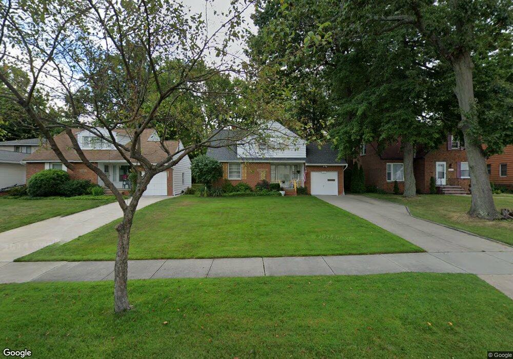
1767 Wrenford Rd Cleveland, OH 44121
Estimated Value: $173,850 - $207,000
3
Beds
2
Baths
1,394
Sq Ft
$136/Sq Ft
Est. Value
About This Home
This home is located at 1767 Wrenford Rd, Cleveland, OH 44121 and is currently estimated at $188,963, approximately $135 per square foot. 1767 Wrenford Rd is a home located in Cuyahoga County with nearby schools including Rowland Elementary School, Greenview Upper Elementary School, and Memorial Junior High School.
Ownership History
Date
Name
Owned For
Owner Type
Purchase Details
Closed on
Jun 6, 2023
Sold by
Kovach Arlene Rita
Bought by
Kovach Ludwig E
Current Estimated Value
Purchase Details
Closed on
May 18, 2023
Sold by
Kovach Ludwig E
Bought by
Ludwig E Kovach Trust and Kovach
Purchase Details
Closed on
Jan 23, 1980
Sold by
Kovach Ludwig E and Kovach Arlene R
Bought by
Kovach Ludwig E
Purchase Details
Closed on
Jan 1, 1975
Bought by
Kovach Ludwig E and Kovach Arlene R
Create a Home Valuation Report for This Property
The Home Valuation Report is an in-depth analysis detailing your home's value as well as a comparison with similar homes in the area
Home Values in the Area
Average Home Value in this Area
Purchase History
| Date | Buyer | Sale Price | Title Company |
|---|---|---|---|
| Kovach Ludwig E | -- | -- | |
| Ludwig E Kovach Trust | -- | None Listed On Document | |
| Kovach Ludwig E | -- | -- | |
| Kovach Ludwig E | -- | -- |
Source: Public Records
Tax History Compared to Growth
Tax History
| Year | Tax Paid | Tax Assessment Tax Assessment Total Assessment is a certain percentage of the fair market value that is determined by local assessors to be the total taxable value of land and additions on the property. | Land | Improvement |
|---|---|---|---|---|
| 2024 | $3,363 | $52,675 | $12,670 | $40,005 |
| 2023 | $2,694 | $36,550 | $9,210 | $27,340 |
| 2022 | $2,717 | $36,540 | $9,205 | $27,335 |
| 2021 | $2,697 | $36,540 | $9,210 | $27,340 |
| 2020 | $2,365 | $29,720 | $7,490 | $22,230 |
| 2019 | $2,169 | $84,900 | $21,400 | $63,500 |
| 2018 | $2,008 | $29,720 | $7,490 | $22,230 |
| 2017 | $1,910 | $25,450 | $6,130 | $19,320 |
| 2016 | $1,898 | $25,450 | $6,130 | $19,320 |
| 2015 | $1,971 | $25,450 | $6,130 | $19,320 |
| 2014 | $1,971 | $26,780 | $6,440 | $20,340 |
Source: Public Records
Map
Nearby Homes
- 4201 Lambert Rd
- 4233 Bayard Rd
- 4154 Bexley Blvd
- 4210 Stonehaven Rd
- 1606 Laclede Rd
- 1605 Laclede Rd
- 4121 Hinsdale Rd
- 1895 Temblethurst Rd
- 1744 S Green Rd
- 4124 Bayard Rd
- 1940 Temblethurst Rd
- 4194 Stilmore Rd
- 4237 Verona Rd
- 4485 Golfway Rd
- 1539 Sheffield Rd
- 4206 Verona Rd
- 1519 Laclede Rd
- 1494 Laclede Rd
- 4033 Stonehaven Rd
- 4040 Bayard Rd
- 1771 Wrenford Rd
- 1763 Wrenford Rd
- 1755 Wrenford Rd
- 1775 Wrenford Rd
- 1751 Wrenford Rd
- 1783 Wrenford Rd
- 4249 Harwood Rd
- 1768 Beaconwood Ave
- 1787 Wrenford Rd
- 1776 Beaconwood Ave
- 1764 Beaconwood Ave
- 1780 Beaconwood Ave
- 4250 Ellison Rd
- 4245 Harwood Rd
- 1760 Beaconwood Ave
- 1784 Beaconwood Ave
- 1791 Wrenford Rd
- 4250 Harwood Rd
- 4243 Harwood Rd
- 1792 Beaconwood Ave