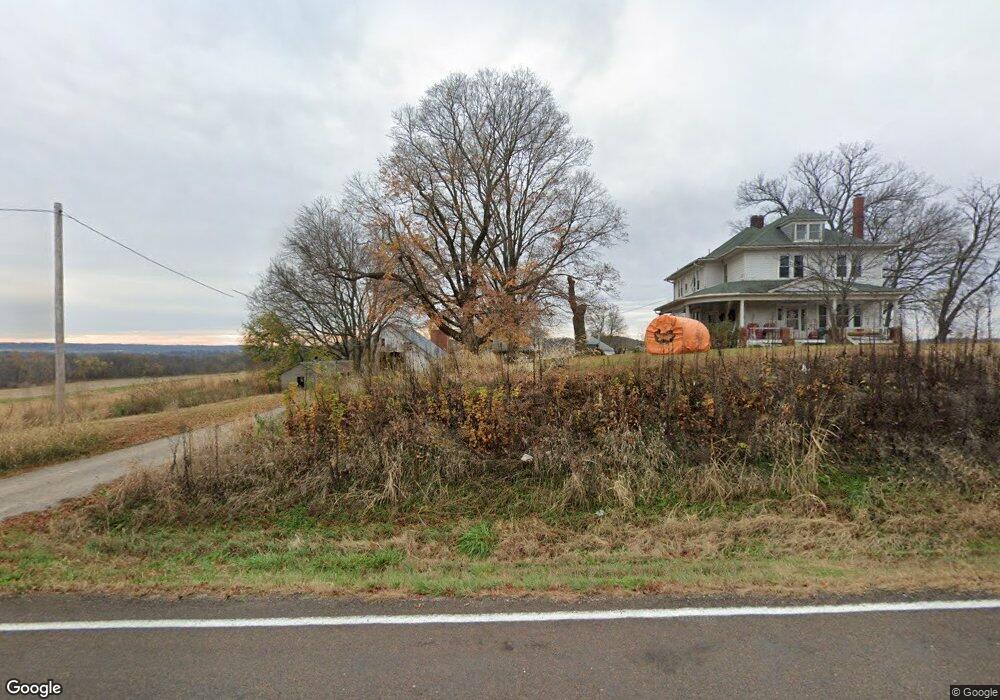
17673 Logan Rd Leavenworth, KS 66048
Estimated Value: $526,000 - $649,000
5
Beds
2
Baths
2,707
Sq Ft
$215/Sq Ft
Est. Value
About This Home
This home is located at 17673 Logan Rd, Leavenworth, KS 66048 and is currently estimated at $581,106, approximately $214 per square foot. 17673 Logan Rd is a home located in Leavenworth County with nearby schools including Pleasant Ridge Elementary School, Pleasant Ridge Middle School, and Pleasant Ridge High School.
Ownership History
Date
Name
Owned For
Owner Type
Purchase Details
Closed on
May 1, 2004
Bought by
Bollin George A and Bollin Linda M
Current Estimated Value
Home Financials for this Owner
Home Financials are based on the most recent Mortgage that was taken out on this home.
Original Mortgage
$820,000
Outstanding Balance
$398,203
Interest Rate
6.01%
Mortgage Type
New Conventional
Estimated Equity
$182,903
Create a Home Valuation Report for This Property
The Home Valuation Report is an in-depth analysis detailing your home's value as well as a comparison with similar homes in the area
Home Values in the Area
Average Home Value in this Area
Purchase History
| Date | Buyer | Sale Price | Title Company |
|---|---|---|---|
| Bollin George A | $375,000 | -- |
Source: Public Records
Mortgage History
| Date | Status | Borrower | Loan Amount |
|---|---|---|---|
| Open | Bollin George A | $820,000 |
Source: Public Records
Tax History Compared to Growth
Tax History
| Year | Tax Paid | Tax Assessment Tax Assessment Total Assessment is a certain percentage of the fair market value that is determined by local assessors to be the total taxable value of land and additions on the property. | Land | Improvement |
|---|---|---|---|---|
| 2025 | $7,555 | $73,688 | $38,490 | $35,198 |
| 2024 | $7,595 | $73,908 | $42,134 | $31,774 |
| 2023 | $7,595 | $74,853 | $45,893 | $28,960 |
| 2022 | $7,732 | $75,776 | $46,241 | $29,535 |
| 2021 | $7,596 | $72,968 | $44,577 | $28,391 |
| 2020 | $7,280 | $69,590 | $40,912 | $28,678 |
| 2019 | $7,139 | $68,083 | $38,878 | $29,205 |
| 2018 | $6,325 | $60,440 | $35,558 | $24,882 |
| 2017 | $6,160 | $58,641 | $32,116 | $26,525 |
| 2016 | $5,453 | $51,877 | $28,644 | $23,233 |
| 2015 | $4,565 | $43,222 | $24,846 | $18,376 |
| 2014 | -- | $40,055 | $21,684 | $18,371 |
Source: Public Records
Map
Nearby Homes
- 33931 167th St
- 18750 Chmidling Dr
- 16321 Hildebrandt Rd
- 34903 195th St
- 19115 Missouri 45
- 20513 Lowemont Rd
- 16425 Fort Riley Rd
- 908 Washington St
- 0 P Hwy Unit HMS2578569
- 17051 Mount Olivet Rd
- 27130 Webster Ct
- 19100 Library Dr
- 19101 Library Dr
- 20119 Cider Ct
- 0 Middle Rd
- 0 Salem Rd
- 000000 195th St
- 0 195th St
- 32378 215 St
- 2017 Metropolitan Ave
- 17856 Logan Rd
- 17480 Logan Rd
- 17921 Logan Rd
- 17450 Logan Rd
- 17971 Logan Rd
- 17974 Logan Rd
- 17362 Logan Rd
- 18059 Logan Rd
- 17063 Logan Rd
- 17124 Logan Rd
- 17075 Kickapoo Rd
- 17145 Kickapoo Rd
- 34726 183rd St
- 34693 170th St
- 34909 183rd St
- 17042 Kickapoo Rd
- 17026 Kickapoo Rd
- 34679 170th St
- 34649 170th St
- 34621 170th St