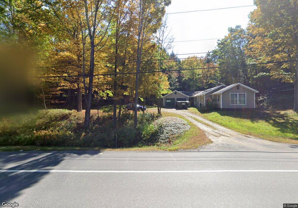
1768 Route 9 Spofford, NH 03462
Estimated Value: $278,854 - $335,000
2
Beds
1
Bath
800
Sq Ft
$389/Sq Ft
Est. Value
About This Home
This home is located at 1768 Route 9, Spofford, NH 03462 and is currently estimated at $311,464, approximately $389 per square foot. 1768 Route 9 is a home with nearby schools including Chesterfield Central School, Mayland Early College High School, and Keene High School.
Ownership History
Date
Name
Owned For
Owner Type
Purchase Details
Closed on
Jul 9, 2004
Sold by
Granger Tracy A
Bought by
Champion Holly A
Current Estimated Value
Home Financials for this Owner
Home Financials are based on the most recent Mortgage that was taken out on this home.
Original Mortgage
$101,850
Outstanding Balance
$51,215
Interest Rate
6.32%
Mortgage Type
Purchase Money Mortgage
Estimated Equity
$260,249
Purchase Details
Closed on
Jul 12, 1999
Sold by
Scrivani Warren L
Bought by
Granger Tracy A
Home Financials for this Owner
Home Financials are based on the most recent Mortgage that was taken out on this home.
Original Mortgage
$67,000
Interest Rate
7.19%
Mortgage Type
Purchase Money Mortgage
Create a Home Valuation Report for This Property
The Home Valuation Report is an in-depth analysis detailing your home's value as well as a comparison with similar homes in the area
Home Values in the Area
Average Home Value in this Area
Purchase History
| Date | Buyer | Sale Price | Title Company |
|---|---|---|---|
| Champion Holly A | $105,000 | -- | |
| Granger Tracy A | $67,000 | -- |
Source: Public Records
Mortgage History
| Date | Status | Borrower | Loan Amount |
|---|---|---|---|
| Open | Granger Tracy A | $101,850 | |
| Previous Owner | Granger Tracy A | $67,000 |
Source: Public Records
Tax History Compared to Growth
Tax History
| Year | Tax Paid | Tax Assessment Tax Assessment Total Assessment is a certain percentage of the fair market value that is determined by local assessors to be the total taxable value of land and additions on the property. | Land | Improvement |
|---|---|---|---|---|
| 2024 | $3,449 | $170,400 | $60,300 | $110,100 |
| 2023 | $3,377 | $170,400 | $60,300 | $110,100 |
| 2022 | $3,305 | $170,200 | $60,300 | $109,900 |
| 2021 | $3,236 | $170,200 | $60,300 | $109,900 |
| 2020 | $3,204 | $141,700 | $54,600 | $87,100 |
| 2019 | $2,844 | $127,400 | $48,500 | $78,900 |
| 2018 | $2,568 | $127,400 | $48,500 | $78,900 |
| 2016 | $2,709 | $127,400 | $48,500 | $78,900 |
| 2014 | $2,830 | $127,400 | $48,500 | $78,900 |
Source: Public Records
Map
Nearby Homes
- 43 Westmoreland Rd
- 563 N Shore Rd
- 36 Canal St
- 21 Valley Park Dr
- 484 Old Swanzey Rd
- 85 Foley Rd
- 28 Owens Dr Unit 92
- 28 Owens Dr Unit 94
- 15 Stearns Rd
- 126 Pondview Rd
- 121 Pondview Rd
- 123 Poocham Rd
- 821 Route 9
- 0 Stow Dr Unit 4929741
- 000 S Village Rd Unit 13
- 00 Orchard Rd Unit 1
- 220 Hurricane Rd
- 61 Orchard Rd
- 110 Arch St Unit 27
- 110 Arch St Unit 42
- 1766 Route 9
- 1776 Route 9
- 1754 Route 9
- 1763 Route 9
- 1782 Route 9
- 121 Wellington Dr
- 1809 Route 9
- 1739 Route 9
- 1739 New Hampshire 9
- 120 Wellington Dr
- 1729 Route 9
- 1720 Route 9
- 14 Wellington Dr
- 112 Wellington Dr
- 0 Route 9 & Old Chesterfield Rd
- 0 Route 9 & Old Chesterfield Rd Unit 4455534
- 0 Route 9 & Old Chesterfield Rd Unit 4455529
- 0 Route 9 & Old Chesterfield Rd Unit 4675687
- 30 Wellington Dr
- 106 Wellington Dr