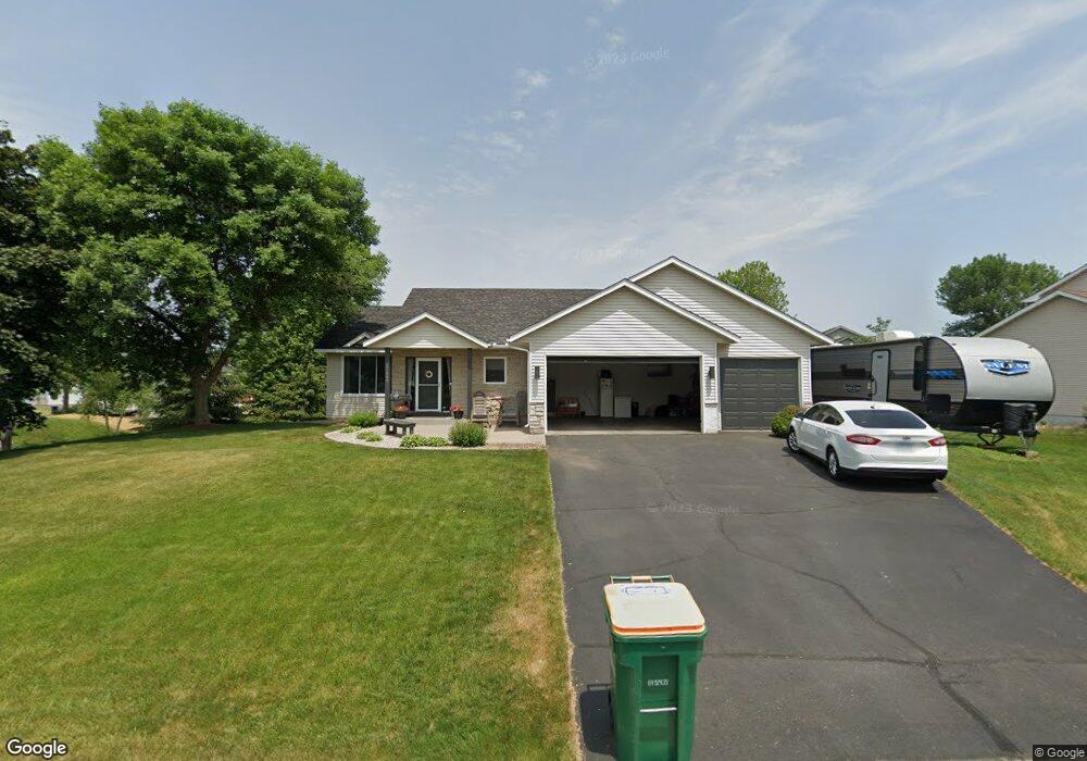
17680 Firebird Path Farmington, MN 55024
Estimated Value: $459,789 - $491,000
4
Beds
3
Baths
1,375
Sq Ft
$346/Sq Ft
Est. Value
About This Home
This home is located at 17680 Firebird Path, Farmington, MN 55024 and is currently estimated at $475,947, approximately $346 per square foot. 17680 Firebird Path is a home located in Dakota County with nearby schools including North Trail Elementary School, Levi P. Dodge Middle School, and Farmington High School.
Ownership History
Date
Name
Owned For
Owner Type
Purchase Details
Closed on
Jun 9, 2006
Sold by
Klun Gene A and Klun Sandra J
Bought by
Bridgeman Keith and Bridgeman Brenda E
Current Estimated Value
Purchase Details
Closed on
Feb 28, 2001
Sold by
Wright Curtis E and Wright Brenda K
Bought by
Klun Gene A and Aronson Sandra J
Purchase Details
Closed on
Jul 23, 1998
Sold by
Marell Inc
Bought by
Wright Homes Inc
Create a Home Valuation Report for This Property
The Home Valuation Report is an in-depth analysis detailing your home's value as well as a comparison with similar homes in the area
Home Values in the Area
Average Home Value in this Area
Purchase History
| Date | Buyer | Sale Price | Title Company |
|---|---|---|---|
| Bridgeman Keith | $315,000 | -- | |
| Klun Gene A | $234,900 | -- | |
| Wright Homes Inc | $38,900 | -- |
Source: Public Records
Tax History Compared to Growth
Tax History
| Year | Tax Paid | Tax Assessment Tax Assessment Total Assessment is a certain percentage of the fair market value that is determined by local assessors to be the total taxable value of land and additions on the property. | Land | Improvement |
|---|---|---|---|---|
| 2024 | $4,626 | $423,400 | $81,700 | $341,700 |
| 2023 | $4,626 | $429,500 | $81,400 | $348,100 |
| 2022 | $4,286 | $412,800 | $81,200 | $331,600 |
| 2021 | $4,012 | $345,500 | $70,600 | $274,900 |
| 2020 | $4,146 | $316,000 | $67,200 | $248,800 |
| 2019 | $3,990 | $315,200 | $64,000 | $251,200 |
| 2018 | $3,787 | $302,900 | $61,000 | $241,900 |
| 2017 | $3,669 | $283,300 | $58,000 | $225,300 |
| 2016 | $3,719 | $267,700 | $55,200 | $212,500 |
| 2015 | $3,326 | $247,904 | $50,794 | $197,110 |
| 2014 | -- | $238,748 | $49,221 | $189,527 |
| 2013 | -- | $217,820 | $44,495 | $173,325 |
Source: Public Records
Map
Nearby Homes
- 17415 Fireside Ln
- 5969 Upper 179th St W
- 17295 Fieldcrest Ave
- 5956 Upper 179th St W
- 17850 Evershed Way
- 17698 Fortune Trail
- 17583 Foxboro Ln
- 17729 Everest Ave
- 17725 Everest Ave
- 17718 Everest Ave
- 17714 Everest Ave
- 5695 Lower 182nd St W
- 17373 N Creek Dr
- 17830 Glasgow Way
- 17936 Genoa Dr
- 17942 Genoa Dr
- 17944 Genoa Dr
- 17775 Empire Trail
- 17751 Empire Trail
- 17935 Genoa Dr
- 17694 Firebird Path
- 17678 Fieldfare Way
- 17692 Fieldfare Way
- 17689 Fair Isle Path
- 17664 17664 Fieldfare-Way-
- 17664 Fieldfare Way
- 17664 Fieldfare Way
- 17687 Firebird Path
- 17664 Fieldfare Way
- 17675 Firebird Path
- 17695 Firebird Path
- 17685 Fair Isle Path
- 17650 Fieldfare Way
- 17667 Firebird Path
- 17698 Fair Isle Path
- 17677 Fieldfare Way
- 17707 Firebird Path
- 17686 Fair Isle Path
- 17691 Fieldfare Way
- 6303 178th St