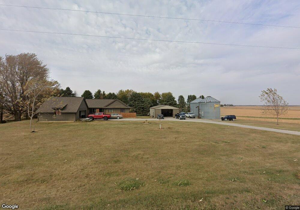
1769 52nd St Mount Auburn, IA 52313
Estimated Value: $177,000 - $318,085
3
Beds
2
Baths
1,660
Sq Ft
$149/Sq Ft
Est. Value
About This Home
This home is located at 1769 52nd St, Mount Auburn, IA 52313 and is currently estimated at $247,521, approximately $149 per square foot. 1769 52nd St is a home located in Benton County with nearby schools including Union High School.
Ownership History
Date
Name
Owned For
Owner Type
Purchase Details
Closed on
Jul 10, 2012
Sold by
Fehl Benjamin Dean and Fehl Sandy Renee
Bought by
Sebetka Luke M
Current Estimated Value
Home Financials for this Owner
Home Financials are based on the most recent Mortgage that was taken out on this home.
Original Mortgage
$145,111
Outstanding Balance
$99,358
Interest Rate
3.5%
Mortgage Type
FHA
Estimated Equity
$148,163
Create a Home Valuation Report for This Property
The Home Valuation Report is an in-depth analysis detailing your home's value as well as a comparison with similar homes in the area
Home Values in the Area
Average Home Value in this Area
Purchase History
| Date | Buyer | Sale Price | Title Company |
|---|---|---|---|
| Sebetka Luke M | $150,000 | None Available |
Source: Public Records
Mortgage History
| Date | Status | Borrower | Loan Amount |
|---|---|---|---|
| Open | Sebetka Luke M | $145,111 |
Source: Public Records
Tax History Compared to Growth
Tax History
| Year | Tax Paid | Tax Assessment Tax Assessment Total Assessment is a certain percentage of the fair market value that is determined by local assessors to be the total taxable value of land and additions on the property. | Land | Improvement |
|---|---|---|---|---|
| 2025 | $3,006 | $295,900 | $50,600 | $245,300 |
| 2024 | $3,006 | $267,300 | $43,100 | $224,200 |
| 2023 | $2,644 | $267,300 | $43,100 | $224,200 |
| 2022 | $2,650 | $206,800 | $34,500 | $172,300 |
| 2021 | $2,650 | $206,800 | $34,500 | $172,300 |
| 2020 | $2,184 | $181,400 | $21,000 | $160,400 |
| 2019 | $1,910 | $181,400 | $21,000 | $160,400 |
| 2018 | $1,854 | $157,800 | $16,600 | $141,200 |
| 2017 | $1,854 | $157,800 | $16,600 | $141,200 |
| 2016 | $1,706 | $145,800 | $15,100 | $130,700 |
| 2015 | $1,706 | $145,800 | $15,100 | $130,700 |
| 2014 | $1,858 | $157,800 | $0 | $0 |
Source: Public Records
Map
Nearby Homes
- 1308 South St
- 1101 E Main St
- Lot 6 Sweet 2nd Addition
- Lot 5 Sweet 2nd Addition
- Lot 1 Sweet 2nd Addition
- Lot 3 Sweet 2nd Addition
- Lot 2 Sweet 2nd Addition
- Lot 1 Sweet 3rd Addition
- 903 Poplar St Unit 905
- 809 Pine St
- 13518 King Rd
- 100 Spruce St
- 804 3rd St
- 700 3rd St
- 301 Walnut St
- 600 Commercial St
- 506 Commercial St Unit L
- 713 Locust St
- 12334 Carr Rd
- 307 W Main St