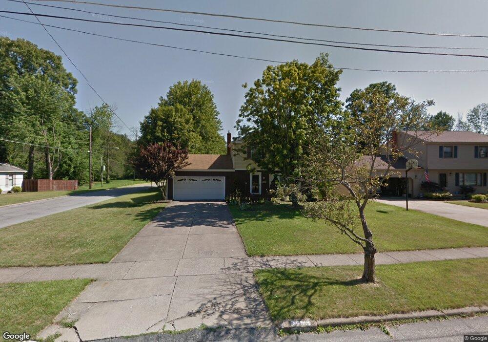
1769 Lemont Dr Youngstown, OH 44514
Estimated Value: $187,395 - $223,000
3
Beds
2
Baths
1,300
Sq Ft
$159/Sq Ft
Est. Value
About This Home
This home is located at 1769 Lemont Dr, Youngstown, OH 44514 and is currently estimated at $206,849, approximately $159 per square foot. 1769 Lemont Dr is a home located in Mahoning County with nearby schools including Poland Union Elementary School, Poland Middle School, and Poland Seminary High School.
Ownership History
Date
Name
Owned For
Owner Type
Purchase Details
Closed on
Apr 28, 2010
Sold by
Romeo Carmen A and Romeo Milissa Ann
Bought by
Glass Thomas A and Glass Jenny L
Current Estimated Value
Home Financials for this Owner
Home Financials are based on the most recent Mortgage that was taken out on this home.
Original Mortgage
$102,123
Outstanding Balance
$68,683
Interest Rate
5.12%
Mortgage Type
FHA
Estimated Equity
$138,166
Purchase Details
Closed on
Apr 13, 1987
Bought by
Eperjesi John E
Create a Home Valuation Report for This Property
The Home Valuation Report is an in-depth analysis detailing your home's value as well as a comparison with similar homes in the area
Home Values in the Area
Average Home Value in this Area
Purchase History
| Date | Buyer | Sale Price | Title Company |
|---|---|---|---|
| Glass Thomas A | $103,500 | Attorney | |
| Eperjesi John E | $53,000 | -- |
Source: Public Records
Mortgage History
| Date | Status | Borrower | Loan Amount |
|---|---|---|---|
| Open | Glass Thomas A | $102,123 |
Source: Public Records
Tax History Compared to Growth
Tax History
| Year | Tax Paid | Tax Assessment Tax Assessment Total Assessment is a certain percentage of the fair market value that is determined by local assessors to be the total taxable value of land and additions on the property. | Land | Improvement |
|---|---|---|---|---|
| 2024 | $2,470 | $47,650 | $5,510 | $42,140 |
| 2023 | $2,441 | $47,650 | $5,510 | $42,140 |
| 2022 | $2,249 | $36,520 | $5,320 | $31,200 |
| 2021 | $2,253 | $36,520 | $5,320 | $31,200 |
| 2020 | $2,290 | $36,980 | $5,320 | $31,660 |
| 2019 | $2,004 | $29,120 | $4,190 | $24,930 |
| 2018 | $1,902 | $29,120 | $4,190 | $24,930 |
| 2017 | $1,864 | $29,120 | $4,190 | $24,930 |
| 2016 | $2,141 | $32,110 | $6,170 | $25,940 |
| 2015 | $2,100 | $32,110 | $6,170 | $25,940 |
| 2014 | $2,107 | $32,110 | $6,170 | $25,940 |
| 2013 | $2,083 | $32,110 | $6,170 | $25,940 |
Source: Public Records
Map
Nearby Homes
- 0 Mathews Rd Unit 5149232
- 0 Mathews Rd Unit 5143059
- 1738 Island Dr
- 1804 Alverne Dr
- 1859 Mathews Rd
- 1827 Alverne Dr
- 1890 Mathews Rd
- 0 Oles Ave
- 0 Woodlawn Ave
- 1841 Wingate Rd
- 928 Edenridge Dr
- 2035 Woodward Ave
- 2061 Mathews Rd
- 1919 Wingate Rd
- 0 Moyer Ave
- 857 Maple Ridge Dr
- 5710 Youngstown Poland Rd
- 34 Venloe Dr
- 43 Venloe Dr
- 42 Edgewater Dr
- 1765 Lemont Dr
- 1777 Lemont Dr
- 1324 Meadow Ln
- 1761 Lemont Dr
- 1768 Lemont Dr
- 1781 Lemont Dr
- 1316 Meadow Ln
- 1762 Lemont Dr
- 1774 Lemont Dr
- 1308 Meadow Ln
- 1757 Lemont Dr
- 1783 Lemont Dr
- 1780 Lemont Dr
- 1753 Lemont Dr
- 1300 Meadow Ln
- 1769 Lealand Ave
- 1784 Lemont Dr
- 1775 Lealand Ave
- 1785 Lemont Dr
- 1763 Lealand Ave