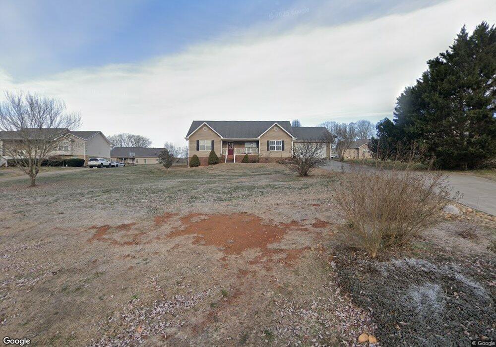
1769 Tahoe Trail Sevierville, TN 37876
Estimated Value: $363,416 - $392,000
--
Bed
2
Baths
1,492
Sq Ft
$253/Sq Ft
Est. Value
About This Home
This home is located at 1769 Tahoe Trail, Sevierville, TN 37876 and is currently estimated at $377,708, approximately $253 per square foot. 1769 Tahoe Trail is a home located in Sevier County with nearby schools including Northview Elementary School, Catons Chapel Elementary School, and Jones Cove Elementary School.
Ownership History
Date
Name
Owned For
Owner Type
Purchase Details
Closed on
Jul 10, 2006
Sold by
Vision Builders Llc
Bought by
Harris Misti G
Current Estimated Value
Home Financials for this Owner
Home Financials are based on the most recent Mortgage that was taken out on this home.
Original Mortgage
$141,200
Outstanding Balance
$83,317
Interest Rate
6.54%
Estimated Equity
$294,391
Purchase Details
Closed on
Jun 16, 2006
Sold by
Smith James T
Bought by
Vision Builders Llc
Home Financials for this Owner
Home Financials are based on the most recent Mortgage that was taken out on this home.
Original Mortgage
$141,200
Outstanding Balance
$83,317
Interest Rate
6.54%
Estimated Equity
$294,391
Purchase Details
Closed on
Nov 22, 2005
Sold by
Vision Builders Llc
Bought by
Smith James T
Purchase Details
Closed on
Mar 28, 2005
Sold by
Brewster Brenda E
Bought by
Vision Builders Llc
Create a Home Valuation Report for This Property
The Home Valuation Report is an in-depth analysis detailing your home's value as well as a comparison with similar homes in the area
Home Values in the Area
Average Home Value in this Area
Purchase History
| Date | Buyer | Sale Price | Title Company |
|---|---|---|---|
| Harris Misti G | $176,500 | -- | |
| Vision Builders Llc | -- | -- | |
| Smith James T | -- | -- | |
| Vision Builders Llc | $25,000 | -- |
Source: Public Records
Mortgage History
| Date | Status | Borrower | Loan Amount |
|---|---|---|---|
| Open | Vision Builders Llc | $141,200 |
Source: Public Records
Tax History Compared to Growth
Tax History
| Year | Tax Paid | Tax Assessment Tax Assessment Total Assessment is a certain percentage of the fair market value that is determined by local assessors to be the total taxable value of land and additions on the property. | Land | Improvement |
|---|---|---|---|---|
| 2025 | $663 | $44,800 | $7,500 | $37,300 |
| 2024 | $663 | $44,800 | $7,500 | $37,300 |
| 2023 | $663 | $44,800 | $0 | $0 |
| 2022 | $663 | $44,800 | $7,500 | $37,300 |
| 2021 | $663 | $44,800 | $7,500 | $37,300 |
| 2020 | $687 | $44,800 | $7,500 | $37,300 |
| 2019 | $687 | $36,925 | $7,500 | $29,425 |
| 2018 | $687 | $36,925 | $7,500 | $29,425 |
| 2017 | $687 | $36,925 | $7,500 | $29,425 |
| 2016 | $687 | $36,925 | $7,500 | $29,425 |
| 2015 | -- | $36,825 | $0 | $0 |
| 2014 | $600 | $36,831 | $0 | $0 |
Source: Public Records
Map
Nearby Homes
- 1934 River Vista Cir
- 1924 River Vista Cir
- 2017 Malibu Ct
- 1719 Tahoe Trail
- 1826 Watauga St
- 1718 Watauga St
- 1843 River Vista Cir
- 0 Chances Ridge Dr
- 1998 Tranquility Ln
- 2725 River Island Blvd
- 9624 Gunnies Dr
- 1861 Big Buck Ln
- 1761 Rays Gap Rd
- 2067 Highpoint Ln
- 1870 Big Buck Ln
- 0 Highpoint Dr Unit 1250528
- 9611 9615 Sybil Lee Ln
- 1923 Big Chiefs Skyview Dr
- The Stratford Plan at The Farm at Riverbend - Craftsman
- The Winston Plan at The Farm at Riverbend - Craftsman
- 1773 Tahoe Trail
- 1765 Tahoe Trail
- 1944 River Vista Cir
- 1766 Tahoe Trail
- 1772 Tahoe Trail
- 1759 Tahoe Trail
- 1779 Tahoe Trail
- 1930 River Vista Cir
- 1954 River Vista Cir
- 1778 Tahoe Trail
- 1753 Tahoe Trail
- 1939 River Vista Cir
- 1947 River Vista Cir
- 0 River Vista Unit 930722
- 1760 Tahoe Trail
- 1929 River Vista Cir
- 1784 Tahoe Trail
- 1748 Tahoe
- 1953 River Vista Cir
- 1752 Tahoe Trail