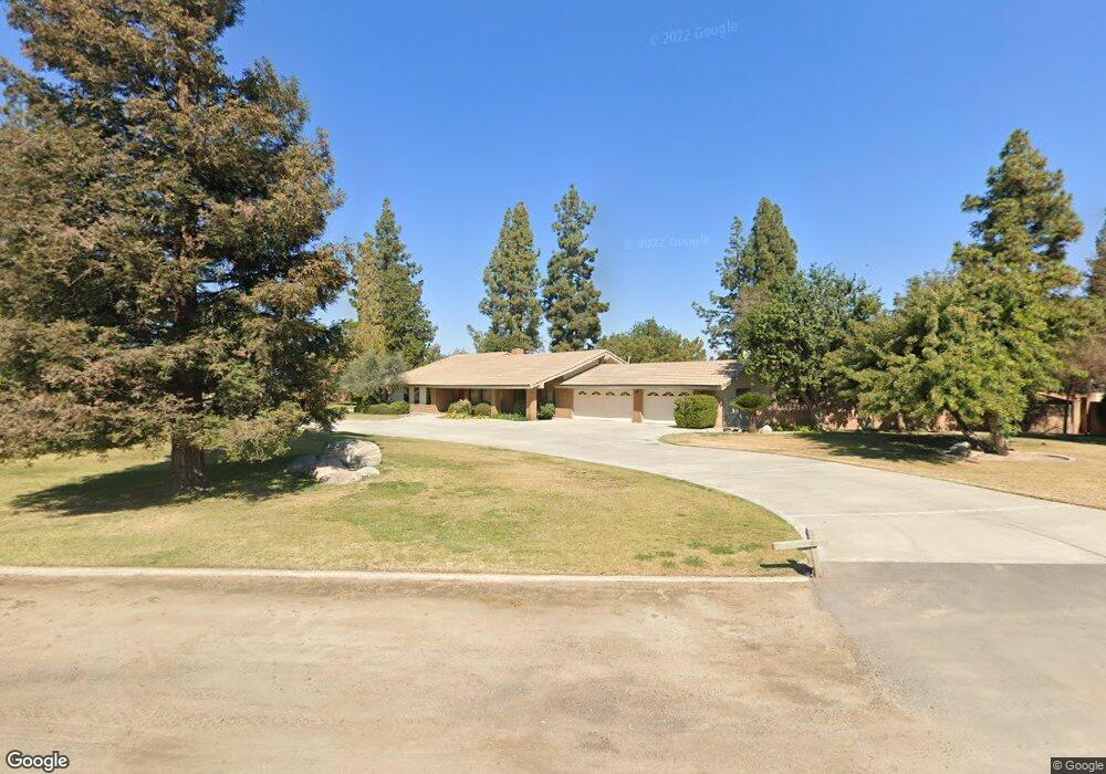
17690 Brimhall Rd Bakersfield, CA 93314
Estimated Value: $596,000 - $813,000
3
Beds
3
Baths
2,491
Sq Ft
$287/Sq Ft
Est. Value
About This Home
This home is located at 17690 Brimhall Rd, Bakersfield, CA 93314 and is currently estimated at $715,367, approximately $287 per square foot. 17690 Brimhall Rd is a home located in Kern County with nearby schools including Rio Bravo-Greeley Elementary School, Rio Bravo Elementary School, and Liberty High School.
Ownership History
Date
Name
Owned For
Owner Type
Purchase Details
Closed on
Mar 17, 2004
Sold by
Bryant Philip D and Bryant Jennie E
Bought by
Bryant Philip D and Bryant Jennie E
Current Estimated Value
Purchase Details
Closed on
Mar 4, 1994
Sold by
Devries Mark C and Devries Caroleen A
Bought by
Bryant Philip D and Bryant Jennie E
Home Financials for this Owner
Home Financials are based on the most recent Mortgage that was taken out on this home.
Original Mortgage
$55,000
Interest Rate
7.09%
Purchase Details
Closed on
Dec 9, 1993
Sold by
United Svgs Bank Fsb
Bought by
Devries Mark C and Devries Caroleen A
Home Financials for this Owner
Home Financials are based on the most recent Mortgage that was taken out on this home.
Original Mortgage
$150,000
Interest Rate
4.87%
Create a Home Valuation Report for This Property
The Home Valuation Report is an in-depth analysis detailing your home's value as well as a comparison with similar homes in the area
Home Values in the Area
Average Home Value in this Area
Purchase History
| Date | Buyer | Sale Price | Title Company |
|---|---|---|---|
| Bryant Philip D | -- | -- | |
| Bryant Philip D | $180,000 | Commonwealth Land Title Ins | |
| Devries Mark C | $256,363 | Commonwealth Land Title |
Source: Public Records
Mortgage History
| Date | Status | Borrower | Loan Amount |
|---|---|---|---|
| Previous Owner | Bryant Philip D | $55,000 | |
| Previous Owner | Devries Mark C | $150,000 |
Source: Public Records
Tax History Compared to Growth
Tax History
| Year | Tax Paid | Tax Assessment Tax Assessment Total Assessment is a certain percentage of the fair market value that is determined by local assessors to be the total taxable value of land and additions on the property. | Land | Improvement |
|---|---|---|---|---|
| 2025 | $4,040 | $305,911 | $59,470 | $246,441 |
| 2024 | $3,959 | $299,913 | $58,304 | $241,609 |
| 2023 | $3,959 | $294,033 | $57,161 | $236,872 |
| 2022 | $3,949 | $288,269 | $56,041 | $232,228 |
| 2021 | $3,852 | $282,618 | $54,943 | $227,675 |
| 2020 | $3,738 | $279,721 | $54,380 | $225,341 |
| 2019 | $3,672 | $279,721 | $54,380 | $225,341 |
| 2018 | $3,519 | $268,861 | $52,269 | $216,592 |
| 2017 | $3,484 | $263,591 | $51,245 | $212,346 |
| 2016 | $3,262 | $258,424 | $50,241 | $208,183 |
| 2015 | $3,177 | $254,543 | $49,487 | $205,056 |
| 2014 | $3,121 | $249,558 | $48,518 | $201,040 |
Source: Public Records
Map
Nearby Homes
- 836 Nord Ave
- 17633 Legend Oaks Ln
- 17340 Legend Oaks Ln
- 17343 Havenridge Dr
- 16451 Barton Ln
- 921 Christian Ave
- 16725 Weatherly Ct
- 16719 Keystone Place
- 16711 Keystone Place
- 119 Spottswoode Ln
- 59 Spottswoode Ln
- 18510 Stockdale Hwy
- 16030 Strebor Dr
- 1547 Greeley Rd
- 15918 Clos du Val Ave
- 311 Saba Way
- 16459 Paraduxx Ct
- 15803 Screaming Eagle Ave
- 8317 Littleton St
- 15733 Joseph Phelps Ave
- 1266 Nord Ave
- 17600 Brimhall Rd
- 17641 Nord Ave
- 17611 Brimhall Rd
- 1334 Nord Ave
- 17540 Brimhall Rd
- 17747 Brimhall Rd
- 1108 Nord Ave
- 17517 Brimhall Rd
- 17801 Brimhall Rd
- 1030 Nord Ave
- 17515 Amy Ave
- 17453 Brimhall Rd
- 1053 Nord Ave
- 17837 Brimhall Rd
- 1020 Nord Ave
- 1430 Nord Ave
- 1031 Nord Ave
- 17847 Brimhall Rd
- 17441 Amy Ave