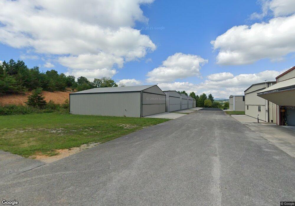
177 Airstrip Ln Unit 1 La Follette, TN 37766
Estimated Value: $341,700
--
Bed
--
Bath
3,360
Sq Ft
$102/Sq Ft
Est. Value
About This Home
This home is located at 177 Airstrip Ln Unit 1, La Follette, TN 37766 and is currently estimated at $341,700, approximately $101 per square foot. 177 Airstrip Ln Unit 1 is a home located in Campbell County.
Ownership History
Date
Name
Owned For
Owner Type
Purchase Details
Closed on
Dec 28, 2023
Sold by
Sharon A Schumacher Trust
Bought by
David W Barnard Revocable Trust and Dee As Barnard Revocable Trust
Current Estimated Value
Purchase Details
Closed on
Mar 10, 2008
Sold by
Wisecup Development Llc
Bought by
Schumacher Sharon A
Purchase Details
Closed on
Mar 12, 2007
Sold by
Fields Paul R
Bought by
Wisecup Development Llc
Create a Home Valuation Report for This Property
The Home Valuation Report is an in-depth analysis detailing your home's value as well as a comparison with similar homes in the area
Home Values in the Area
Average Home Value in this Area
Purchase History
| Date | Buyer | Sale Price | Title Company |
|---|---|---|---|
| David W Barnard Revocable Trust | $265,000 | None Listed On Document | |
| David W Barnard Revocable Trust | $265,000 | None Listed On Document | |
| Schumacher Sharon A | $184,500 | -- | |
| Wisecup Development Llc | $25,000 | -- |
Source: Public Records
Tax History Compared to Growth
Tax History
| Year | Tax Paid | Tax Assessment Tax Assessment Total Assessment is a certain percentage of the fair market value that is determined by local assessors to be the total taxable value of land and additions on the property. | Land | Improvement |
|---|---|---|---|---|
| 2025 | $437 | $35,950 | $0 | $0 |
| 2024 | $437 | $35,950 | $11,700 | $24,250 |
| 2023 | $549 | $26,550 | $6,250 | $20,300 |
| 2022 | $549 | $26,550 | $6,250 | $20,300 |
| 2021 | $549 | $26,550 | $6,250 | $20,300 |
| 2020 | $538 | $26,550 | $6,250 | $20,300 |
| 2019 | $549 | $26,550 | $6,250 | $20,300 |
| 2018 | $573 | $25,475 | $5,000 | $20,475 |
| 2017 | $573 | $25,475 | $5,000 | $20,475 |
| 2016 | $573 | $25,475 | $5,000 | $20,475 |
| 2015 | $507 | $25,475 | $5,000 | $20,475 |
| 2014 | -- | $25,475 | $5,000 | $20,475 |
| 2013 | -- | $25,475 | $5,000 | $20,475 |
Source: Public Records
Map
Nearby Homes
- Lot 21 Buckeye Landing
- 0 Antlers Way Unit 1260064
- 824 Deerfield Way
- 134 Doe Crossing
- 111 Deer Run Point
- 234 Cameron Loop
- 115 Pinnacle Ln
- 226 Deer Run Point
- Lot #65 Pinnacle Ln
- 0 Sam & Maria Lot 28 Way Unit 1298020
- 207 N Deer Hill Village Unit A
- 0 Lot 29 Sam & Maria Way Unit 1298022
- Lot #64 Pinnacle Ln
- Lot 98 Pinnacle Ln
- 0 Lot 30 Sam & Maria Way Unit 1298023
- 195 N Deer Village Ln Unit B
- 0 Cameron Loop Ln Unit 1302081
- 0 Cameron Loop Ln Unit 1311949
- 0 Deerfield Way Unit 1308162
- 0 Deerfield Way Unit 1304037
- 179 Airstrip Ln
- 0 Deerfield Landing Ln Unit 7 1042805
- Lot# 27 Airstrip Ln
- 146 Skyline Knoll Ln
- 146 Skyline Knoll Ln Unit 3
- 146 Skyline Knoll Ln Unit 4
- 146 Skyline Knoll Ln Unit 2
- 119 Championship Way
- 344 Deerfield Landing Rd
- 344 Deerfield Landing
- 0 Deerfield Landing Unit 842955
- 0 Deerfield Landing
- 185 White Tail Ln
- 0 Whitetail Ln Unit 308808
- 0 Whitetail Ln Unit 1274686
- 0 Whitetail Ln Unit 1220350
- 0 Whitetail Ln Unit 726879
- 0 Whitetail Ln Unit 843432
- 0 Whitetail Ln Unit 843639
- 0 Whitetail Ln Unit 906929