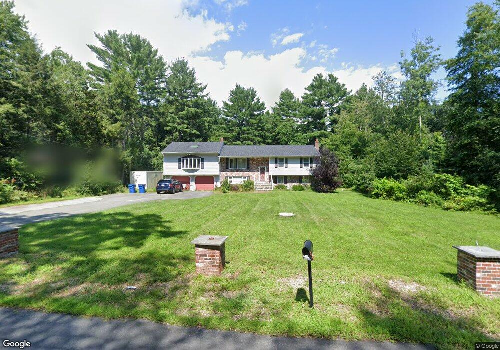
177 Chestnut St North Easton, MA 02356
Estimated Value: $711,723 - $761,000
4
Beds
3
Baths
1,790
Sq Ft
$411/Sq Ft
Est. Value
About This Home
This home is located at 177 Chestnut St, North Easton, MA 02356 and is currently estimated at $736,431, approximately $411 per square foot. 177 Chestnut St is a home located in Bristol County with nearby schools including Easton Middle School and St Mary's Catholic School.
Ownership History
Date
Name
Owned For
Owner Type
Purchase Details
Closed on
May 2, 1997
Sold by
Joshua Rt
Bought by
Int Sandra D Geary
Current Estimated Value
Purchase Details
Closed on
Oct 28, 1992
Sold by
Dolloff Donna C and Dolloff Gry W
Bought by
Miranda Miria M
Home Financials for this Owner
Home Financials are based on the most recent Mortgage that was taken out on this home.
Original Mortgage
$141,000
Interest Rate
7.85%
Mortgage Type
Purchase Money Mortgage
Create a Home Valuation Report for This Property
The Home Valuation Report is an in-depth analysis detailing your home's value as well as a comparison with similar homes in the area
Home Values in the Area
Average Home Value in this Area
Purchase History
| Date | Buyer | Sale Price | Title Company |
|---|---|---|---|
| Int Sandra D Geary | $193,000 | -- | |
| Sandra D Geary Int D | $193,000 | -- | |
| Miranda Miria M | $188,000 | -- | |
| Miranda Miria M | $188,000 | -- |
Source: Public Records
Mortgage History
| Date | Status | Borrower | Loan Amount |
|---|---|---|---|
| Previous Owner | Miranda Miria M | $141,000 | |
| Previous Owner | Miranda Miria M | $141,000 |
Source: Public Records
Tax History Compared to Growth
Tax History
| Year | Tax Paid | Tax Assessment Tax Assessment Total Assessment is a certain percentage of the fair market value that is determined by local assessors to be the total taxable value of land and additions on the property. | Land | Improvement |
|---|---|---|---|---|
| 2025 | $7,867 | $630,400 | $374,000 | $256,400 |
| 2024 | $7,469 | $559,500 | $303,600 | $255,900 |
| 2023 | $7,539 | $516,700 | $303,600 | $213,100 |
| 2022 | $7,161 | $465,300 | $259,500 | $205,800 |
| 2021 | $6,943 | $448,500 | $242,700 | $205,800 |
| 2020 | $6,718 | $436,800 | $232,900 | $203,900 |
| 2019 | $6,253 | $391,800 | $218,300 | $173,500 |
| 2018 | $5,891 | $363,400 | $206,600 | $156,800 |
| 2017 | $5,656 | $348,700 | $206,600 | $142,100 |
| 2016 | $5,391 | $333,000 | $199,600 | $133,400 |
| 2015 | $5,138 | $306,200 | $172,800 | $133,400 |
| 2014 | $5,013 | $301,100 | $165,100 | $136,000 |
Source: Public Records
Map
Nearby Homes
- 4 Plantation Rd
- 29 Owl Ridge Rd
- 34 Kevins Way
- 23 Estelle Marsan Dr
- 16 Erick Rd Unit 34
- 98 Massapoag Ave
- 151 Stearns Ave
- 6 Erick Rd Unit 73
- 55 Eastman St
- 89 Massapoag Ave
- 157 Highland St
- 3 Cushing Ln
- 11 Hilltop Ln
- 28 Heidi Rd
- 36 Sierra Dr
- 218 Massapoag Ave
- 6 Pinebrook Ln Unit 6
- 631 East St Unit E203
- 212 Mill St
- 260 Massapoag Ave
- 177 Chestnut St
- 181 Chestnut St
- 171 Chestnut St
- 178 Chestnut St
- 186 Chestnut St
- 167 Chestnut St
- 182 Chestnut St
- 185A Chestnut St
- 174 Chestnut St
- 161 Chestnut St
- 185 Chestnut St
- 187 Chestnut St
- 170 Chestnut St
- 153 Chestnut St
- 164 Chestnut St
- 158 Chestnut St
- 189 Chestnut St
- 141 Chestnut St
- 162 Chestnut St
- 501 Stearns Ave