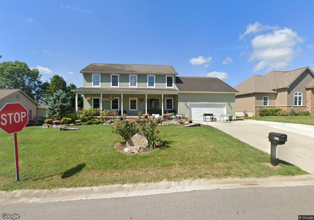
177 Hanover Dr Chillicothe, OH 45601
Estimated Value: $382,609 - $516,000
2
Beds
3
Baths
2,736
Sq Ft
$166/Sq Ft
Est. Value
About This Home
This home is located at 177 Hanover Dr, Chillicothe, OH 45601 and is currently estimated at $454,652, approximately $166 per square foot. 177 Hanover Dr is a home located in Ross County with nearby schools including Unioto Elementary School, Unioto Middle School, and Unioto High School.
Ownership History
Date
Name
Owned For
Owner Type
Purchase Details
Closed on
Jun 16, 2014
Sold by
Goodman Joan D and Fox Richard William
Bought by
Fox Christopher W and Fox Emily K
Current Estimated Value
Home Financials for this Owner
Home Financials are based on the most recent Mortgage that was taken out on this home.
Original Mortgage
$240,000
Outstanding Balance
$182,412
Interest Rate
4.18%
Mortgage Type
Seller Take Back
Estimated Equity
$272,240
Purchase Details
Closed on
Aug 13, 2013
Sold by
Fry Wayne E and Fry Patricia A
Bought by
Goodman Joan D
Create a Home Valuation Report for This Property
The Home Valuation Report is an in-depth analysis detailing your home's value as well as a comparison with similar homes in the area
Home Values in the Area
Average Home Value in this Area
Purchase History
| Date | Buyer | Sale Price | Title Company |
|---|---|---|---|
| Fox Christopher W | $240,000 | Chicago Title Agency | |
| Goodman Joan D | $27,500 | Attorney |
Source: Public Records
Mortgage History
| Date | Status | Borrower | Loan Amount |
|---|---|---|---|
| Open | Fox Christopher W | $240,000 |
Source: Public Records
Tax History Compared to Growth
Tax History
| Year | Tax Paid | Tax Assessment Tax Assessment Total Assessment is a certain percentage of the fair market value that is determined by local assessors to be the total taxable value of land and additions on the property. | Land | Improvement |
|---|---|---|---|---|
| 2024 | $3,950 | $113,040 | $10,490 | $102,550 |
| 2023 | $3,950 | $103,840 | $10,490 | $93,350 |
| 2022 | $4,029 | $103,840 | $10,490 | $93,350 |
| 2021 | $3,749 | $95,730 | $9,990 | $85,740 |
| 2020 | $3,768 | $95,730 | $9,990 | $85,740 |
| 2019 | $3,719 | $95,730 | $9,990 | $85,740 |
| 2018 | $3,610 | $90,890 | $9,360 | $81,530 |
| 2017 | $3,542 | $90,890 | $9,360 | $81,530 |
| 2016 | $3,483 | $90,890 | $9,360 | $81,530 |
| 2015 | $3,348 | $87,420 | $9,360 | $78,060 |
| 2014 | $297 | $7,950 | $7,950 | $0 |
| 2013 | $299 | $7,950 | $7,950 | $0 |
Source: Public Records
Map
Nearby Homes
- 310 Almahurst Dr
- 47 N Fork Dr
- 59 Limestone Blvd
- 23 Shawnee Dr
- 88 Fruit Hill Dr
- 87 Limestone Blvd
- 30 Fruit Hill Dr
- 14 Fruit Hill Dr
- 44 Banyas Blvd
- 63 Page Rd
- 6 Mcintosh Ct
- 48 Banyas Blvd
- 10 Dun Rd
- 1310 Western Ave
- 160 Stanhope Dr
- 5 Kensington Dr
- 7 Kensington Dr
- 9 Kensington Dr
- 15 Windsor Dr
- 0 Nelson Dr
- 169 Hanover Dr
- 185 Hanover Dr
- 323 Meadowlark Dr
- 11 Almahurst Dr
- 151 Hanover Dr
- 339 Meadowlark Dr
- 156 Hanover Dr
- 309 Meadowlark Dr
- 29 Almahurst Dr
- 133 Hanover Dr
- 359 Meadowlark Dr
- 36 Almahurst Dr
- 124 Hanover Dr
- 47 Almahurst Dr
- 117 Hanover Dr
- 295 Meadowlark Dr
- 267 Hanover Dr
- 294 Meadowlark Dr
- 379 Meadowlark Dr
- 50 Almahurst Dr