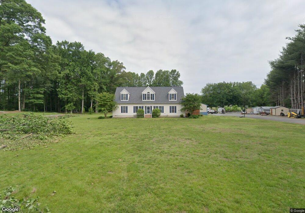
177 Jaacs Ln Woodside, DE 19980
Estimated Value: $372,000 - $545,693
4
Beds
4
Baths
2,520
Sq Ft
$176/Sq Ft
Est. Value
About This Home
This home is located at 177 Jaacs Ln, Woodside, DE 19980 and is currently estimated at $443,564, approximately $176 per square foot. 177 Jaacs Ln is a home located in Kent County with nearby schools including Nellie Hughes Stokes Elementary School, Fred Fifer Middle School, and Caesar Rodney High School.
Ownership History
Date
Name
Owned For
Owner Type
Purchase Details
Closed on
Nov 17, 2006
Sold by
Frank S Aaron
Bought by
Frank S Aaron
Current Estimated Value
Create a Home Valuation Report for This Property
The Home Valuation Report is an in-depth analysis detailing your home's value as well as a comparison with similar homes in the area
Home Values in the Area
Average Home Value in this Area
Purchase History
| Date | Buyer | Sale Price | Title Company |
|---|---|---|---|
| Frank S Aaron | -- | None Available |
Source: Public Records
Tax History Compared to Growth
Tax History
| Year | Tax Paid | Tax Assessment Tax Assessment Total Assessment is a certain percentage of the fair market value that is determined by local assessors to be the total taxable value of land and additions on the property. | Land | Improvement |
|---|---|---|---|---|
| 2025 | $1,866 | $472,400 | $135,700 | $336,700 |
| 2024 | $1,866 | $472,400 | $135,700 | $336,700 |
| 2023 | $1,703 | $67,400 | $12,000 | $55,400 |
| 2022 | $1,607 | $67,400 | $12,000 | $55,400 |
| 2021 | $1,594 | $67,400 | $12,000 | $55,400 |
| 2020 | $1,568 | $67,400 | $12,000 | $55,400 |
| 2019 | $1,505 | $67,400 | $12,000 | $55,400 |
| 2018 | $1,451 | $67,400 | $12,000 | $55,400 |
| 2017 | $1,350 | $64,600 | $0 | $0 |
| 2016 | $1,322 | $64,600 | $0 | $0 |
| 2015 | $1,124 | $64,600 | $0 | $0 |
| 2014 | $1,025 | $60,100 | $0 | $0 |
Source: Public Records
Map
Nearby Homes
- 0 Fleming St
- 1731 Upper King Rd
- 0 Dundee Rd Unit DEKT2042924
- 3182 Upper King Rd
- 104 Lake Front Dr
- 688 S Wynn Wood Cir
- 78 Cove Rd
- 687 Ashland Ave
- 138 Saddlebrook Dr
- 133 Candor Ln
- 21 Starfire Ct
- 124 Redmond Ln
- 45 Harcrest Ct
- 537 Wynn Wood Cir
- 1224 Barney Jenkins Rd
- 734 Hampton Hills Dr
- 21 Crowberry Dr
- 173 Currant Cir
- 193 Currant Cir
- 459 Currant Cir