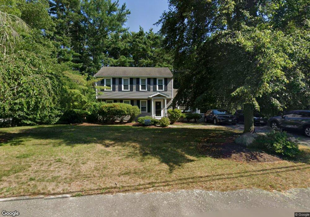
177 Peterson Path Marshfield, MA 02050
Estimated Value: $807,094 - $982,000
4
Beds
3
Baths
2,531
Sq Ft
$353/Sq Ft
Est. Value
About This Home
This home is located at 177 Peterson Path, Marshfield, MA 02050 and is currently estimated at $894,274, approximately $353 per square foot. 177 Peterson Path is a home located in Plymouth County with nearby schools including Governor Edward Winslow School, Furnace Brook Middle School, and Marshfield High School.
Ownership History
Date
Name
Owned For
Owner Type
Purchase Details
Closed on
Apr 30, 2010
Sold by
Hamilton Pauline and Mcgowan Martin E
Bought by
Nichol Kevin G and Nichol Katie A
Current Estimated Value
Home Financials for this Owner
Home Financials are based on the most recent Mortgage that was taken out on this home.
Original Mortgage
$451,566
Outstanding Balance
$306,960
Interest Rate
5.5%
Mortgage Type
FHA
Estimated Equity
$587,314
Purchase Details
Closed on
Mar 31, 2000
Sold by
Brown Robert E and Brown Susan M
Bought by
Hamilton Pauline and Mcgowan Martin E
Purchase Details
Closed on
Mar 31, 1989
Sold by
Karstunen Richard
Bought by
Brown Robert E
Create a Home Valuation Report for This Property
The Home Valuation Report is an in-depth analysis detailing your home's value as well as a comparison with similar homes in the area
Home Values in the Area
Average Home Value in this Area
Purchase History
| Date | Buyer | Sale Price | Title Company |
|---|---|---|---|
| Nichol Kevin G | $459,900 | -- | |
| Nichol Kevin G | $459,900 | -- | |
| Hamilton Pauline | $274,900 | -- | |
| Brown Robert E | $209,000 | -- |
Source: Public Records
Mortgage History
| Date | Status | Borrower | Loan Amount |
|---|---|---|---|
| Open | Nichol Kevin G | $451,566 | |
| Closed | Brown Robert E | $451,566 | |
| Previous Owner | Brown Robert E | $10,000 |
Source: Public Records
Tax History
| Year | Tax Paid | Tax Assessment Tax Assessment Total Assessment is a certain percentage of the fair market value that is determined by local assessors to be the total taxable value of land and additions on the property. | Land | Improvement |
|---|---|---|---|---|
| 2025 | $6,907 | $697,700 | $303,800 | $393,900 |
| 2024 | $6,747 | $649,400 | $289,400 | $360,000 |
| 2023 | $6,514 | $582,000 | $268,700 | $313,300 |
| 2022 | $6,514 | $503,000 | $237,700 | $265,300 |
| 2021 | $6,264 | $474,900 | $237,700 | $237,200 |
| 2020 | $5,772 | $433,000 | $217,000 | $216,000 |
| 2019 | $5,617 | $419,800 | $217,000 | $202,800 |
| 2018 | $5,554 | $415,400 | $217,000 | $198,400 |
| 2017 | $5,487 | $399,900 | $217,000 | $182,900 |
| 2016 | $5,363 | $386,400 | $217,000 | $169,400 |
| 2015 | $5,075 | $381,900 | $217,000 | $164,900 |
| 2014 | $5,006 | $376,700 | $217,000 | $159,700 |
Source: Public Records
Map
Nearby Homes
- 116 Outlook Rd
- 86 Barouche Dr
- 184 King Phillips Pathe
- 242 Enterprise St
- 713 Webster St
- 431 Moraine St
- 42 Carr Rd
- 32 Gratto Rd
- 30 Chandler Dr
- 68 Abrams Hill Rd
- 152 Acorn St
- 106 Careswell St
- 74 Teakettle Ln
- 62 Teakettle Ln
- 92 Salt Meadow Waye
- 387 Lot 2A Old Cove Rd
- 387 Lot 3A Old Cove Rd
- 387 Lot 4A Old Cove Rd
- Two Railroad Ave Unit 9
- Two Railroad Ave Unit 1
- 167 Peterson Path
- 185 Peterson Path
- 12 Grace Ln
- 24 Grace Ln
- 182 Peterson Path
- 170 Peterson Path
- 121 Signal Hill Rd
- 193 Peterson Path
- 158 Peterson Path
- 194 Peterson Path
- 7 Grace Ln
- 203 Peterson Path
- 23 Grace Ln
- 55 Travelers Ln
- 61 Travelers Ln
- 146 Peterson Path
- 204 Peterson Path
- 37 Grace Ln
- 49 Travelers Ln
- 114 Signal Hill Rd