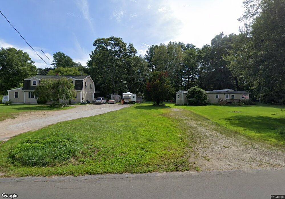
177 Porter Plain Rd Thompson, CT 06277
Estimated Value: $359,000 - $568,000
3
Beds
3
Baths
1,814
Sq Ft
$276/Sq Ft
Est. Value
About This Home
This home is located at 177 Porter Plain Rd, Thompson, CT 06277 and is currently estimated at $500,298, approximately $275 per square foot. 177 Porter Plain Rd is a home located in Windham County with nearby schools including Mary R. Fisher Elementary School, Thompson Middle School, and Tourtellotte Memorial High School.
Ownership History
Date
Name
Owned For
Owner Type
Purchase Details
Closed on
May 31, 2013
Sold by
Anderson Arthur F and Anderson Ellen J
Bought by
Poplawski David J and Poplawski Karen L
Current Estimated Value
Home Financials for this Owner
Home Financials are based on the most recent Mortgage that was taken out on this home.
Original Mortgage
$200,000
Outstanding Balance
$41,713
Interest Rate
2.7%
Mortgage Type
Stand Alone Refi Refinance Of Original Loan
Estimated Equity
$458,585
Create a Home Valuation Report for This Property
The Home Valuation Report is an in-depth analysis detailing your home's value as well as a comparison with similar homes in the area
Home Values in the Area
Average Home Value in this Area
Purchase History
| Date | Buyer | Sale Price | Title Company |
|---|---|---|---|
| Poplawski David J | $110,000 | -- | |
| Poplawski David J | $110,000 | -- |
Source: Public Records
Mortgage History
| Date | Status | Borrower | Loan Amount |
|---|---|---|---|
| Open | Poplawski David J | $200,000 | |
| Previous Owner | Poplawski David J | $105,000 | |
| Previous Owner | Poplawski David J | $59,000 |
Source: Public Records
Tax History
| Year | Tax Paid | Tax Assessment Tax Assessment Total Assessment is a certain percentage of the fair market value that is determined by local assessors to be the total taxable value of land and additions on the property. | Land | Improvement |
|---|---|---|---|---|
| 2025 | $6,673 | $351,200 | $59,800 | $291,400 |
| 2024 | $6,418 | $228,300 | $37,700 | $190,600 |
| 2023 | $5,936 | $228,300 | $37,700 | $190,600 |
| 2022 | $5,712 | $228,300 | $37,700 | $190,600 |
| 2021 | $5,696 | $228,300 | $37,700 | $190,600 |
| 2020 | $5,532 | $228,300 | $37,700 | $190,600 |
| 2019 | $4,673 | $168,400 | $39,400 | $129,000 |
| 2018 | $4,673 | $168,400 | $39,400 | $129,000 |
| 2017 | $4,389 | $168,400 | $39,400 | $129,000 |
| 2016 | $4,389 | $168,400 | $39,400 | $129,000 |
| 2015 | $4,176 | $168,400 | $39,400 | $129,000 |
| 2014 | $3,483 | $152,300 | $47,500 | $104,800 |
Source: Public Records
Map
Nearby Homes
- 597 E Thompson Rd Unit Lot 10C
- 0 Porter Plain Rd
- 2 Mary Rd
- 117 New Rd
- 121 New Rd
- 1350 Thompson Rd
- 13 S Point Rd
- 24 Cooper Rd
- 151 Brandy Hill Rd
- 361 Pasay Rd
- 171 Upper Gore Rd
- 16 Hilltop Dr
- 53-55 Point Pleasant Rd
- 0 Thompson Rd
- 69 Sunset Hill Rd
- 27 Ash St
- 14 Indian Run Dr
- 0 Wilsonville Rd Unit 24140220
- 10 Indian Point Rd
- 51 &52 lot Oscar Rd
- 191 Porter Plain Rd
- 169 Porter Plain Rd
- 203 Porter Plain Rd
- 172 Porter Plain Rd
- 190 Porter Plain Rd
- 200 Porter Plain Rd
- 213 Porter Plain Rd
- 145 Porter Plain Rd
- 273 Porter Plain Rd
- 223 Porter Plain Rd
- 233 Porter Plain Rd
- 152 Porter Plain Rd
- 127 Porter Plain Rd
- 123 Porter Plain Rd
- 245 Porter Plain Rd
- 248 Porter Plain Rd
- 113 Porter Plain Rd
- 510 E Thompson Rd
- 116 Porter Plain Rd
- 105 Porter Plain Rd
Your Personal Tour Guide
Ask me questions while you tour the home.