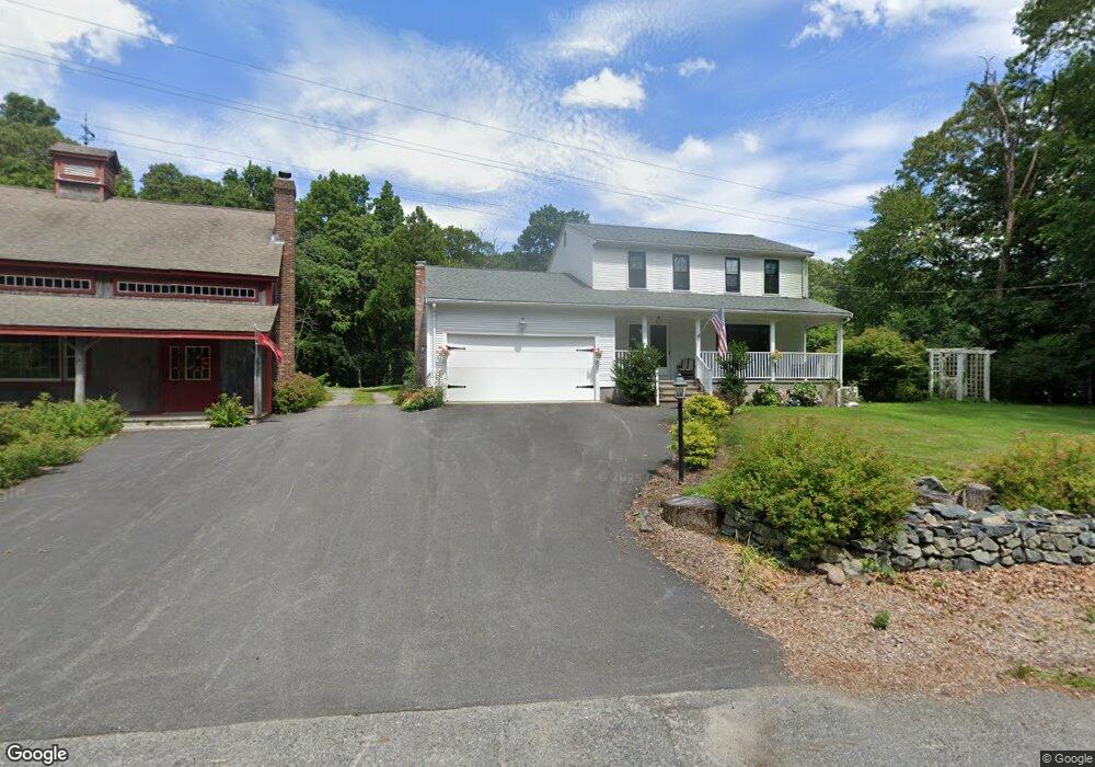
177 Scott Rd Cumberland, RI 02864
Lippitt Estates NeighborhoodEstimated Value: $759,024
Studio
--
Bath
--
Sq Ft
5.18
Acres
About This Home
This home is located at 177 Scott Rd, Cumberland, RI 02864 and is currently estimated at $759,024. 177 Scott Rd is a home located in Providence County with nearby schools including Ashton Elementary School, North Cumberland Middle School, and Cumberland High School.
Ownership History
Date
Name
Owned For
Owner Type
Purchase Details
Closed on
May 16, 2023
Sold by
Paradis Paul E and Paradis Melanie J
Bought by
Moore Richard O and Moore Jennifer M
Current Estimated Value
Home Financials for this Owner
Home Financials are based on the most recent Mortgage that was taken out on this home.
Original Mortgage
$521,800
Outstanding Balance
$504,823
Interest Rate
6.32%
Mortgage Type
Purchase Money Mortgage
Estimated Equity
$254,201
Purchase Details
Closed on
Feb 13, 1985
Bought by
Paradis Paul E and Paradis Melanie J
Create a Home Valuation Report for This Property
The Home Valuation Report is an in-depth analysis detailing your home's value as well as a comparison with similar homes in the area
Home Values in the Area
Average Home Value in this Area
Purchase History
| Date | Buyer | Sale Price | Title Company |
|---|---|---|---|
| Moore Richard O | $621,800 | None Available | |
| Paradis Paul E | -- | -- |
Source: Public Records
Mortgage History
| Date | Status | Borrower | Loan Amount |
|---|---|---|---|
| Open | Moore Richard O | $521,800 | |
| Previous Owner | Paradis Paul E | $281,600 | |
| Previous Owner | Paradis Paul E | $100,000 | |
| Previous Owner | Paradis Paul E | $100,000 |
Source: Public Records
Tax History
| Year | Tax Paid | Tax Assessment Tax Assessment Total Assessment is a certain percentage of the fair market value that is determined by local assessors to be the total taxable value of land and additions on the property. | Land | Improvement |
|---|---|---|---|---|
| 2025 | $7,461 | $608,100 | $192,300 | $415,800 |
| 2024 | $7,267 | $608,100 | $192,300 | $415,800 |
| 2023 | $6,995 | $602,000 | $192,300 | $409,700 |
| 2022 | $7,371 | $491,700 | $150,700 | $341,000 |
| 2021 | $7,248 | $491,700 | $150,700 | $341,000 |
| 2020 | $7,041 | $491,700 | $150,700 | $341,000 |
| 2019 | $6,924 | $436,000 | $126,300 | $309,700 |
| 2018 | $6,723 | $436,000 | $126,300 | $309,700 |
| 2017 | $6,632 | $436,000 | $126,300 | $309,700 |
| 2016 | $6,864 | $401,900 | $132,300 | $269,600 |
| 2015 | $6,864 | $401,900 | $132,300 | $269,600 |
| 2014 | $15,555 | $401,900 | $132,300 | $269,600 |
| 2013 | $6,762 | $428,500 | $138,300 | $290,200 |
Source: Public Records
Map
Nearby Homes
- 164 Scott Rd
- 27 Oxford Rd
- 140 Lippitt Ave
- 1504 Hunting Hill Dr
- 1502 Hunting Hill Dr
- 1503 Hunting Hill Dr
- 1501 Hunting Hill Dr
- 1302 Hunting Hill Dr
- 45 Leigh Rd
- 150 Leigh Rd
- 97 Angell Rd
- 46 Circledale Dr
- 73 Westwood Dr
- 1 Barway Ln
- 2 School St Unit 409
- 1251 Mendon Rd
- 7 Hidden Valley Ln
- 16 Owen Dr
- 30 Bear Hill Rd
- 2970 Mendon Rd Unit 187
Your Personal Tour Guide
Ask me questions while you tour the home.