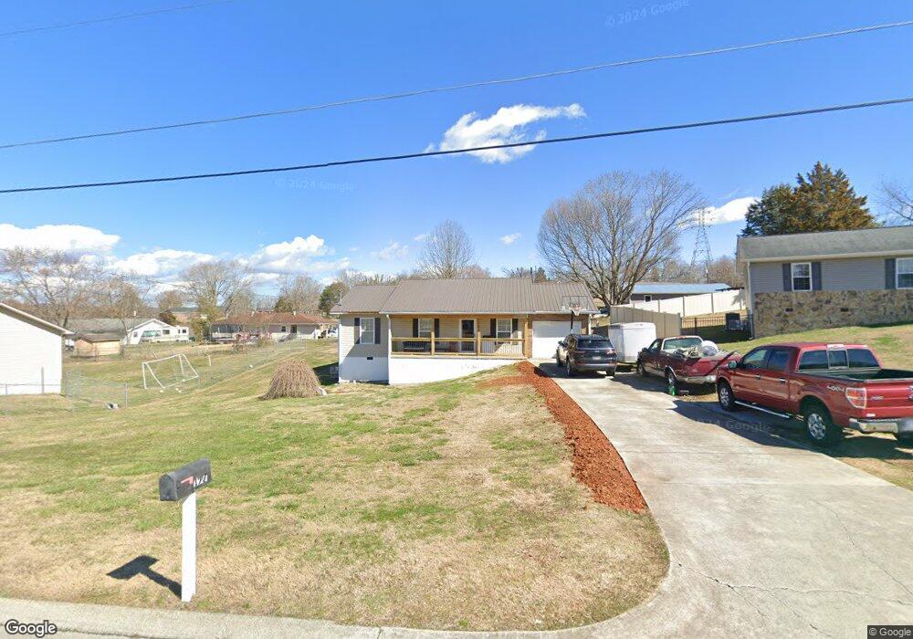
177 Thompson Cir Loudon, TN 37774
Estimated Value: $245,164 - $364,000
--
Bed
2
Baths
1,580
Sq Ft
$183/Sq Ft
Est. Value
About This Home
This home is located at 177 Thompson Cir, Loudon, TN 37774 and is currently estimated at $288,541, approximately $182 per square foot. 177 Thompson Cir is a home located in Loudon County with nearby schools including Loudon High School.
Ownership History
Date
Name
Owned For
Owner Type
Purchase Details
Closed on
Oct 6, 2005
Sold by
Property Management
Bought by
Cheryl Collis Melinda
Current Estimated Value
Purchase Details
Closed on
Aug 3, 2005
Sold by
Jane Robinson Sharon
Bought by
Property Management
Purchase Details
Closed on
Jun 7, 2001
Sold by
Rick Bolinger
Bought by
Sharon Robinson
Home Financials for this Owner
Home Financials are based on the most recent Mortgage that was taken out on this home.
Original Mortgage
$16,990
Interest Rate
7.06%
Purchase Details
Closed on
Jun 6, 2001
Bought by
Collis Melinda Cheryl Etvir Randal D
Home Financials for this Owner
Home Financials are based on the most recent Mortgage that was taken out on this home.
Original Mortgage
$16,990
Interest Rate
7.06%
Purchase Details
Closed on
Feb 14, 2001
Sold by
Carl Barber
Bought by
Rick Bolinger
Purchase Details
Closed on
Nov 8, 1996
Bought by
Barber Carl and Barber Lisa
Create a Home Valuation Report for This Property
The Home Valuation Report is an in-depth analysis detailing your home's value as well as a comparison with similar homes in the area
Home Values in the Area
Average Home Value in this Area
Purchase History
| Date | Buyer | Sale Price | Title Company |
|---|---|---|---|
| Cheryl Collis Melinda | $113,500 | -- | |
| Property Management | $82,000 | -- | |
| Sharon Robinson | $84,950 | -- | |
| Collis Melinda Cheryl Etvir Randal D | $85,000 | -- | |
| Rick Bolinger | $8,000 | -- | |
| Barber Carl | $7,800 | -- |
Source: Public Records
Mortgage History
| Date | Status | Borrower | Loan Amount |
|---|---|---|---|
| Previous Owner | Barber Carl | $16,990 |
Source: Public Records
Tax History Compared to Growth
Tax History
| Year | Tax Paid | Tax Assessment Tax Assessment Total Assessment is a certain percentage of the fair market value that is determined by local assessors to be the total taxable value of land and additions on the property. | Land | Improvement |
|---|---|---|---|---|
| 2025 | $1,052 | $40,200 | $5,700 | $34,500 |
| 2023 | $1,052 | $40,200 | $0 | $0 |
| 2022 | $1,052 | $40,200 | $5,700 | $34,500 |
| 2021 | $1,052 | $40,200 | $5,700 | $34,500 |
| 2020 | $1,052 | $40,200 | $5,700 | $34,500 |
| 2019 | $858 | $34,600 | $6,250 | $28,350 |
| 2018 | $841 | $28,250 | $6,250 | $22,000 |
| 2017 | $841 | $28,250 | $6,250 | $22,000 |
| 2016 | $764 | $25,175 | $4,375 | $20,800 |
| 2015 | $764 | $25,175 | $4,375 | $20,800 |
| 2014 | $764 | $25,175 | $4,375 | $20,800 |
Source: Public Records
Map
Nearby Homes
- 181 Thompson Cir
- 173 Thompson Cir
- 411 Coffee Ln
- 415 Coffee Ln
- 176 Thompson Cir
- 407 Coffee Ln
- 172 Thompson Cir
- 419 Coffee Ln
- 327 River Bend Dr
- 168 Thompson Cir
- 118 Thompson Cir
- 325 River Bend Dr
- 114 Thompson Cir
- 423 Coffee Ln
- 106 Thompson Cir
- 412 Coffee Ln
- 193 Thompson Cir
- 193 Thompson Cir Unit 19
- 162 Thompson Cir
- 416 Coffee Ln