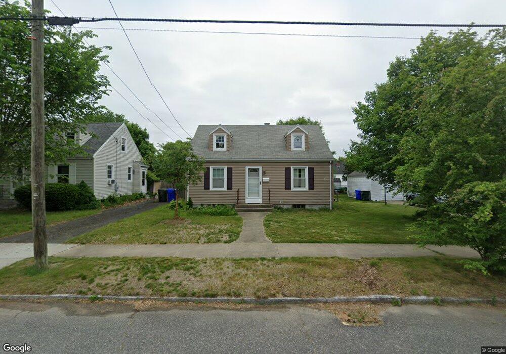
177 Winton St Springfield, MA 01118
East Forest Park NeighborhoodEstimated Value: $269,797 - $315,000
4
Beds
1
Bath
1,116
Sq Ft
$265/Sq Ft
Est. Value
About This Home
This home is located at 177 Winton St, Springfield, MA 01118 and is currently estimated at $296,199, approximately $265 per square foot. 177 Winton St is a home located in Hampden County with nearby schools including Mary A. Dryden Veterans Memorial School, M Marcus Kiley Middle, and Springfield High School of Science and Technology.
Ownership History
Date
Name
Owned For
Owner Type
Purchase Details
Closed on
Mar 1, 1989
Sold by
Boyd Douglas F
Bought by
Wallock Oliver F
Current Estimated Value
Home Financials for this Owner
Home Financials are based on the most recent Mortgage that was taken out on this home.
Original Mortgage
$87,100
Interest Rate
10.63%
Mortgage Type
Purchase Money Mortgage
Create a Home Valuation Report for This Property
The Home Valuation Report is an in-depth analysis detailing your home's value as well as a comparison with similar homes in the area
Home Values in the Area
Average Home Value in this Area
Purchase History
| Date | Buyer | Sale Price | Title Company |
|---|---|---|---|
| Wallock Oliver F | $10,890 | -- |
Source: Public Records
Mortgage History
| Date | Status | Borrower | Loan Amount |
|---|---|---|---|
| Open | Wallock Oliver F | $65,400 | |
| Closed | Wallock Oliver F | $87,100 |
Source: Public Records
Tax History
| Year | Tax Paid | Tax Assessment Tax Assessment Total Assessment is a certain percentage of the fair market value that is determined by local assessors to be the total taxable value of land and additions on the property. | Land | Improvement |
|---|---|---|---|---|
| 2025 | $3,338 | $212,900 | $47,400 | $165,500 |
| 2024 | $3,051 | $190,000 | $47,400 | $142,600 |
| 2023 | $2,776 | $162,800 | $45,100 | $117,700 |
| 2022 | $2,928 | $155,600 | $45,100 | $110,500 |
| 2021 | $2,897 | $153,300 | $41,000 | $112,300 |
| 2020 | $2,689 | $137,700 | $41,000 | $96,700 |
| 2019 | $2,482 | $126,100 | $41,000 | $85,100 |
| 2018 | $2,427 | $123,300 | $41,000 | $82,300 |
| 2017 | $2,371 | $120,600 | $41,000 | $79,600 |
| 2016 | $2,153 | $109,500 | $41,000 | $68,500 |
| 2015 | $1,991 | $101,200 | $41,000 | $60,200 |
Source: Public Records
Map
Nearby Homes
- 384 Abbott St
- 75 Gillette Cir
- 37 Chesterfield Ave
- 509 Plumtree Rd
- 7 Ashbrook St
- 54 S Shore Dr
- 647 Plumtree Rd
- 79 Arvilla St
- 101 Regal St
- 47 Hartford Terrace
- 170 Plumtree Rd
- 236 Pondview Dr
- 79 Roosevelt Ave
- 118 Pilgrim Rd
- 134 Eddywood St
- 30 W Hill Rd
- 1088 Sumner Ave
- 19 Manor Ct Unit 19
- 44 Amanda St
- 55 Allen St
Your Personal Tour Guide
Ask me questions while you tour the home.