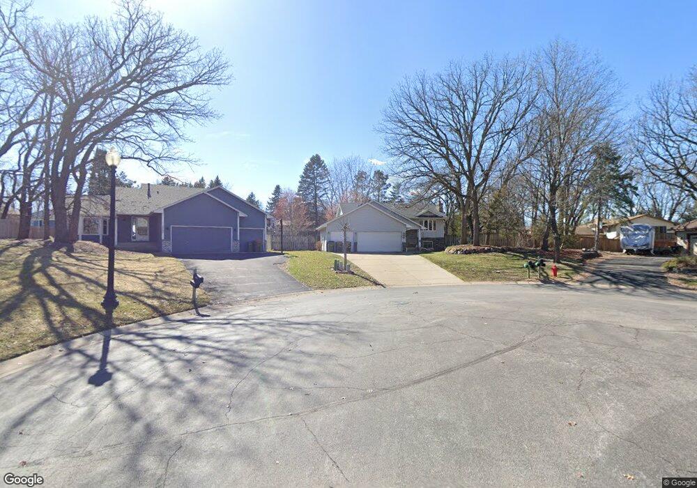
1770 132nd Ln NW Coon Rapids, MN 55448
Estimated Value: $390,000 - $430,000
4
Beds
2
Baths
2,100
Sq Ft
$193/Sq Ft
Est. Value
About This Home
This home is located at 1770 132nd Ln NW, Coon Rapids, MN 55448 and is currently estimated at $405,663, approximately $193 per square foot. 1770 132nd Ln NW is a home located in Anoka County with nearby schools including Lucile Bruner Elementary School, Morris Bye Elementary School, and Laughlin Junior/Senior High School.
Ownership History
Date
Name
Owned For
Owner Type
Purchase Details
Closed on
Aug 12, 2022
Sold by
Ryberg Paul and Ryberg Audrey
Bought by
Mai Kathy and Tran Bonnie
Current Estimated Value
Home Financials for this Owner
Home Financials are based on the most recent Mortgage that was taken out on this home.
Original Mortgage
$300,000
Outstanding Balance
$287,243
Interest Rate
5.7%
Mortgage Type
New Conventional
Estimated Equity
$118,420
Purchase Details
Closed on
Jul 1, 2019
Sold by
Sauer Annette L
Bought by
Ryberg Paul and Ryberg Audrey
Home Financials for this Owner
Home Financials are based on the most recent Mortgage that was taken out on this home.
Original Mortgage
$259,865
Interest Rate
4%
Mortgage Type
New Conventional
Create a Home Valuation Report for This Property
The Home Valuation Report is an in-depth analysis detailing your home's value as well as a comparison with similar homes in the area
Home Values in the Area
Average Home Value in this Area
Purchase History
| Date | Buyer | Sale Price | Title Company |
|---|---|---|---|
| Mai Kathy | $390,000 | -- | |
| Ryberg Paul | $283,000 | All American Title Co Inc |
Source: Public Records
Mortgage History
| Date | Status | Borrower | Loan Amount |
|---|---|---|---|
| Open | Mai Kathy | $300,000 | |
| Previous Owner | Ryberg Paul | $259,865 |
Source: Public Records
Tax History Compared to Growth
Tax History
| Year | Tax Paid | Tax Assessment Tax Assessment Total Assessment is a certain percentage of the fair market value that is determined by local assessors to be the total taxable value of land and additions on the property. | Land | Improvement |
|---|---|---|---|---|
| 2025 | $3,585 | $357,800 | $94,500 | $263,300 |
| 2024 | $3,585 | $342,900 | $91,400 | $251,500 |
| 2023 | $3,370 | $334,700 | $75,600 | $259,100 |
| 2022 | $2,983 | $344,200 | $75,600 | $268,600 |
| 2021 | $2,889 | $274,300 | $58,800 | $215,500 |
| 2020 | $2,952 | $260,400 | $58,800 | $201,600 |
| 2019 | $2,850 | $255,200 | $58,800 | $196,400 |
| 2018 | $2,702 | $240,300 | $0 | $0 |
| 2017 | $2,316 | $222,400 | $0 | $0 |
| 2016 | $2,348 | $189,700 | $0 | $0 |
| 2015 | $2,295 | $189,700 | $52,500 | $137,200 |
| 2014 | -- | $158,700 | $37,200 | $121,500 |
Source: Public Records
Map
Nearby Homes
- 1776 133rd Ave NW
- 1687 131st Ln NW
- 12859 Grouse St NW
- 1520 129th Ave NW
- 13519 Partridge Cir NW
- 13416 Swallow St NW
- 1930 127th Cir NW
- 12796 Bluebird St NW
- 12554 Grouse St NW
- 1593 126th Ln NW
- 12760 Raven St NW
- 1450 126th Ln NW
- 1234 128th Cir NW
- 2270 137th Ln NW
- 13208 Zion St NW
- 2147 125th Ln NW
- 13182 Zion St NW
- 2201 139th Ave NW
- 12365 Jay St NW
- 1625 124th Ave NW
- 1760 132nd Ln NW
- 1765 132nd Ln NW
- 13243 Jay St NW
- 13251 Jay St NW
- 13237 Jay St NW
- 1755 132nd Ln NW
- 1750 132nd Ln NW
- 1740 132nd Ln NW
- 1767 132nd Ave NW
- 1745 132nd Ln NW
- 1757 132nd Ave NW
- 13257 Jay St NW
- 1777 132nd Ave NW
- 13220 Jay St NW
- 1747 132nd Ave NW
- 13267 Jay St NW
- 1735 132nd Ln NW
- 1746 133rd Ave NW
- 1787 132nd Ave NW
- 1730 132nd Ln NW