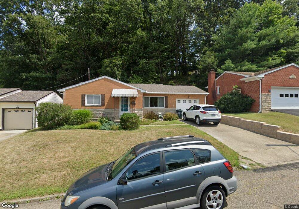
1770 Marrose Dr Lancaster, OH 43130
Estimated Value: $221,165 - $239,000
3
Beds
2
Baths
1,056
Sq Ft
$219/Sq Ft
Est. Value
About This Home
This home is located at 1770 Marrose Dr, Lancaster, OH 43130 and is currently estimated at $231,291, approximately $219 per square foot. 1770 Marrose Dr is a home located in Fairfield County with nearby schools including Tarhe Elementary School, General Sherman Junior High School, and Lancaster High School.
Ownership History
Date
Name
Owned For
Owner Type
Purchase Details
Closed on
Feb 2, 1996
Sold by
Nixon Ronald E
Bought by
Bibler Michael J and Bibler Linda M
Current Estimated Value
Purchase Details
Closed on
Jun 6, 1994
Sold by
Graf Lois F
Bought by
Nixon Ronald E and Nixon Loretta A
Home Financials for this Owner
Home Financials are based on the most recent Mortgage that was taken out on this home.
Original Mortgage
$89,000
Interest Rate
7.5%
Mortgage Type
New Conventional
Purchase Details
Closed on
May 4, 1994
Sold by
Graf Lois Fricker
Bought by
Graf Lois Fricker
Home Financials for this Owner
Home Financials are based on the most recent Mortgage that was taken out on this home.
Original Mortgage
$89,000
Interest Rate
7.5%
Mortgage Type
New Conventional
Purchase Details
Closed on
Oct 14, 1992
Sold by
Fricker Lois
Bought by
Graf Lois Fricker
Create a Home Valuation Report for This Property
The Home Valuation Report is an in-depth analysis detailing your home's value as well as a comparison with similar homes in the area
Home Values in the Area
Average Home Value in this Area
Purchase History
| Date | Buyer | Sale Price | Title Company |
|---|---|---|---|
| Bibler Michael J | $95,000 | -- | |
| Nixon Ronald E | $89,000 | -- | |
| Graf Lois Fricker | -- | -- | |
| Graf Lois Fricker | -- | -- |
Source: Public Records
Mortgage History
| Date | Status | Borrower | Loan Amount |
|---|---|---|---|
| Previous Owner | Nixon Ronald E | $89,000 |
Source: Public Records
Tax History
| Year | Tax Paid | Tax Assessment Tax Assessment Total Assessment is a certain percentage of the fair market value that is determined by local assessors to be the total taxable value of land and additions on the property. | Land | Improvement |
|---|---|---|---|---|
| 2025 | $5,436 | $71,070 | $16,760 | $54,310 |
| 2024 | $5,436 | $60,470 | $8,380 | $52,090 |
| 2023 | $1,866 | $60,470 | $8,380 | $52,090 |
| 2022 | $1,889 | $60,470 | $8,380 | $52,090 |
| 2021 | $1,312 | $42,420 | $8,380 | $34,040 |
| 2020 | $1,413 | $42,420 | $8,380 | $34,040 |
| 2019 | $1,506 | $42,420 | $8,380 | $34,040 |
| 2018 | $1,369 | $32,290 | $8,380 | $23,910 |
| 2017 | $1,370 | $36,630 | $8,380 | $28,250 |
| 2016 | $1,334 | $36,630 | $8,380 | $28,250 |
| 2015 | $1,327 | $35,370 | $8,380 | $26,990 |
| 2014 | $1,264 | $35,370 | $8,380 | $26,990 |
| 2013 | $1,264 | $35,370 | $8,380 | $26,990 |
Source: Public Records
Map
Nearby Homes
- 0 Wacker Dr Unit 225036189
- 136 N Arlington Ave
- 202 Wildwood Ave
- 1917 Nichole Cir
- 1400 N Columbus St
- 2014 N Columbus St
- 0 Marks Ave Unit 225036443
- 338 Scott Dr
- 181 Marks Ave
- 249 Marvel Dr
- 148 Marks Ave
- 0 Hillside Ave
- 1125 Zimmer St
- 1156 Forest Rose Ave
- 932 Goodwin Ave
- 330 Park St
- 336 Reber Ave
- 844 Washington Ave
- 308 Reber Ave
- 1004 W Fair Ave
- 1776 Marrose Dr
- 1762 Marrose Dr
- 1782 Marrose Dr
- 1788 Marrose Dr
- 1775 Marrose Dr
- 1769 Marrose Dr
- 1663 Baltimore Rd NW
- 1761 Marrose Dr
- 1781 Marrose Dr
- 214 Hartford Dr
- 1790 Marrose Dr
- 1785 Marrose Dr
- 220 Hartford Dr
- 1753 Marrose Dr
- 1789 Marrose Dr
- 228 Hartford Dr
- 1758 Glenmar Dr
- 1764 Glenmar Dr
- 1752 Glenmar Dr
- 1741 Marrose Dr
Your Personal Tour Guide
Ask me questions while you tour the home.