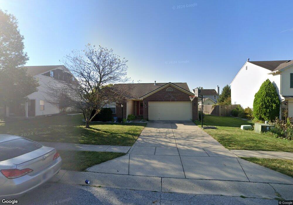
1771 Eastfork Dr Brownsburg, IN 46112
Estimated Value: $261,000 - $272,000
3
Beds
2
Baths
1,254
Sq Ft
$213/Sq Ft
Est. Value
About This Home
This home is located at 1771 Eastfork Dr, Brownsburg, IN 46112 and is currently estimated at $266,615, approximately $212 per square foot. 1771 Eastfork Dr is a home located in Hendricks County with nearby schools including Brownsburg East Middle School and Brownsburg High School.
Ownership History
Date
Name
Owned For
Owner Type
Purchase Details
Closed on
Jul 18, 2017
Sold by
Considine Jessica Diane
Bought by
Aiken Taylor C
Current Estimated Value
Purchase Details
Closed on
Dec 29, 2009
Sold by
Secretary Of Housing & Urban Development
Bought by
Considine Jessica Diane
Home Financials for this Owner
Home Financials are based on the most recent Mortgage that was taken out on this home.
Original Mortgage
$81,496
Interest Rate
4.84%
Mortgage Type
FHA
Purchase Details
Closed on
Sep 21, 2009
Sold by
National City Real Estate Services Llc
Bought by
Secretary Of Housing & Urban Development
Purchase Details
Closed on
Aug 20, 2009
Sold by
Davis Ray A and Davis Jennifer M
Bought by
National City Real Estate Services Llc
Create a Home Valuation Report for This Property
The Home Valuation Report is an in-depth analysis detailing your home's value as well as a comparison with similar homes in the area
Home Values in the Area
Average Home Value in this Area
Purchase History
| Date | Buyer | Sale Price | Title Company |
|---|---|---|---|
| Aiken Taylor C | $146,900 | First American Title | |
| Considine Jessica Diane | -- | None Available | |
| Secretary Of Housing & Urban Development | -- | None Available | |
| National City Real Estate Services Llc | $116,115 | None Available |
Source: Public Records
Mortgage History
| Date | Status | Borrower | Loan Amount |
|---|---|---|---|
| Previous Owner | Considine Jessica Diane | $81,496 |
Source: Public Records
Tax History Compared to Growth
Tax History
| Year | Tax Paid | Tax Assessment Tax Assessment Total Assessment is a certain percentage of the fair market value that is determined by local assessors to be the total taxable value of land and additions on the property. | Land | Improvement |
|---|---|---|---|---|
| 2024 | $2,193 | $219,300 | $44,100 | $175,200 |
| 2023 | $1,858 | $185,800 | $37,400 | $148,400 |
| 2022 | $1,767 | $177,700 | $34,600 | $143,100 |
| 2021 | $1,526 | $153,500 | $31,500 | $122,000 |
| 2020 | $1,368 | $137,800 | $31,500 | $106,300 |
| 2019 | $1,340 | $135,000 | $31,500 | $103,500 |
| 2018 | $1,302 | $128,200 | $31,500 | $96,700 |
| 2017 | $1,249 | $122,900 | $31,500 | $91,400 |
| 2016 | $1,209 | $120,100 | $31,500 | $88,600 |
| 2014 | $1,092 | $112,100 | $30,600 | $81,500 |
Source: Public Records
Map
Nearby Homes
- 1844 Creekside Dr
- 1560 Cold Spring Dr
- 8915 E County Road 400 N
- 3924 Castle Hill Dr
- 1686 Cape Hatteras Trail
- 6527 Gulfwood Dr
- 8903 Motorsports Way
- 8542 Goldfinch Rd
- 3747 Bellmore Dr
- 3947 Wren Dr
- 3883 Wren Dr
- T-1647 Wren Plan at Talon Woods - Townhomes
- T-1356 Piper Plan at Talon Woods - Townhomes
- T-1415 Adler Plan at Talon Woods - Townhomes
- Bria Plan at Talon Woods - Townhomes
- 3931 Wren Dr
- 3717 Bellmore Dr
- 8524 Goldfinch Rd
- 8516 Goldfinch Rd
- 8520 Goldfinch Rd
- 1771 E Fork Dr
- 1791 E Fork Dr
- 1791 Eastfork Dr
- 1751 Eastfork Dr
- 1764 Creekside Dr
- 1731 E Fork Dr
- 1811 Eastfork Dr
- 1731 Eastfork Dr
- 1744 Creekside Dr
- 1784 Creekside Dr
- 1790 Eastfork Dr
- 1770 E Fork Dr
- 1770 Eastfork Dr
- 1724 Creekside Dr
- 1804 Creekside Dr
- 1810 Eastfork Dr
- 1810 Eastfork Dr
- 1831 Eastfork Dr
- 1711 Eastfork Dr
- 1750 Eastfork Dr