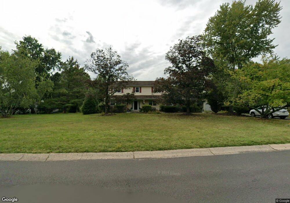
1772 Franklin Dr Furlong, PA 18925
Estimated Value: $716,000 - $842,000
4
Beds
3
Baths
3,017
Sq Ft
$254/Sq Ft
Est. Value
About This Home
This home is located at 1772 Franklin Dr, Furlong, PA 18925 and is currently estimated at $765,489, approximately $253 per square foot. 1772 Franklin Dr is a home located in Bucks County with nearby schools including Bridge Valley Elementary School, Holicong Middle School, and Central Bucks High School - East.
Ownership History
Date
Name
Owned For
Owner Type
Purchase Details
Closed on
Oct 27, 2008
Sold by
Skudris John P and Skudris Joyce
Bought by
Cobb Jeffrey and Cobb Pamela
Current Estimated Value
Home Financials for this Owner
Home Financials are based on the most recent Mortgage that was taken out on this home.
Original Mortgage
$170,000
Outstanding Balance
$111,757
Interest Rate
6.11%
Mortgage Type
Purchase Money Mortgage
Estimated Equity
$653,732
Purchase Details
Closed on
Jul 24, 1995
Sold by
Key Bank Of New York
Bought by
Skudris John P and Skudris Joyce
Home Financials for this Owner
Home Financials are based on the most recent Mortgage that was taken out on this home.
Original Mortgage
$155,600
Interest Rate
7.09%
Purchase Details
Closed on
Mar 23, 1995
Sold by
Keycorp Mtg Inc
Bought by
Key Bank Of New York
Create a Home Valuation Report for This Property
The Home Valuation Report is an in-depth analysis detailing your home's value as well as a comparison with similar homes in the area
Home Values in the Area
Average Home Value in this Area
Purchase History
| Date | Buyer | Sale Price | Title Company |
|---|---|---|---|
| Cobb Jeffrey | $450,000 | None Available | |
| Skudris John P | $194,500 | -- | |
| Key Bank Of New York | -- | -- |
Source: Public Records
Mortgage History
| Date | Status | Borrower | Loan Amount |
|---|---|---|---|
| Open | Cobb Jeffrey | $170,000 | |
| Previous Owner | Skudris John P | $155,600 |
Source: Public Records
Tax History Compared to Growth
Tax History
| Year | Tax Paid | Tax Assessment Tax Assessment Total Assessment is a certain percentage of the fair market value that is determined by local assessors to be the total taxable value of land and additions on the property. | Land | Improvement |
|---|---|---|---|---|
| 2025 | $7,346 | $45,120 | $9,080 | $36,040 |
| 2024 | $7,346 | $45,120 | $9,080 | $36,040 |
| 2023 | $7,097 | $45,120 | $9,080 | $36,040 |
| 2022 | $7,012 | $45,120 | $9,080 | $36,040 |
| 2021 | $6,928 | $45,120 | $9,080 | $36,040 |
| 2020 | $6,928 | $45,120 | $9,080 | $36,040 |
| 2019 | $6,883 | $45,120 | $9,080 | $36,040 |
| 2018 | $6,883 | $45,120 | $9,080 | $36,040 |
| 2017 | $6,827 | $45,120 | $9,080 | $36,040 |
| 2016 | -- | $45,120 | $9,080 | $36,040 |
| 2015 | -- | $45,120 | $9,080 | $36,040 |
| 2014 | -- | $45,120 | $9,080 | $36,040 |
Source: Public Records
Map
Nearby Homes
- 1515 Sugar Bottom Rd
- 2080 Bedfordshire Rd
- 0 Old York Rd Unit PABU2103356
- 2113 Redbud Ln
- 108 Eagle Ct Unit 105
- 3017 Dorchester St E Unit 125
- 2310 S Whittmore St
- 2209 Swamp Rd
- 2807 Mountain Laurel Dr
- 1948 Forest Grove Rd
- 1501 Deborah Ct Unit 2102
- 2443 Sugar Bottom Rd
- 547 Mccarty Dr
- 1834 Augusta Dr
- 3657 Powder Horn Dr
- 1416 Angela Ct Unit 1004
- 1530 Spruce Ct
- 3772 Powder Horn Dr
- 1249 Pebble Hill Rd
- 106 Saddle Dr
- 1788 Franklin Dr
- 1750 Franklin Dr
- 3115 Lower Mountain Rd
- 3179 Lower Mountain Rd
- 1736 Franklin Dr
- 1741 Franklin Dr
- 3120 Lower Mountain Rd
- 1568 Franklin Dr
- 3195 Lower Mountain Rd
- 3091 Lower Mountain Rd
- 1577 Franklin Dr
- 3152 Lower Mountain Rd
- 1711 Franklin Dr
- 1580 Franklin Dr
- 3183 Lower Mountain Rd
- 1706 Franklin Dr
- 1818 Lower Mountain Rd
- 1607 Franklin Dr
- 1845 Lower Mountain Rd
- 3073 Lower Mountain Rd