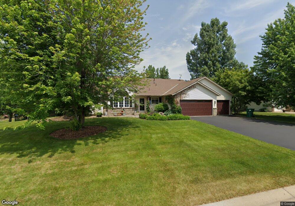
17720 Firebird Path Farmington, MN 55024
Estimated Value: $482,040 - $569,000
4
Beds
3
Baths
1,651
Sq Ft
$316/Sq Ft
Est. Value
About This Home
This home is located at 17720 Firebird Path, Farmington, MN 55024 and is currently estimated at $521,010, approximately $315 per square foot. 17720 Firebird Path is a home located in Dakota County with nearby schools including North Trail Elementary School, Levi P. Dodge Middle School, and Farmington High School.
Ownership History
Date
Name
Owned For
Owner Type
Purchase Details
Closed on
May 30, 2000
Sold by
Lomax Billy R and Lomax Jennifer D
Bought by
Becker John F and Becker Sharon
Current Estimated Value
Purchase Details
Closed on
Apr 17, 1998
Sold by
Marell Inc
Bought by
The Windwood Co Inc
Purchase Details
Closed on
Jan 7, 1998
Sold by
The Windwood Company Inc
Bought by
Lomax Billy R and Lomax Jennifer D
Create a Home Valuation Report for This Property
The Home Valuation Report is an in-depth analysis detailing your home's value as well as a comparison with similar homes in the area
Home Values in the Area
Average Home Value in this Area
Purchase History
| Date | Buyer | Sale Price | Title Company |
|---|---|---|---|
| Becker John F | $237,000 | -- | |
| The Windwood Co Inc | $38,900 | -- | |
| Lomax Billy R | $185,902 | -- |
Source: Public Records
Tax History Compared to Growth
Tax History
| Year | Tax Paid | Tax Assessment Tax Assessment Total Assessment is a certain percentage of the fair market value that is determined by local assessors to be the total taxable value of land and additions on the property. | Land | Improvement |
|---|---|---|---|---|
| 2024 | $5,012 | $452,400 | $85,800 | $366,600 |
| 2023 | $5,012 | $465,500 | $85,500 | $380,000 |
| 2022 | $4,674 | $447,500 | $85,200 | $362,300 |
| 2021 | $4,384 | $374,200 | $74,100 | $300,100 |
| 2020 | $4,422 | $342,600 | $70,600 | $272,000 |
| 2019 | $4,305 | $334,300 | $65,900 | $268,400 |
| 2018 | $4,015 | $324,400 | $62,700 | $261,700 |
| 2017 | $4,005 | $298,600 | $59,700 | $238,900 |
| 2016 | $4,013 | $289,500 | $56,900 | $232,600 |
| 2015 | $3,594 | $267,851 | $52,824 | $215,027 |
| 2014 | -- | $258,150 | $51,154 | $206,996 |
| 2013 | -- | $235,587 | $46,308 | $189,279 |
Source: Public Records
Map
Nearby Homes
- 5969 Upper 179th St W
- 17415 Fireside Ln
- 17850 Evershed Way
- 5956 Upper 179th St W
- 17295 Fieldcrest Ave
- 17698 Fortune Trail
- 17583 Foxboro Ln
- 17729 Everest Ave
- 17725 Everest Ave
- 17718 Everest Ave
- 17714 Everest Ave
- 5695 Lower 182nd St W
- 17373 N Creek Dr
- 17775 Empire Trail
- 17751 Empire Trail
- 17703 Empire Trail
- 17691 Empire Trail
- xxxx Empire Trail
- xxx Empire Trail
- 17762 Empire Trail
- 17724 Firebird Path
- 17698 Fair Isle Path
- 17711 17711 Flair Cir
- 17711 Flair Cir
- 17686 Fair Isle Path
- 17680 Fair Isle Path
- 17721 Firebird Path
- 17715 Firebird Path
- 17725 Firebird Path
- 17676 Fair Isle Path
- 17707 Firebird Path
- 17708 Flair Cir
- 17733 Firebird Path
- 17713 Flair Cir
- 17694 Firebird Path
- 6233 178th St W
- 6233 178 St
- 17689 Fair Isle Path
- 17672 Fair Isle Path
- 6213 178th St