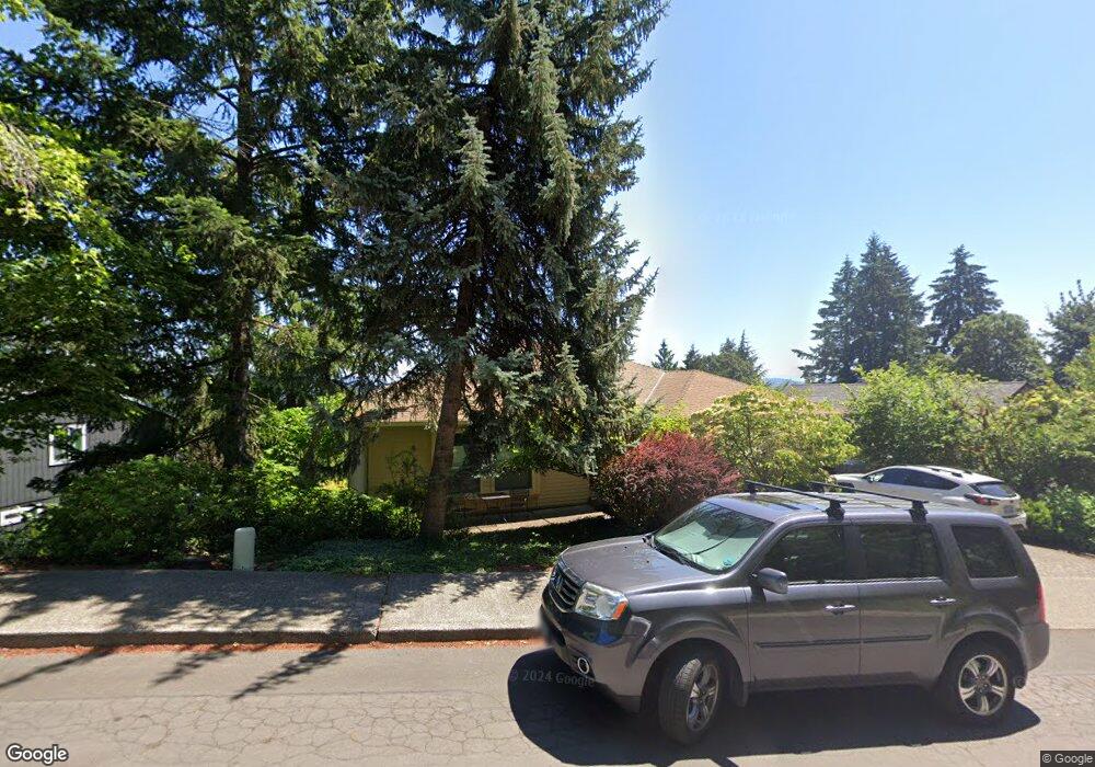
17725 Hillside Dr West Linn, OR 97068
Robinwood NeighborhoodEstimated Value: $984,000 - $1,159,634
5
Beds
4
Baths
4,402
Sq Ft
$247/Sq Ft
Est. Value
About This Home
This home is located at 17725 Hillside Dr, West Linn, OR 97068 and is currently estimated at $1,085,659, approximately $246 per square foot. 17725 Hillside Dr is a home located in Clackamas County with nearby schools including Cedaroak Park Primary School, West Linn High School, and Harmony Academy.
Ownership History
Date
Name
Owned For
Owner Type
Purchase Details
Closed on
Nov 15, 2016
Sold by
Finigan Michael W and Roth Finigan Veronica S
Bought by
Orenstein Sean B and Orenstein Aubrey M
Current Estimated Value
Home Financials for this Owner
Home Financials are based on the most recent Mortgage that was taken out on this home.
Original Mortgage
$417,000
Outstanding Balance
$333,879
Interest Rate
3.42%
Mortgage Type
New Conventional
Estimated Equity
$751,780
Create a Home Valuation Report for This Property
The Home Valuation Report is an in-depth analysis detailing your home's value as well as a comparison with similar homes in the area
Home Values in the Area
Average Home Value in this Area
Purchase History
| Date | Buyer | Sale Price | Title Company |
|---|---|---|---|
| Orenstein Sean B | $607,000 | Fidelity Natl Title Of Or |
Source: Public Records
Mortgage History
| Date | Status | Borrower | Loan Amount |
|---|---|---|---|
| Open | Orenstein Sean B | $417,000 |
Source: Public Records
Tax History Compared to Growth
Tax History
| Year | Tax Paid | Tax Assessment Tax Assessment Total Assessment is a certain percentage of the fair market value that is determined by local assessors to be the total taxable value of land and additions on the property. | Land | Improvement |
|---|---|---|---|---|
| 2025 | $11,437 | $593,461 | -- | -- |
| 2024 | $11,009 | $576,176 | -- | -- |
| 2023 | $11,009 | $559,395 | $0 | $0 |
| 2022 | $10,391 | $543,102 | $0 | $0 |
| 2021 | $9,821 | $527,284 | $0 | $0 |
| 2020 | $9,748 | $511,927 | $0 | $0 |
| 2019 | $9,344 | $497,017 | $0 | $0 |
| 2018 | $8,897 | $482,541 | $0 | $0 |
| 2017 | $8,302 | $468,486 | $0 | $0 |
| 2016 | $7,950 | $454,841 | $0 | $0 |
| 2015 | $7,571 | $441,593 | $0 | $0 |
| 2014 | $7,147 | $428,731 | $0 | $0 |
Source: Public Records
Map
Nearby Homes
- 1354 Skye Pkwy
- 17911 Hillside Dr
- 2455 College Hill Place
- 17833 Marylcreek Dr
- 17634 Brookhurst Dr
- 17623 Brookhurst Dr
- 1777 Skyland Dr
- 1384 Celtic Ct
- 17514 Brookhurst Dr
- 2167 Marylwood Ct
- 1397 Skye Pkwy
- 18004 Eastridge Ln
- 2636 Maria Ct
- 2041 Marylhurst Dr
- 2424 Glenmorrie Dr
- 18194 Shady Hollow Way
- 1611 Arran Ct
- 3340 Arbor Dr
- 1321 Troon Dr
- 17900 Crestline Dr
- 17701 Hillside Drrelist
- 17701 Hillside Dr(relisted
- 17701 Hillside Dr(relist)
- 17765 Hillside Dr
- 17701 Hillside Dr
- 17795 Hillside Dr
- 18040 Upper Midhlml#203546
- 18080 Upper Midhill Dr
- 18040 Upper Midhill Dr
- 17821 Hillside Dr
- 18100 Upper Midhill Dr
- 18130 Upper Midhill Dr
- 17692 Woodhurst Place
- 17887 Hillside Dr
- 17680 Woodhurst Place
- 18150 Upper Midhill Dr
- 18035 Upper Midhill Dr Unit Garden Apartment
- 18035 Upper Midhill Dr
- 18095 Upper Midhill Dr
- 1358 Skye Pkwy