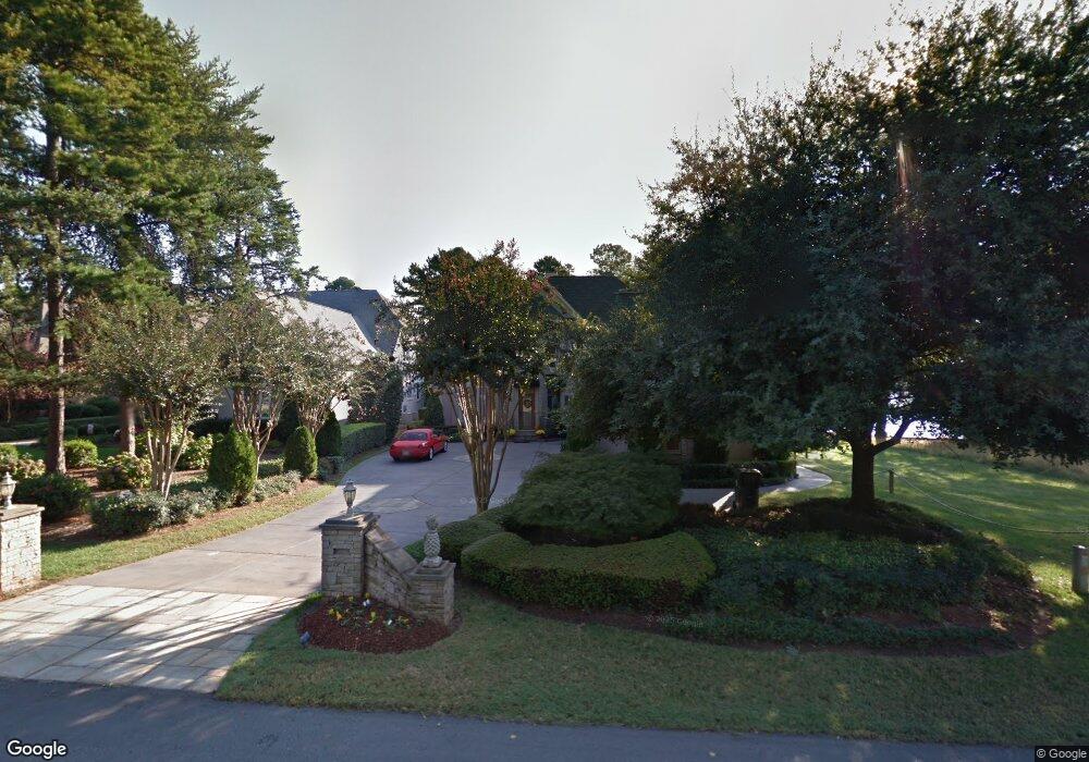
17732 John Connor Rd Cornelius, NC 28031
Estimated Value: $2,399,000 - $3,079,000
3
Beds
4
Baths
4,027
Sq Ft
$709/Sq Ft
Est. Value
About This Home
This home is located at 17732 John Connor Rd, Cornelius, NC 28031 and is currently estimated at $2,855,019, approximately $708 per square foot. 17732 John Connor Rd is a home located in Mecklenburg County with nearby schools including Cornelius Elementary School, Bailey Middle School, and William Amos Hough High School.
Ownership History
Date
Name
Owned For
Owner Type
Purchase Details
Closed on
Mar 15, 2002
Sold by
First Charter Bank
Bought by
Belk B and Belk Harriet C
Current Estimated Value
Home Financials for this Owner
Home Financials are based on the most recent Mortgage that was taken out on this home.
Original Mortgage
$650,000
Outstanding Balance
$243,882
Interest Rate
5.62%
Mortgage Type
Seller Take Back
Estimated Equity
$2,611,137
Purchase Details
Closed on
Nov 13, 2001
Sold by
Smith David C and Smith Kimberly L
Bought by
First Charter Bank
Purchase Details
Closed on
Mar 16, 1999
Sold by
Heath Brown Christopher
Bought by
Smith David C and Smith Kimberly L
Home Financials for this Owner
Home Financials are based on the most recent Mortgage that was taken out on this home.
Original Mortgage
$862,500
Interest Rate
6.74%
Mortgage Type
Purchase Money Mortgage
Create a Home Valuation Report for This Property
The Home Valuation Report is an in-depth analysis detailing your home's value as well as a comparison with similar homes in the area
Home Values in the Area
Average Home Value in this Area
Purchase History
| Date | Buyer | Sale Price | Title Company |
|---|---|---|---|
| Belk B | $885,000 | -- | |
| First Charter Bank | $720,000 | -- | |
| Smith David C | $1,110,000 | -- |
Source: Public Records
Mortgage History
| Date | Status | Borrower | Loan Amount |
|---|---|---|---|
| Open | Belk B | $650,000 | |
| Previous Owner | Smith David C | $862,500 |
Source: Public Records
Tax History
| Year | Tax Paid | Tax Assessment Tax Assessment Total Assessment is a certain percentage of the fair market value that is determined by local assessors to be the total taxable value of land and additions on the property. | Land | Improvement |
|---|---|---|---|---|
| 2025 | $13,918 | $2,113,400 | $1,102,500 | $1,010,900 |
| 2024 | $13,918 | $2,113,400 | $1,102,500 | $1,010,900 |
| 2023 | $12,006 | $2,191,500 | $1,102,500 | $1,089,000 |
| 2022 | $12,006 | $1,409,600 | $720,000 | $689,600 |
| 2021 | $11,865 | $1,409,600 | $720,000 | $689,600 |
| 2020 | $11,865 | $1,409,600 | $720,000 | $689,600 |
| 2019 | $11,859 | $1,409,600 | $720,000 | $689,600 |
| 2018 | $10,330 | $955,500 | $350,000 | $605,500 |
| 2017 | $10,255 | $955,500 | $350,000 | $605,500 |
| 2016 | $10,251 | $955,500 | $350,000 | $605,500 |
| 2015 | $10,104 | $955,500 | $350,000 | $605,500 |
| 2014 | $10,102 | $955,500 | $350,000 | $605,500 |
Source: Public Records
Map
Nearby Homes
- 17005 Belle Isle Dr
- 17235 Connor Quay Ct
- 17832 Mollypop Ln
- 17426 Springwinds Dr Unit 122
- 18316 Mainsail Pointe Dr
- 18326 Bowsprit Pointe Rd
- 17206 Players Ridge Dr
- 17318 Players Ridge Dr
- 16318 Belle Isle Dr
- 17429 Staysail Ct
- 18408 Harbor Light Blvd
- 17210 Jetton Rd
- 18019 Harbor Light Blvd
- 16921 Jetton Rd
- 18112 Harbor Light Blvd
- 18103 Harbor Light Blvd
- 19002 Lakehouse Pointe Dr
- 16821 America Cup Rd
- 16624 Flying Jib Rd
- 17811 Largo Place
- 17800 John Connor Rd
- 17806 John Connor Rd Unit 13
- 17812 John Connor Rd
- 17818 John Connor Rd
- 17807 John Connor Rd
- 17824 John Connor Rd
- 17315 Belle Isle Dr
- 17813 John Connor Rd
- 17830 John Connor Rd
- 17825 John Connor Rd
- 17836 John Connor Rd
- 17311 Belle Isle Dr
- 17703 John Connor Rd
- 17904 John Connor Rd
- 17821 John Connor Rd
- Lot 4 John Connor Rd
- Lot 2 John Connor Rd
- 17908 John Connor Rd
- Lot 3 John Connor Rd
- 17901 John Connor Rd
Your Personal Tour Guide
Ask me questions while you tour the home.