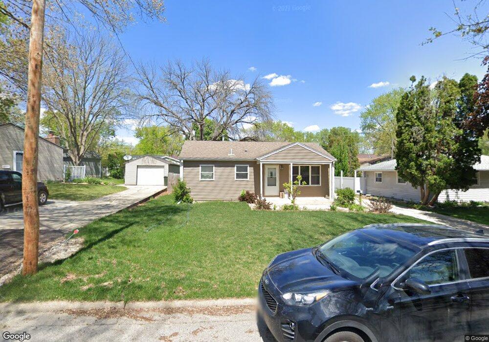
1774 Corning Ave Waterloo, IA 50701
Alabar Hills NeighborhoodEstimated Value: $139,000 - $157,000
3
Beds
2
Baths
864
Sq Ft
$172/Sq Ft
Est. Value
About This Home
This home is located at 1774 Corning Ave, Waterloo, IA 50701 and is currently estimated at $149,001, approximately $172 per square foot. 1774 Corning Ave is a home located in Black Hawk County with nearby schools including Becker Elementary School, Central Middle School, and West High School.
Ownership History
Date
Name
Owned For
Owner Type
Purchase Details
Closed on
Jun 30, 2017
Sold by
Fouts Trevor
Bought by
Greenwood Ryan J
Current Estimated Value
Home Financials for this Owner
Home Financials are based on the most recent Mortgage that was taken out on this home.
Original Mortgage
$99,000
Outstanding Balance
$82,166
Interest Rate
3.94%
Mortgage Type
New Conventional
Estimated Equity
$66,835
Purchase Details
Closed on
Oct 13, 2015
Sold by
Fouts Launne M and Fouts James W
Bought by
Fouts Trevor
Purchase Details
Closed on
Aug 26, 2005
Sold by
Mauer Kristi M
Bought by
Simpson Luanne M
Home Financials for this Owner
Home Financials are based on the most recent Mortgage that was taken out on this home.
Original Mortgage
$71,160
Interest Rate
5.8%
Mortgage Type
New Conventional
Create a Home Valuation Report for This Property
The Home Valuation Report is an in-depth analysis detailing your home's value as well as a comparison with similar homes in the area
Home Values in the Area
Average Home Value in this Area
Purchase History
| Date | Buyer | Sale Price | Title Company |
|---|---|---|---|
| Greenwood Ryan J | $110,000 | None Available | |
| Fouts Trevor | $78,500 | Title Services Corporation | |
| Simpson Luanne M | $89,000 | Title Services Corporation |
Source: Public Records
Mortgage History
| Date | Status | Borrower | Loan Amount |
|---|---|---|---|
| Open | Greenwood Ryan J | $99,000 | |
| Previous Owner | Simpson Luanne M | $71,160 |
Source: Public Records
Tax History
| Year | Tax Paid | Tax Assessment Tax Assessment Total Assessment is a certain percentage of the fair market value that is determined by local assessors to be the total taxable value of land and additions on the property. | Land | Improvement |
|---|---|---|---|---|
| 2025 | $2,636 | $145,660 | $14,850 | $130,810 |
| 2024 | $2,636 | $131,730 | $14,850 | $116,880 |
| 2023 | $2,242 | $131,730 | $14,850 | $116,880 |
| 2022 | $2,180 | $110,920 | $14,850 | $96,070 |
| 2021 | $2,068 | $110,920 | $14,850 | $96,070 |
| 2020 | $2,030 | $99,870 | $14,850 | $85,020 |
| 2019 | $2,030 | $99,870 | $14,850 | $85,020 |
| 2018 | $2,226 | $99,870 | $14,850 | $85,020 |
| 2017 | $2,098 | $99,870 | $14,850 | $85,020 |
| 2016 | $2,266 | $99,870 | $14,850 | $85,020 |
| 2015 | $2,266 | $99,870 | $14,850 | $85,020 |
| 2014 | $2,418 | $104,610 | $14,850 | $89,760 |
Source: Public Records
Map
Nearby Homes
- 819 Hanna Blvd
- 1906 Coachman Dr
- 1286 Scott Ave
- 1290 Scott Ave
- 1114 Eleanor Dr
- 1221 Julian Ave
- 1839 Rush St
- 320 Valley Rd
- 0 Bergen Dr
- 1221 Downing Ave
- 1414 Maxine Ave
- 743 Progress Ave
- 1214 Pleasant Valley Dr
- 1044 Dundee Ave
- 2320 University Ave
- 645 Dundee Ave
- 4009 Sager Ave
- 301 S Hackett Rd
- 3816 Monterey Dr
- 915 Evergreen Ave
- 1768 Corning Ave
- 1782 Corning Ave
- 1760 Corning Ave
- 1767 Flower St
- 1781 Flower St
- 1019 Sheerer Ave
- 1775 Corning Ave
- 1759 Flower St
- 1754 Corning Ave
- 1759 Corning Ave
- 1001 Sheerer Ave
- 1100 Sheerer Ave
- 1753 Flower St
- 1115 Sheerer Ave
- 1753 Corning Ave
- 1040 Sheerer Ave
- 1110 Sheerer Ave
- 1746 Corning Ave
- 1034 Sheerer Ave
- 1116 Sheerer Ave
Your Personal Tour Guide
Ask me questions while you tour the home.