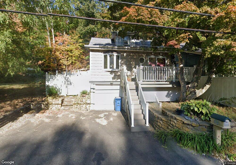
1774 Daniel Bray Hwy Stockton, NJ 08559
Estimated Value: $287,340 - $373,000
--
Bed
--
Bath
1,046
Sq Ft
$325/Sq Ft
Est. Value
About This Home
This home is located at 1774 Daniel Bray Hwy, Stockton, NJ 08559 and is currently estimated at $339,585, approximately $324 per square foot. 1774 Daniel Bray Hwy is a home located in Hunterdon County with nearby schools including Delaware Township School, Hunterdon Central Regional High School District, and The Jesus School.
Ownership History
Date
Name
Owned For
Owner Type
Purchase Details
Closed on
Aug 18, 2022
Sold by
Gest Mary A
Bought by
Triandafilou Cynthia
Current Estimated Value
Home Financials for this Owner
Home Financials are based on the most recent Mortgage that was taken out on this home.
Original Mortgage
$163,000
Outstanding Balance
$155,873
Interest Rate
5.54%
Mortgage Type
New Conventional
Estimated Equity
$183,712
Create a Home Valuation Report for This Property
The Home Valuation Report is an in-depth analysis detailing your home's value as well as a comparison with similar homes in the area
Home Values in the Area
Average Home Value in this Area
Purchase History
| Date | Buyer | Sale Price | Title Company |
|---|---|---|---|
| Triandafilou Cynthia | $250,000 | -- |
Source: Public Records
Mortgage History
| Date | Status | Borrower | Loan Amount |
|---|---|---|---|
| Open | Triandafilou Cynthia | $163,000 |
Source: Public Records
Tax History Compared to Growth
Tax History
| Year | Tax Paid | Tax Assessment Tax Assessment Total Assessment is a certain percentage of the fair market value that is determined by local assessors to be the total taxable value of land and additions on the property. | Land | Improvement |
|---|---|---|---|---|
| 2025 | $5,306 | $193,000 | $120,400 | $72,600 |
| 2024 | $5,169 | $193,000 | $120,400 | $72,600 |
| 2023 | $5,169 | $193,000 | $120,400 | $72,600 |
| 2022 | $4,987 | $193,000 | $120,400 | $72,600 |
| 2021 | $5,018 | $193,000 | $120,400 | $72,600 |
| 2020 | $4,985 | $193,000 | $120,400 | $72,600 |
| 2019 | $4,881 | $193,000 | $120,400 | $72,600 |
| 2018 | $4,922 | $193,000 | $120,400 | $72,600 |
| 2017 | $4,840 | $193,000 | $120,400 | $72,600 |
| 2016 | $4,802 | $193,000 | $120,400 | $72,600 |
| 2015 | $4,614 | $193,000 | $120,400 | $72,600 |
| 2014 | $4,504 | $193,000 | $120,400 | $72,600 |
Source: Public Records
Map
Nearby Homes
- 36 S Main St
- 9 Mill St
- 13 S Main St
- 7189 Center Bridge Rd
- 5 Ferry St
- 2 Broad St
- 2 Old Prallsville Rd
- 925 Sergeantsville Rd
- 960 Sergeantsville Rd
- 7043 Phillips Mill Rd
- 7000 Ely Rd
- 6950 Upper York Rd
- 6853 Phillips Mill Rd
- 6859 Phillips Mill Rd
- 616 Heath Ct
- 617 Heath Ct
- 274 N Union St
- 3014 Comfort Rd
- 300 Holcombe Way
- 5 Arnett Ave
- 1776 Daniel Bray Hwy
- 1780 Daniel Bray Hwy
- 4 Brookville Hollow Rd
- 82 S Main St
- 6 Brookville Hollow Rd
- 80 S Main St
- 67 S Main St
- 78 S Main St
- 65 S Main St
- 14 Brookville Hollow Rd
- 12 Brookville Hollow Rd
- 76 S Main St
- 76 S Main St
- 74 S Main St
- 72 S Main St
- 70 S Main St
- 63 S Main St
- 11 Brookville Hollow Rd
- 68 S Main St
- 16 Brookville Hollow Rd