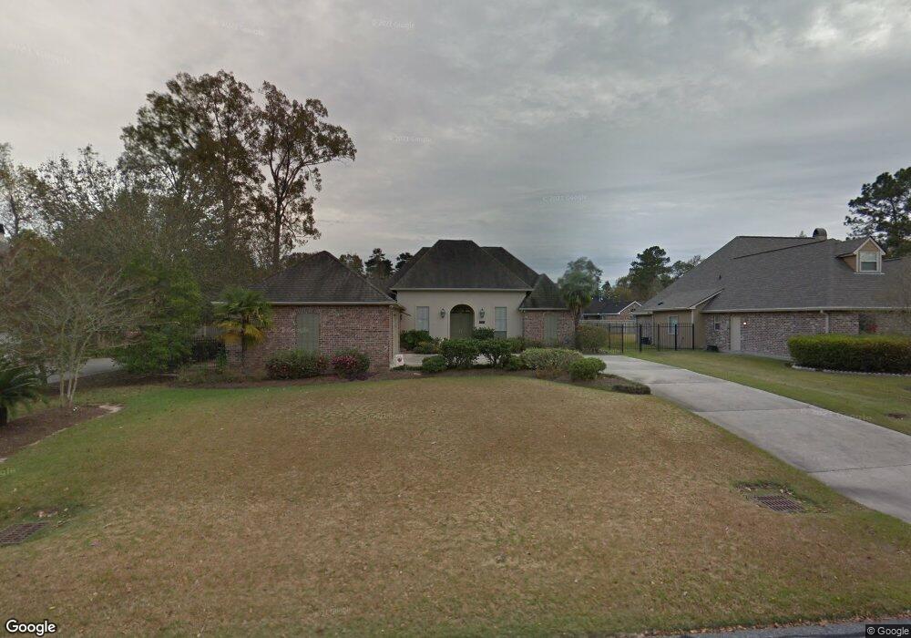
17740 Brookcrest Ave Baton Rouge, LA 70817
Shenandoah NeighborhoodEstimated Value: $456,687 - $472,000
--
Bed
--
Bath
2,614
Sq Ft
$178/Sq Ft
Est. Value
About This Home
This home is located at 17740 Brookcrest Ave, Baton Rouge, LA 70817 and is currently estimated at $466,422, approximately $178 per square foot. 17740 Brookcrest Ave is a home located in East Baton Rouge Parish with nearby schools including Shenandoah Elementary School, Woodlawn Middle School, and Woodlawn High School.
Ownership History
Date
Name
Owned For
Owner Type
Purchase Details
Closed on
Jun 25, 2010
Sold by
Bahm Robert F
Bought by
Boyle James E
Current Estimated Value
Home Financials for this Owner
Home Financials are based on the most recent Mortgage that was taken out on this home.
Original Mortgage
$200,000
Outstanding Balance
$133,499
Interest Rate
4.81%
Mortgage Type
New Conventional
Estimated Equity
$332,923
Create a Home Valuation Report for This Property
The Home Valuation Report is an in-depth analysis detailing your home's value as well as a comparison with similar homes in the area
Home Values in the Area
Average Home Value in this Area
Purchase History
| Date | Buyer | Sale Price | Title Company |
|---|---|---|---|
| Boyle James E | $346,500 | -- |
Source: Public Records
Mortgage History
| Date | Status | Borrower | Loan Amount |
|---|---|---|---|
| Open | Boyle James E | $200,000 |
Source: Public Records
Tax History Compared to Growth
Tax History
| Year | Tax Paid | Tax Assessment Tax Assessment Total Assessment is a certain percentage of the fair market value that is determined by local assessors to be the total taxable value of land and additions on the property. | Land | Improvement |
|---|---|---|---|---|
| 2024 | $3,815 | $40,517 | $5,500 | $35,017 |
| 2023 | $3,815 | $35,290 | $5,500 | $29,790 |
| 2022 | $3,991 | $35,290 | $5,500 | $29,790 |
| 2021 | $3,913 | $35,290 | $5,500 | $29,790 |
| 2020 | $3,965 | $35,290 | $5,500 | $29,790 |
| 2019 | $4,052 | $34,650 | $5,500 | $29,150 |
| 2018 | $4,000 | $34,650 | $5,500 | $29,150 |
| 2017 | $4,000 | $34,650 | $5,500 | $29,150 |
| 2016 | $3,061 | $34,650 | $5,500 | $29,150 |
| 2015 | $3,060 | $34,650 | $5,500 | $29,150 |
| 2014 | $2,994 | $34,650 | $5,500 | $29,150 |
| 2013 | -- | $34,650 | $5,500 | $29,150 |
Source: Public Records
Map
Nearby Homes
- 17237 Monitor Ave
- 4036 Copperridge Dr
- 17440 Beachwood Ave
- 4818 Pine Hill Dr
- 16849 Monitor Ave
- 3801 Villa Michel Dr
- 16570 Spiller's
- 17750 Shady Elm Ave
- 3439 Timber Grove Dr
- 17561 Martin Lake Dr
- 16756 Merrimac Ave
- 3336 Grassy Lake Dr
- 16825 Chadsford Ave
- 3306 Grassy Lake Dr
- 3246 Pine Grove Dr
- 5246 Stones River Ave
- 18107 Ferry Lane Ave
- 4830 Kennesaw Dr Unit A
- 18403 Shadow Creek Ave
- 3112 Grassy Lake Dr
- 17750 Brookcrest Ave
- 17750 Brookcrest Ave
- 17730 Brookcrest Ave
- 17847 Gray Moss Ave
- 17760 Brookcrest Ave
- 17837 Gray Moss Ave
- 17720 Brookcrest Ave
- 17731 Brookcrest Ave
- 17721 Brookcrest Ave
- 17867 Gray Moss Ave
- 17827 Gray Moss Ave
- 17741 Brookcrest Ave
- 17710 Brookcrest Ave
- 17817 Gray Moss Ave
- 17711 Brookcrest Ave
- 17761 Brookcrest Ave
- 4033 Canebrake Dr
- 3911 Frostwood Ave
- 4013 Canebrake Dr
- 17866 Gray Moss Ave