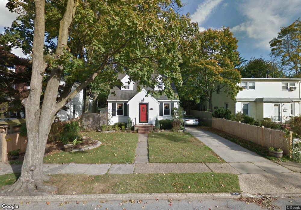
1775 Hanover Place Merrick, NY 11566
Estimated Value: $502,000 - $623,069
Studio
2
Baths
1,027
Sq Ft
$548/Sq Ft
Est. Value
About This Home
This home is located at 1775 Hanover Place, Merrick, NY 11566 and is currently estimated at $562,535, approximately $547 per square foot. 1775 Hanover Place is a home located in Nassau County with nearby schools including Merrick Avenue Middle School, Sanford H Calhoun High School, and Progressive School of Long Island.
Ownership History
Date
Name
Owned For
Owner Type
Purchase Details
Closed on
Aug 15, 2006
Sold by
Herman Michael
Bought by
Puglisi John
Current Estimated Value
Purchase Details
Closed on
Aug 9, 1999
Sold by
Cudahy John K
Bought by
Herman Michael
Home Financials for this Owner
Home Financials are based on the most recent Mortgage that was taken out on this home.
Original Mortgage
$135,000
Interest Rate
7.6%
Mortgage Type
Purchase Money Mortgage
Purchase Details
Closed on
Dec 27, 1995
Sold by
Cudahy John and Cudahy Ella
Bought by
Cudahy John
Create a Home Valuation Report for This Property
The Home Valuation Report is an in-depth analysis detailing your home's value as well as a comparison with similar homes in the area
Home Values in the Area
Average Home Value in this Area
Purchase History
| Date | Buyer | Sale Price | Title Company |
|---|---|---|---|
| Puglisi John | $371,000 | -- | |
| Herman Michael | $180,000 | First American Title Ins Co | |
| Cudahy John | $45,000 | -- |
Source: Public Records
Mortgage History
| Date | Status | Borrower | Loan Amount |
|---|---|---|---|
| Previous Owner | Herman Michael | $135,000 |
Source: Public Records
Tax History
| Year | Tax Paid | Tax Assessment Tax Assessment Total Assessment is a certain percentage of the fair market value that is determined by local assessors to be the total taxable value of land and additions on the property. | Land | Improvement |
|---|---|---|---|---|
| 2025 | $11,901 | $445 | $191 | $254 |
| 2024 | $3,353 | $445 | $191 | $254 |
Source: Public Records
Map
Nearby Homes
- 132 Webster St
- 1715 Remson Ave
- TBD Camp Ave
- 2 Garfield St
- 1826 Camp Ave
- 1741 Bushwick Ave
- 1772 Rose St
- 1911 Carroll Ave
- 1617 Richard Ave
- 1680 Lake Ave
- 45 Richard Ave
- 1729 Gormley Ave
- 1721 Michael William Rd
- 19 Margaret Blvd
- 1709 Camp Ave
- 2016 Abbot Ave
- 236 Thelma Ave
- 221 Thelma Ave
- 1750 Henry Rd
- 1526 Rhode Ave
- 36 Hanover Place
- 135 Webster St
- 45 Mabel Place
- 1782 Mabel Place
- 1788 Mabel Place
- 41 Hanover Place
- 28 Hanover Place
- 1780 Hanover Place
- 1787 Hanover Place
- 1770 Hanover Place
- 1794 Mabel Place
- 136 Webster St
- 128 Webster St
- 140 Webster St
- 24 Hanover Place
- 1790 Hanover Place
- 1790 Hanover Place
- 1800 Mabel Place
- 124 Webster St
- 144 Webster St
Your Personal Tour Guide
Ask me questions while you tour the home.